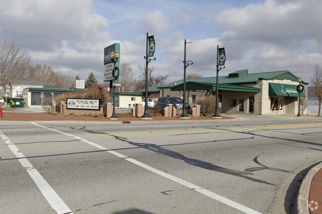
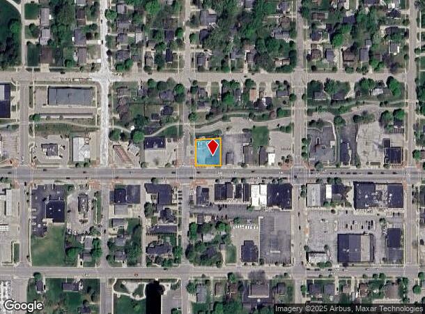
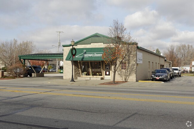
Property Record
217 W Savidge St, Spring Lake, MI 49456
NEARBY LISTINGS FOR SALE OR LEASE
Property Detail
217 W Savidge St
Grand Rapids-Wyoming, MI
Bryants Add
70-03-15-378-001
LOTS 2 & 3 BLK 9 S OF GTRR EXC E 30 FT OF LOT 3 BRYANT'S ADD TO VILLAGE OF MILL POINT
Laundromat
Ottawa
X
Michigan
26139C0079F
2-3
2024
0.27 AC
2025
Grand Haven/Ferrysburg
021100
West Michigan
4,444 SF
DEMOGRAPHICS near 217 W Savidge St
1 Mile
3 Mile
5 Mile
2024 Total Population
3,974
35,988
56,082
2029 Population
4,245
38,285
59,152
Pop Growth 2024-2029
+ 6.82%
+ 6.38%
+ 5.47%
Average Age
46
43
43
2024 Total Households
1,804
15,651
23,533
HH Growth 2024-2029
+ 6.87%
+ 6.51%
+ 5.61%
Median Household Inc
$76,846
$68,000
$72,212
Avg Household Size
2.20
2.30
2.30
2024 Avg HH Vehicles
2.00
2.00
2.00
Median Home Value
$293,710
$287,867
$283,660
Median Year Built
1971
1977
1982
Nearby Places
Map Layers
Map Styles
 Street
 Aerial
- Restaurants
- Banks
- Shops
- Fitness
- Groceries
Nearby Properties
Address
Land Use
TOTAL SIZE
Lot Size
Zoning
Address
Land Use
TOTAL SIZE
Lot Size
Zoning
348,731 SF
40.52 AC
R-4
Address
Land Use
TOTAL SIZE
Lot Size
Zoning
199,740 SF
15 AC
PUD
Address
Land Use
TOTAL SIZE
Lot Size
Zoning
381,476 SF
17.96 AC
I INDU
Address
Land Use
TOTAL SIZE
Lot Size
Zoning
188,314 SF
9.72 AC
Address
Land Use
TOTAL SIZE
Lot Size
Zoning
220,630 SF
10.34 AC
PUD
Address
Land Use
TOTAL SIZE
Lot Size
Zoning
184,312 SF
11.47 AC
PUD
Address
Land Use
TOTAL SIZE
Lot Size
Zoning
131,302 SF
4.70 AC
Address
Land Use
TOTAL SIZE
Lot Size
Zoning
191,144 SF
16.60 AC
Address
Land Use
TOTAL SIZE
Lot Size
Zoning
121,189 SF
8.73 AC
PUD
Address
Land Use
TOTAL SIZE
Lot Size
Zoning
192,833 SF
14.44 AC
I INDU
Address
Land Use
TOTAL SIZE
Lot Size
Zoning
40,251 SF
159.38 AC
PR
Address
Land Use
TOTAL SIZE
Lot Size
Zoning
113,566 SF
6.70 AC
PUD
Address
Land Use
TOTAL SIZE
Lot Size
Zoning
192,641 SF
25.16 AC
Address
Land Use
TOTAL SIZE
Lot Size
Zoning
37,874 SF
20.27 AC
PORT IN
Address
Land Use
TOTAL SIZE
Lot Size
Zoning
242,746 SF
36.05 AC
I INDU
Address
Land Use
TOTAL SIZE
Lot Size
Zoning
112,745 SF
10.56 AC
PUD
Address
Land Use
TOTAL SIZE
Lot Size
Zoning
53,682 SF
0.99 AC
Address
Land Use
TOTAL SIZE
Lot Size
Zoning
184,100 SF
9.74 AC
Address
Land Use
TOTAL SIZE
Lot Size
Zoning
90,701 SF
5.65 AC
Address
Land Use
TOTAL SIZE
Lot Size
Zoning
217,995 SF
40.96 AC
PUD
Address
Land Use
TOTAL SIZE
Lot Size
Zoning
125,088 SF
7.24 AC
CBD
Address
Land Use
TOTAL SIZE
Lot Size
Zoning
2,724 SF
56.50 AC
MHP
Address
Land Use
TOTAL SIZE
Lot Size
Zoning
143,083 SF
12.25 AC
Address
Land Use
TOTAL SIZE
Lot Size
Zoning
148,413 SF
38.08 AC
Address
Land Use
TOTAL SIZE
Lot Size
Zoning
960 SF
22.46 AC
Address
Land Use
TOTAL SIZE
Lot Size
Zoning
105,179 SF
20.81 AC
I INDU
Address
Land Use
TOTAL SIZE
Lot Size
Zoning
99,081 SF
11.66 AC
R-4
Address
Land Use
TOTAL SIZE
Lot Size
Zoning
27,006 SF
6.12 AC
MU
Address
Land Use
TOTAL SIZE
Lot Size
Zoning
127,211 SF
11.74 AC
I INDU
Address
Land Use
TOTAL SIZE
Lot Size
Zoning
98,248 SF
17.79 AC
I-1
The World's #1 Commercial Real Estate Marketplace
Connect with us
© 2025 CoStar Group
The information above has been obtained from sources believed reliable. While we do not doubt its accuracy we have not verified it and make no guarantee, warranty or representation about it. It is your responsibility to independently confirm its accuracy and completeness. Any projections, opinions, assumptions, or estimates used are for example only and do not represent the current or future performance of the property. The value of this transaction to you depends on tax and other factors which should be evaluated by your tax, financial, and legal advisors. You and your advisors should conduct a careful, independent investigation of the property to determine to your satisfaction the suitability of the property for your needs.