Property Record
2170 Adelaida Rd, Paso Robles, CA 93446
Property Detail
2170 Adelaida Rd
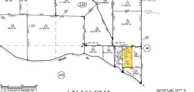
026-232-020
PM 43/99 PTN PAR 2
Winery
SAN LUIS OBISPO
RR
California
B and X Area of moderate flood hazard, usually the area between the limits of the 100-year and 500-year floods.
9.20 AC
0
North 101 Corridor
2025
San Luis Obispo/Paso Robles
010206
San Luis Obispo-Paso Robles, CA
2,835 SF
NEARBY LISTINGS FOR SALE OR LEASE
-
-
View all Paso Robles listings for sale on LoopNet.com
DEMOGRAPHICS near 2170 Adelaida Rd
1 mile
3 mile
5 mile
2025 Total Population
248
9,116
26,306
2030 Population
246
9,096
26,106
Pop Growth 2025-2030
(0.81%)
(0.22%)
(0.76%)
Average Age
47
38
40
2025 Total Households
104
3,501
9,817
HH Growth 2025-2030
(0.96%)
(0.37%)
(0.93%)
Median Household Inc
$116,911
$73,412
$91,191
Avg Household Size
2.40
2.60
2.60
2025 Avg HH Vehicles
3.00
2.00
2.00
Median Home Value
$1,038,372
$765,056
$756,922
Median Year Built
1985
1980
1986
Nearby Places
Map Layers
Map Styles
 Street
 Aerial
Layers
 Traffic
 Biking
Places
Listings with unknown addresses are not visible on the map
- Restaurants
- Banks
- Shops
- Fitness
- Groceries
PUBLIC TRANSPORTATION
COMMUTER RAIL
Drive
Walk
Distance
10 min
4.6 mi
AIRPORT
San Luis County Regional
Drive
Walk
Distance
San Luis County Regional
54 min
38.4 mi
Nearby Properties
Address
Land Use
TOTAL SIZE
Lot Size
Zoning
Address
Land Use
TOTAL SIZE
Lot Size
Zoning
4.27 AC
PM
Address
Land Use
TOTAL SIZE
Lot Size
Zoning
4.25 AC
Address
Land Use
TOTAL SIZE
Lot Size
Zoning
48.88 AC
R1
Address
Land Use
TOTAL SIZE
Lot Size
Zoning
58,884 SF
2.34 AC
T4N
Address
Land Use
TOTAL SIZE
Lot Size
Zoning
89,417 SF
3.13 AC
T4N
Address
Land Use
TOTAL SIZE
Lot Size
Zoning
1.59 AC
C3
Address
Land Use
TOTAL SIZE
Lot Size
Zoning
64,323 SF
2.56 AC
T4N
Address
Land Use
TOTAL SIZE
Lot Size
Zoning
54,961 SF
2.93 AC
T4N
Address
Land Use
TOTAL SIZE
Lot Size
Zoning
17,804 SF
0.22 AC
C1
Address
Land Use
TOTAL SIZE
Lot Size
Zoning
38,563 SF
0.24 AC
Address
Land Use
TOTAL SIZE
Lot Size
Zoning
50,869 SF
2.05 AC
Address
Land Use
TOTAL SIZE
Lot Size
Zoning
45,068 SF
1.95 AC
R3
Address
Land Use
TOTAL SIZE
Lot Size
Zoning
23,354 SF
2.07 AC
TC2
Address
Land Use
TOTAL SIZE
Lot Size
Zoning
1,709 SF
200.02 AC
AG
Address
Land Use
TOTAL SIZE
Lot Size
Zoning
9,346 SF
68.70 AC
AG
Address
Land Use
TOTAL SIZE
Lot Size
Zoning
31,489 SF
1.62 AC
R3
Address
Land Use
TOTAL SIZE
Lot Size
Zoning
20,996 SF
1.52 AC
TC2
Address
Land Use
TOTAL SIZE
Lot Size
Zoning
1,723 SF
80.83 AC
AG
Address
Land Use
TOTAL SIZE
Lot Size
Zoning
20,680 SF
0.24 AC
TC1
Address
Land Use
TOTAL SIZE
Lot Size
Zoning
Address
Land Use
TOTAL SIZE
Lot Size
Zoning
36,825 SF
2.07 AC
CC
Address
Land Use
TOTAL SIZE
Lot Size
Zoning
22,528 SF
1.53 AC
T4N
Address
Land Use
TOTAL SIZE
Lot Size
Zoning
27,551 SF
0.99 AC
R4
Address
Land Use
TOTAL SIZE
Lot Size
Zoning
0.48 AC
R2
Address
Land Use
TOTAL SIZE
Lot Size
Zoning
14,766 SF
39.14 AC
AG
Address
Land Use
TOTAL SIZE
Lot Size
Zoning
14,216 SF
0.20 AC
TC1
Address
Land Use
TOTAL SIZE
Lot Size
Zoning
1.06 AC
R3
Address
Land Use
TOTAL SIZE
Lot Size
Zoning
0.91 AC
R4
Address
Land Use
TOTAL SIZE
Lot Size
Zoning
35,020 SF
1.41 AC
C2
Address
Land Use
TOTAL SIZE
Lot Size
Zoning
21,345 SF
1.60 AC
R3
The World's #1 Commercial Real Estate Marketplace
Connect with us
© 2026 CoStar Group
The information above has been obtained from sources believed reliable. While we do not doubt its accuracy we have not verified it and make no guarantee, warranty or representation about it. It is your responsibility to independently confirm its accuracy and completeness. Any projections, opinions, assumptions, or estimates used are for example only and do not represent the current or future performance of the property. The value of this transaction to you depends on tax and other factors which should be evaluated by your tax, financial, and legal advisors. You and your advisors should conduct a careful, independent investigation of the property to determine to your satisfaction the suitability of the property for your needs.