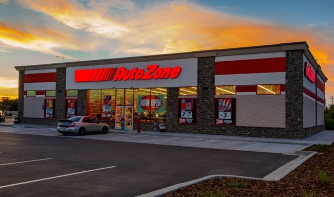
Property Record
2170 N State Route 53, Fremont, OH 43420
NEARBY LISTINGS FOR SALE OR LEASE
Property Detail
2170 N State Route 53
34-60-00-0382-18
OL 382 PT 1.410 AC PER SURVEY
Commercialnec
Sandusky
X
Ohio
39143C0140D
1.41 AC
2024
Sandusky County
2024
Toledo
960900
Fremont, OH
10,310 SF
DEMOGRAPHICS near 2170 N State Route 53
1 Mile
3 Mile
5 Mile
2024 Total Population
1,539
20,271
27,004
2029 Population
1,535
20,288
26,976
Pop Growth 2024-2029
(0.26%)
+ 0.08%
(0.10%)
Average Age
46
41
42
2024 Total Households
660
8,653
11,580
HH Growth 2024-2029
(0.15%)
+ 0.13%
(0.09%)
Median Household Inc
$80,281
$48,367
$53,491
Avg Household Size
2.20
2.20
2.20
2024 Avg HH Vehicles
2.00
2.00
2.00
Median Home Value
$158,571
$117,640
$135,231
Median Year Built
1970
1956
1958
Nearby Places
Map Layers
Map Styles
 Street
 Aerial
- Restaurants
- Banks
- Shops
- Fitness
- Groceries
SALE & LEASE HISTORY
LISTING DATE
SALE/LEASE

Jun 05, 2018
For Sale
Jun 01, 2017
For Sale
Aug 02, 2017
For Sale
Aug 01, 2017
For Sale
Nearby Properties
Address
Land Use
TOTAL SIZE
Lot Size
Zoning
Address
Land Use
TOTAL SIZE
Lot Size
Zoning
147,101 SF
72.51 AC
Address
Land Use
TOTAL SIZE
Lot Size
Zoning
43,664 SF
103.23 AC
Address
Land Use
TOTAL SIZE
Lot Size
Zoning
15,600 SF
25.87 AC
Address
Land Use
TOTAL SIZE
Lot Size
Zoning
61,831 SF
4.13 AC
Address
Land Use
TOTAL SIZE
Lot Size
Zoning
17,672 SF
111.70 AC
Address
Land Use
TOTAL SIZE
Lot Size
Zoning
96,488 SF
65.53 AC
Address
Land Use
TOTAL SIZE
Lot Size
Zoning
60,673 SF
14.72 AC
Address
Land Use
TOTAL SIZE
Lot Size
Zoning
26,714 SF
10.50 AC
Address
Land Use
TOTAL SIZE
Lot Size
Zoning
35,072 SF
6.30 AC
Address
Land Use
TOTAL SIZE
Lot Size
Zoning
33,008 SF
10.88 AC
Address
Land Use
TOTAL SIZE
Lot Size
Zoning
38,801 SF
11.85 AC
Address
Land Use
TOTAL SIZE
Lot Size
Zoning
22,320 SF
12.25 AC
Address
Land Use
TOTAL SIZE
Lot Size
Zoning
463,542 SF
25 AC
Address
Land Use
TOTAL SIZE
Lot Size
Zoning
215,945 SF
21.75 AC
Address
Land Use
TOTAL SIZE
Lot Size
Zoning
80,000 SF
7.54 AC
Address
Land Use
TOTAL SIZE
Lot Size
Zoning
12,547 SF
23.91 AC
Address
Land Use
TOTAL SIZE
Lot Size
Zoning
90,200 SF
8.49 AC
Address
Land Use
TOTAL SIZE
Lot Size
Zoning
128,820 SF
16.91 AC
Address
Land Use
TOTAL SIZE
Lot Size
Zoning
131,520 SF
27.72 AC
Address
Land Use
TOTAL SIZE
Lot Size
Zoning
256,000 SF
23.91 AC
Address
Land Use
TOTAL SIZE
Lot Size
Zoning
47,808 SF
0.60 AC
Address
Land Use
TOTAL SIZE
Lot Size
Zoning
17,170 SF
27 AC
Address
Land Use
TOTAL SIZE
Lot Size
Zoning
71,884 SF
5.58 AC
Address
Land Use
TOTAL SIZE
Lot Size
Zoning
25,164 SF
2.81 AC
Address
Land Use
TOTAL SIZE
Lot Size
Zoning
22,692 SF
22.24 AC
Address
Land Use
TOTAL SIZE
Lot Size
Zoning
54,566 SF
6.72 AC
Address
Land Use
TOTAL SIZE
Lot Size
Zoning
2,344 SF
12.67 AC
Address
Land Use
TOTAL SIZE
Lot Size
Zoning
23,416 SF
1 AC
Address
Land Use
TOTAL SIZE
Lot Size
Zoning
18,252 SF
3.67 AC
Address
Land Use
TOTAL SIZE
Lot Size
Zoning
47,840 SF
2.87 AC
The World's #1 Commercial Real Estate Marketplace
Connect with us
© 2026 CoStar Group
The information above has been obtained from sources believed reliable. While we do not doubt its accuracy we have not verified it and make no guarantee, warranty or representation about it. It is your responsibility to independently confirm its accuracy and completeness. Any projections, opinions, assumptions, or estimates used are for example only and do not represent the current or future performance of the property. The value of this transaction to you depends on tax and other factors which should be evaluated by your tax, financial, and legal advisors. You and your advisors should conduct a careful, independent investigation of the property to determine to your satisfaction the suitability of the property for your needs.