Property Record
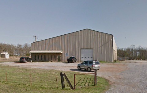
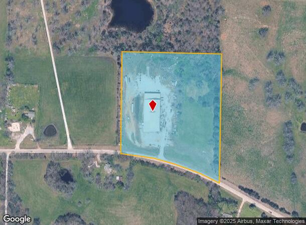
21700 W Highway 72, Gravette, AR 72736
NEARBY LISTINGS FOR SALE OR LEASE
-
-
View all Gravette listings for sale on LoopNet.com
Property Detail
21700 W Highway 72
18-14891-002
Rural
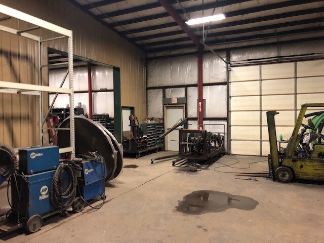
Lightindustrial
PART OF THE SE 1/4 OF THE NE 1/4 OF SECTION 8, T-20-N, R-33-W, BENTON COUNTY, ARKANSAS, MORE PARTICULARLY DESCRIBED AS FOLLOWS: BEGINNING AT A POINT 688.91 S 87 2356 E OF THE NW CORNER OF THE SE 1/4 OF THE NE 1/4 OF SAID SECTION 8 ; THENCE S 87 2356
X
Benton
40041C0350F
Arkansas
2025
10 AC
2025
Outlying Benton County
021001
Fayetteville/Springdale/Rogers
23,800 SF
Fayetteville-Springdale-Rogers, AR-MO
DEMOGRAPHICS near 21700 W Highway 72
1 Mile
3 Mile
5 Mile
2024 Total Population
247
2,225
6,336
2029 Population
291
2,615
7,451
Pop Growth 2024-2029
+ 17.81%
+ 17.53%
+ 17.60%
Average Age
39
38
38
2024 Total Households
88
795
2,293
HH Growth 2024-2029
+ 18.18%
+ 17.61%
+ 17.62%
Median Household Inc
$64,000
$53,333
$56,798
Avg Household Size
2.80
2.70
2.70
2024 Avg HH Vehicles
3.00
2.00
2.00
Median Home Value
$272,499
$210,648
$201,576
Median Year Built
1993
1992
1991
Nearby Places
Map Layers
Map Styles
 Street
 Aerial
- Restaurants
- Banks
- Shops
- Fitness
- Groceries
PUBLIC TRANSPORTATION
AIRPORT
Northwest Arkansas Ntl
DRIVE
WALK
Distance
Northwest Arkansas Ntl
47 min
25.0 mi
Freight Ports
Tulsa Port of Inola
DRIVE
WALK
Distance
Tulsa Port of Inola
103 min
86.5 mi
SALE & LEASE HISTORY
LISTING DATE
SALE/LEASE

May 29, 2019
For Sale
Nearby Properties
Address
Land Use
TOTAL SIZE
Lot Size
Zoning
Address
Land Use
TOTAL SIZE
Lot Size
Zoning
59,340 SF
9.40 AC
Address
Land Use
TOTAL SIZE
Lot Size
Zoning
10,022 SF
22.97 AC
Address
Land Use
TOTAL SIZE
Lot Size
Zoning
16,684 SF
3.01 AC
Address
Land Use
TOTAL SIZE
Lot Size
Zoning
15,552 SF
0.99 AC
Address
Land Use
TOTAL SIZE
Lot Size
Zoning
7,056 SF
1.21 AC
Address
Land Use
TOTAL SIZE
Lot Size
Zoning
4,037 SF
2.80 AC
Address
Land Use
TOTAL SIZE
Lot Size
Zoning
14,992 SF
1.24 AC
Address
Land Use
TOTAL SIZE
Lot Size
Zoning
29,796 SF
3.17 AC
Address
Land Use
TOTAL SIZE
Lot Size
Zoning
2,356 SF
0.16 AC
Address
Land Use
TOTAL SIZE
Lot Size
Zoning
10,363 SF
1.09 AC
Address
Land Use
TOTAL SIZE
Lot Size
Zoning
4,526 SF
0.25 AC
Address
Land Use
TOTAL SIZE
Lot Size
Zoning
4,526 SF
0.25 AC
Address
Land Use
TOTAL SIZE
Lot Size
Zoning
4,376 SF
0.48 AC
Address
Land Use
TOTAL SIZE
Lot Size
Zoning
4,376 SF
0.52 AC
Address
Land Use
TOTAL SIZE
Lot Size
Zoning
4,376 SF
0.60 AC
Address
Land Use
TOTAL SIZE
Lot Size
Zoning
4,466 SF
0.25 AC
Address
Land Use
TOTAL SIZE
Lot Size
Zoning
4,376 SF
0.25 AC
Address
Land Use
TOTAL SIZE
Lot Size
Zoning
4,376 SF
0.66 AC
Address
Land Use
TOTAL SIZE
Lot Size
Zoning
17,750 SF
0.70 AC
Address
Land Use
TOTAL SIZE
Lot Size
Zoning
6,923 SF
1.93 AC
Address
Land Use
TOTAL SIZE
Lot Size
Zoning
8,000 SF
0.52 AC
Address
Land Use
TOTAL SIZE
Lot Size
Zoning
1,946 SF
0.15 AC
Address
Land Use
TOTAL SIZE
Lot Size
Zoning
4,390 SF
0.21 AC
Address
Land Use
TOTAL SIZE
Lot Size
Zoning
4,390 SF
0.22 AC
Address
Land Use
TOTAL SIZE
Lot Size
Zoning
4,390 SF
0.19 AC
Address
Land Use
TOTAL SIZE
Lot Size
Zoning
4,390 SF
0.22 AC
Address
Land Use
TOTAL SIZE
Lot Size
Zoning
4,390 SF
0.22 AC
Address
Land Use
TOTAL SIZE
Lot Size
Zoning
4,390 SF
0.22 AC
Address
Land Use
TOTAL SIZE
Lot Size
Zoning
4,390 SF
0.22 AC
The World's #1 Commercial Real Estate Marketplace
Connect with us
© 2025 CoStar Group
The information above has been obtained from sources believed reliable. While we do not doubt its accuracy we have not verified it and make no guarantee, warranty or representation about it. It is your responsibility to independently confirm its accuracy and completeness. Any projections, opinions, assumptions, or estimates used are for example only and do not represent the current or future performance of the property. The value of this transaction to you depends on tax and other factors which should be evaluated by your tax, financial, and legal advisors. You and your advisors should conduct a careful, independent investigation of the property to determine to your satisfaction the suitability of the property for your needs.