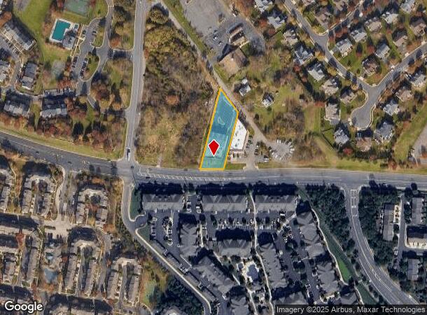
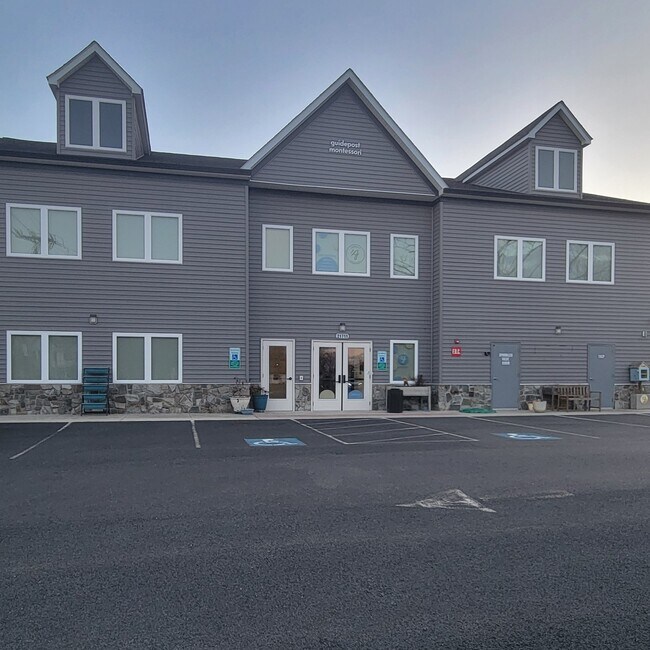
Property Record
21711 Shellhorn Rd, Ashburn, VA 20147

NEARBY LISTINGS FOR SALE OR LEASE
Property Detail
21711 Shellhorn Rd
119-30-7673
Ryan
Publichealthcarefacility
RYAN 201908280050711/12P ST.DEDD 201206080043802P ST DEDD, 200902100007062
X
Loudoun
51107C0263E
Virginia
2025
0.68 AC
2025
Route 28 Corridor North
611020
Washington, DC
7,222 SF
Washington-Arlington-Alexandria, DC-VA-MD-WV
DEMOGRAPHICS near 21711 Shellhorn Rd
1 Mile
3 Mile
5 Mile
2024 Total Population
17,704
94,502
178,270
2029 Population
19,465
101,518
192,294
Pop Growth 2024-2029
+ 9.95%
+ 7.42%
+ 7.87%
Average Age
36
38
38
2024 Total Households
6,372
32,368
61,359
HH Growth 2024-2029
+ 10.33%
+ 7.72%
+ 8.14%
Median Household Inc
$138,441
$160,947
$157,223
Avg Household Size
2.80
2.90
2.90
2024 Avg HH Vehicles
2.00
2.00
2.00
Median Home Value
$661,510
$693,875
$686,697
Median Year Built
2005
2004
2004
Nearby Places
Map Layers
Map Styles
 Street
 Aerial
- Restaurants
- Banks
- Shops
- Fitness
- Groceries
PUBLIC TRANSPORTATION
TRANSIT/SUBWAY
Ashburn, Silver Line Center Platform (Metrorail Silver Line - WMATA)
DRIVE
WALK
Distance
Ashburn, Silver Line Center Platform (Metrorail Silver Line - WMATA)
4 min
18 min
0.9 mi
AIRPORT
Washington Dulles International
DRIVE
WALK
Distance
Washington Dulles International
16 min
8.3 mi
Ronald Reagan Washington Ntl
DRIVE
WALK
Distance
Ronald Reagan Washington Ntl
48 min
33.2 mi
Freight Ports
Port of Baltimore
DRIVE
WALK
Distance
Port of Baltimore
89 min
65.2 mi
SALE & LEASE HISTORY
LISTING DATE
SALE/LEASE

Sep 25, 2016
For Lease
Feb 27, 2025
For Lease
Feb 25, 2025
For Lease
Nearby Properties
Address
Land Use
TOTAL SIZE
Lot Size
Zoning
Address
Land Use
TOTAL SIZE
Lot Size
Zoning
2,735,138 SF
123.03 AC
PDAAAR
Address
Land Use
TOTAL SIZE
Lot Size
Zoning
431.05 AC
LB:PRC
Address
Land Use
TOTAL SIZE
Lot Size
Zoning
125.80 AC
TRC
Address
Land Use
TOTAL SIZE
Lot Size
Zoning
624,852 SF
22.54 AC
R24
Address
Land Use
TOTAL SIZE
Lot Size
Zoning
549,027 SF
21.01 AC
R16
Address
Land Use
TOTAL SIZE
Lot Size
Zoning
119,087 SF
339.95 AC
PDIP
Address
Land Use
TOTAL SIZE
Lot Size
Zoning
378,278 SF
112.87 AC
PDGI
Address
Land Use
TOTAL SIZE
Lot Size
Zoning
100,121 SF
2.20 AC
PDIP
Address
Land Use
TOTAL SIZE
Lot Size
Zoning
264,155 SF
10.95 AC
PDTRC
Address
Land Use
TOTAL SIZE
Lot Size
Zoning
29,800 SF
43.29 AC
IP
Address
Land Use
TOTAL SIZE
Lot Size
Zoning
230.43 AC
PDGI
Address
Land Use
TOTAL SIZE
Lot Size
Zoning
454,700 SF
54.92 AC
PDGI
Address
Land Use
TOTAL SIZE
Lot Size
Zoning
164,455 SF
14.15 AC
PDIP
Address
Land Use
TOTAL SIZE
Lot Size
Zoning
320,609 SF
2.02 AC
PDTRC
Address
Land Use
TOTAL SIZE
Lot Size
Zoning
198,672 SF
21.41 AC
R16
Address
Land Use
TOTAL SIZE
Lot Size
Zoning
152,394 SF
10.73 AC
PDIP
Address
Land Use
TOTAL SIZE
Lot Size
Zoning
61,692 SF
19.86 AC
PDH4
Address
Land Use
TOTAL SIZE
Lot Size
Zoning
218,277 SF
14.54 AC
PDH3
Address
Land Use
TOTAL SIZE
Lot Size
Zoning
260,741 SF
37.30 AC
PDH4
Address
Land Use
TOTAL SIZE
Lot Size
Zoning
259,361 SF
65.01 AC
PDH4
Address
Land Use
TOTAL SIZE
Lot Size
Zoning
238,594 SF
50.64 AC
PDGI
Address
Land Use
TOTAL SIZE
Lot Size
Zoning
29.72 AC
OP
Address
Land Use
TOTAL SIZE
Lot Size
Zoning
29.66 AC
OP
Address
Land Use
TOTAL SIZE
Lot Size
Zoning
136.07 AC
PDGI
Address
Land Use
TOTAL SIZE
Lot Size
Zoning
290,695 SF
3.32 AC
PDOP
Address
Land Use
TOTAL SIZE
Lot Size
Zoning
243,052 SF
50.01 AC
PDH3
Address
Land Use
TOTAL SIZE
Lot Size
Zoning
247,082 SF
57.50 AC
PDH4
Address
Land Use
TOTAL SIZE
Lot Size
Zoning
507,073 SF
3.81 AC
TRC
Address
Land Use
TOTAL SIZE
Lot Size
Zoning
141,978 SF
15.92 AC
PDCCCC
Address
Land Use
TOTAL SIZE
Lot Size
Zoning
180,278 SF
23.95 AC
PDH3
The World's #1 Commercial Real Estate Marketplace
Connect with us
© 2026 CoStar Group
The information above has been obtained from sources believed reliable. While we do not doubt its accuracy we have not verified it and make no guarantee, warranty or representation about it. It is your responsibility to independently confirm its accuracy and completeness. Any projections, opinions, assumptions, or estimates used are for example only and do not represent the current or future performance of the property. The value of this transaction to you depends on tax and other factors which should be evaluated by your tax, financial, and legal advisors. You and your advisors should conduct a careful, independent investigation of the property to determine to your satisfaction the suitability of the property for your needs.