Property Record
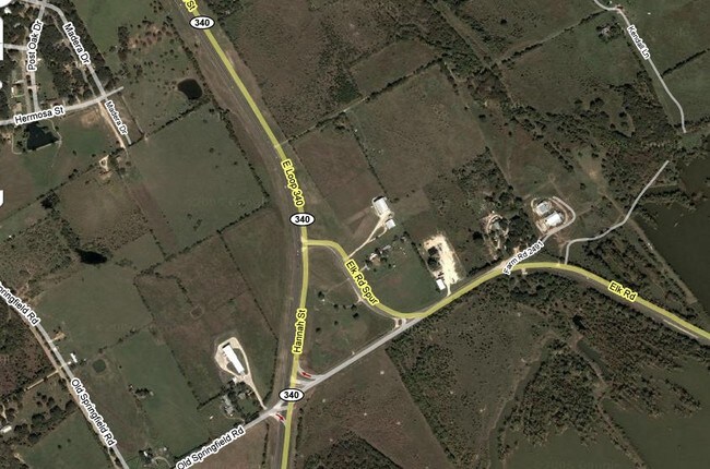
2172 E Loop 340, Waco, TX 76705

Property Detail
2172 E Loop 340
28-026701-028303-1
TOMAS DE LA VEGA ACRES 5.116
Commercialnec
McLennan
R1B
Texas
B and X Area of moderate flood hazard, usually the area between the limits of the 100-year and 500-year floods.
5.12 AC
2024
Waco
2025
Other Market Areas
001800
Waco, TX
49,465 SF
NEARBY LISTINGS FOR SALE OR LEASE
DEMOGRAPHICS near 2172 E Loop 340
1 mile
3 mile
5 mile
2024 Total Population
1,345
14,694
63,606
2029 Population
1,394
15,285
66,119
Pop Growth 2024-2029
+ 3.64%
+ 4.02%
+ 3.95%
Average Age
39
36
33
2024 Total Households
322
5,128
22,951
HH Growth 2024-2029
+ 4.66%
+ 4.04%
+ 4.26%
Median Household Inc
$64,865
$49,701
$36,659
Avg Household Size
2.70
2.60
2.40
2024 Avg HH Vehicles
2.00
2.00
2.00
Median Home Value
$227,067
$175,806
$154,939
Median Year Built
1963
1984
1982
Nearby Places
Map Layers
Map Styles
 Street
 Aerial
Transit
 Traffic
 Biking
Places
Listings with unknown addresses are not visible on the map
- Restaurants
- Banks
- Shops
- Fitness
- Groceries
PUBLIC TRANSPORTATION
AIRPORT
Waco Regional
Drive
Walk
Distance
Waco Regional
23 min
12.5 mi
Freight Ports
Port of Houston
Drive
Walk
Distance
Port of Houston
209 min
183.0 mi
Nearby Properties
Address
Land Use
TOTAL SIZE
Lot Size
Zoning
Address
Land Use
TOTAL SIZE
Lot Size
Zoning
93.17 AC
2007 TIF
Address
Land Use
TOTAL SIZE
Lot Size
Zoning
206,452 SF
11.97 AC
2007 TIF
Address
Land Use
TOTAL SIZE
Lot Size
Zoning
339,476 SF
Address
Land Use
TOTAL SIZE
Lot Size
Zoning
250,924 SF
17.73 AC
O-2
Address
Land Use
TOTAL SIZE
Lot Size
Zoning
139,104 SF
12.86 AC
M1
Address
Land Use
TOTAL SIZE
Lot Size
Zoning
3,096 SF
51.73 AC
2007 TIF
Address
Land Use
TOTAL SIZE
Lot Size
Zoning
136,295 SF
6.09 AC
2007 TIF
Address
Land Use
TOTAL SIZE
Lot Size
Zoning
200,951 SF
7.09 AC
R-3E
Address
Land Use
TOTAL SIZE
Lot Size
Zoning
30.89 AC
R1
Address
Land Use
TOTAL SIZE
Lot Size
Zoning
3.29 AC
2007 TIF
Address
Land Use
TOTAL SIZE
Lot Size
Zoning
21.14 AC
2007 TIF
Address
Land Use
TOTAL SIZE
Lot Size
Zoning
293,368 SF
21.23 AC
M3
Address
Land Use
TOTAL SIZE
Lot Size
Zoning
173,492 SF
15.50 AC
O-2
Address
Land Use
TOTAL SIZE
Lot Size
Zoning
8.86 AC
R1
Address
Land Use
TOTAL SIZE
Lot Size
Zoning
223,916 SF
11.31 AC
R1A
Address
Land Use
TOTAL SIZE
Lot Size
Zoning
1,174,171 SF
44.99 AC
M3
Address
Land Use
TOTAL SIZE
Lot Size
Zoning
34.95 AC
R1B
Address
Land Use
TOTAL SIZE
Lot Size
Zoning
132,772 SF
27.36 AC
C
Address
Land Use
TOTAL SIZE
Lot Size
Zoning
75,523 SF
17.78 AC
R1
Address
Land Use
TOTAL SIZE
Lot Size
Zoning
47.44 AC
Address
Land Use
TOTAL SIZE
Lot Size
Zoning
55,756 SF
7.72 AC
R
Address
Land Use
TOTAL SIZE
Lot Size
Zoning
94,428 SF
6.20 AC
B1
Address
Land Use
TOTAL SIZE
Lot Size
Zoning
139,192 SF
13.28 AC
B1
Address
Land Use
TOTAL SIZE
Lot Size
Zoning
339,476 SF
17.97 AC
2007TIF
Address
Land Use
TOTAL SIZE
Lot Size
Zoning
20.10 AC
2007 TIF
Address
Land Use
TOTAL SIZE
Lot Size
Zoning
37,580 SF
2.13 AC
C
Address
Land Use
TOTAL SIZE
Lot Size
Zoning
117,165 SF
7.06 AC
C
Address
Land Use
TOTAL SIZE
Lot Size
Zoning
38,295 SF
Address
Land Use
TOTAL SIZE
Lot Size
Zoning
10.07 AC
2007 TIF
Address
Land Use
TOTAL SIZE
Lot Size
Zoning
70,759 SF
13.89 AC
C2
The World's #1 Commercial Real Estate Marketplace
Connect with us
© 2026 CoStar Group
The information above has been obtained from sources believed reliable. While we do not doubt its accuracy we have not verified it and make no guarantee, warranty or representation about it. It is your responsibility to independently confirm its accuracy and completeness. Any projections, opinions, assumptions, or estimates used are for example only and do not represent the current or future performance of the property. The value of this transaction to you depends on tax and other factors which should be evaluated by your tax, financial, and legal advisors. You and your advisors should conduct a careful, independent investigation of the property to determine to your satisfaction the suitability of the property for your needs.