Property Record
2174 S Boston Rd, Danville, VA 24540

Save to a Folder
{{folder.Name}}
{{folder.ListingIds.length}} Properties
{{folder.ListingIds.length}} Property
Create a New Folder
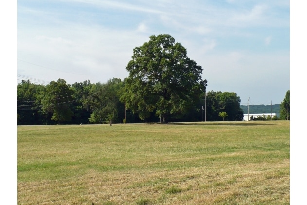
Property Detail
2174 S Boston Rd
77054
30.111 AC SOUTH BOSTON RD & WILDERNESS LN
Autorepair
Danville City
LIGHT ECON
Virginia
B and X Area of moderate flood hazard, usually the area between the limits of the 100-year and 500-year floods.
30.11 AC
2025
Virginia South Central
2025
Other Market Areas
001301
Danville, VA
37,706 SF
NEARBY LISTINGS FOR SALE OR LEASE
-
-
View all Danville listings for sale on LoopNet.com
DEMOGRAPHICS near 2174 S Boston Rd
1 mile
3 mile
5 mile
2025 Total Population
655
4,143
17,840
2030 Population
640
4,061
17,953
Pop Growth 2025-2030
(2.29%)
(1.98%)
+ 0.63%
Average Age
45
44
43
2025 Total Households
309
1,909
7,872
HH Growth 2025-2030
(2.27%)
(2.10%)
+ 0.70%
Median Household Inc
$42,941
$43,499
$38,367
Avg Household Size
2.10
2.20
2.20
2025 Avg HH Vehicles
2.00
2.00
2.00
Median Home Value
$146,969
$132,299
$96,249
Median Year Built
1977
1977
1965
Nearby Places
Map Layers
Map Styles
 Street
 Aerial
Layers
 Traffic
 Biking
Places
Listings with unknown addresses are not visible on the map
- Restaurants
- Banks
- Shops
- Fitness
- Groceries
PUBLIC TRANSPORTATION
COMMUTER RAIL
Danville Amtrak Station (Crescent - Amtrak)
Drive
Walk
Distance
Danville Amtrak Station (Crescent - Amtrak)
10 min
5.5 mi
Freight Ports
Virginia Port Authority - Richmond
Drive
Walk
Distance
Virginia Port Authority - Richmond
178 min
136.6 mi
Nearby Properties
Address
Land Use
TOTAL SIZE
Lot Size
Zoning
Address
Land Use
TOTAL SIZE
Lot Size
Zoning
87.04 AC
M-1
Address
Land Use
TOTAL SIZE
Lot Size
Zoning
23.16 AC
M-1
Address
Land Use
TOTAL SIZE
Lot Size
Zoning
1,440 SF
75.14 AC
LIGHT ECON
Address
Land Use
TOTAL SIZE
Lot Size
Zoning
485,973 SF
135.71 AC
MANUFACTUR
Address
Land Use
TOTAL SIZE
Lot Size
Zoning
66,846 SF
22.99 AC
CYBER PARK
Address
Land Use
TOTAL SIZE
Lot Size
Zoning
23.30 AC
M-1
Address
Land Use
TOTAL SIZE
Lot Size
Zoning
7,554 SF
961.50 AC
LIGHT ECON
Address
Land Use
TOTAL SIZE
Lot Size
Zoning
2,421 SF
14.29 AC
LIGHT ECON
Address
Land Use
TOTAL SIZE
Lot Size
Zoning
833,039 SF
66.18 AC
MANUFACTUR
Address
Land Use
TOTAL SIZE
Lot Size
Zoning
205,652 SF
7.13 AC
LIGHT ECON
Address
Land Use
TOTAL SIZE
Lot Size
Zoning
312,528 SF
23.32 AC
M-1
Address
Land Use
TOTAL SIZE
Lot Size
Zoning
93,442 SF
11.94 AC
CYBER PARK
Address
Land Use
TOTAL SIZE
Lot Size
Zoning
241,200 SF
55.54 AC
M-1
Address
Land Use
TOTAL SIZE
Lot Size
Zoning
420 SF
40.78 AC
LIGHT ECON
Address
Land Use
TOTAL SIZE
Lot Size
Zoning
51.53 AC
M-1
Address
Land Use
TOTAL SIZE
Lot Size
Zoning
77,004 SF
22.58 AC
THRESHOLD
Address
Land Use
TOTAL SIZE
Lot Size
Zoning
42,244 SF
6.10 AC
MULTI-FAMI
Address
Land Use
TOTAL SIZE
Lot Size
Zoning
62,336 SF
16.65 AC
CYBER PARK
Address
Land Use
TOTAL SIZE
Lot Size
Zoning
85,041 SF
10 AC
CYBER PARK
Address
Land Use
TOTAL SIZE
Lot Size
Zoning
150,000 SF
23.41 AC
M-1
Address
Land Use
TOTAL SIZE
Lot Size
Zoning
123.22 AC
M-2
Address
Land Use
TOTAL SIZE
Lot Size
Zoning
92,090 SF
3.13 AC
HIGHWAY RE
Address
Land Use
TOTAL SIZE
Lot Size
Zoning
50,652 SF
9.76 AC
LIGHT ECON
Address
Land Use
TOTAL SIZE
Lot Size
Zoning
67,940 SF
20.53 AC
M-1
Address
Land Use
TOTAL SIZE
Lot Size
Zoning
9,784 SF
4.81 AC
R-1
Address
Land Use
TOTAL SIZE
Lot Size
Zoning
60,016 SF
6.18 AC
PLANNED SH
Address
Land Use
TOTAL SIZE
Lot Size
Zoning
71,138 SF
17.72 AC
LIGHT ECON
Address
Land Use
TOTAL SIZE
Lot Size
Zoning
40,000 SF
36.31 AC
M-1
The World's #1 Commercial Real Estate Marketplace
Connect with us
© 2026 CoStar Group
The information above has been obtained from sources believed reliable. While we do not doubt its accuracy we have not verified it and make no guarantee, warranty or representation about it. It is your responsibility to independently confirm its accuracy and completeness. Any projections, opinions, assumptions, or estimates used are for example only and do not represent the current or future performance of the property. The value of this transaction to you depends on tax and other factors which should be evaluated by your tax, financial, and legal advisors. You and your advisors should conduct a careful, independent investigation of the property to determine to your satisfaction the suitability of the property for your needs.