Property Record
2183 Northdale Blvd Nw, Minneapolis, MN 55433

NEARBY LISTINGS FOR SALE OR LEASE
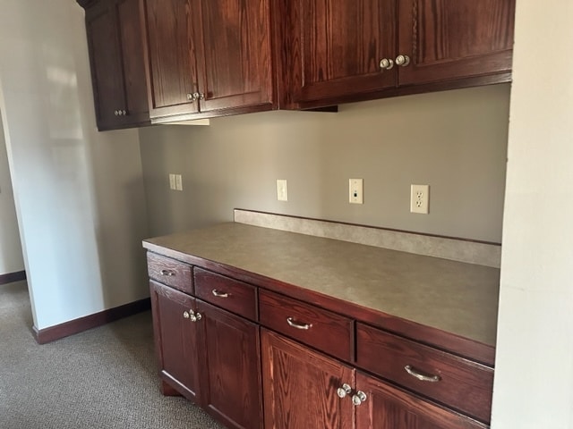
Property Detail
2183 Northdale Blvd Nw
Minneapolis-St. Paul-Bloomington, MN-WI
Northdale Commons Twnoff Park
10-31-24-34-0012
LOT 3 BLOCK 1 NORTHDALE COMMONS TOWNOFFICE PARK
Commercialnec
Anoka
X
Minnesota
27053C0087F
3
2025
0.07 AC
2025
Suburban St Paul
050602
Minneapolis/St Paul
3,072 SF
DEMOGRAPHICS near 2183 Northdale Blvd Nw
1 Mile
3 Mile
5 Mile
2024 Total Population
9,962
81,994
196,828
2029 Population
10,266
84,230
201,494
Pop Growth 2024-2029
+ 3.05%
+ 2.73%
+ 2.37%
Average Age
39
40
40
2024 Total Households
3,857
30,908
72,962
HH Growth 2024-2029
+ 2.96%
+ 2.84%
+ 2.48%
Median Household Inc
$75,017
$82,371
$89,468
Avg Household Size
2.50
2.60
2.60
2024 Avg HH Vehicles
2.00
2.00
2.00
Median Home Value
$249,882
$266,287
$284,053
Median Year Built
1982
1983
1986
Nearby Places
Map Layers
Map Styles
 Street
 Aerial
- Restaurants
- Banks
- Shops
- Fitness
- Groceries
PUBLIC TRANSPORTATION
COMMUTER RAIL
Coon Rapids-Riverdale Station (Northstar Corridor - Northstar Commuter Rail)
DRIVE
WALK
Distance
Coon Rapids-Riverdale Station (Northstar Corridor - Northstar Commuter Rail)
6 min
1.8 mi
Anoka Station (Northstar Corridor - Northstar Commuter Rail)
DRIVE
WALK
Distance
Anoka Station (Northstar Corridor - Northstar Commuter Rail)
11 min
5.3 mi
AIRPORT
Minneapolis-St Paul International/Wold-Chamberlain
DRIVE
WALK
Distance
Minneapolis-St Paul International/Wold-Chamberlain
49 min
32.8 mi
SALE & LEASE HISTORY
LISTING DATE
SALE/LEASE

Sep 07, 2023
For Sale
May 14, 2018
For Lease
Jan 27, 2020
For Lease
Aug 30, 2024
For Sale
Aug 22, 2023
For Lease
Nearby Properties
Address
Land Use
TOTAL SIZE
Lot Size
Zoning
Address
Land Use
TOTAL SIZE
Lot Size
Zoning
517,619 SF
3.85 AC
Address
Land Use
TOTAL SIZE
Lot Size
Zoning
412,914 SF
40 AC
Address
Land Use
TOTAL SIZE
Lot Size
Zoning
319,826 SF
37.97 AC
Address
Land Use
TOTAL SIZE
Lot Size
Zoning
5,110 SF
38.62 AC
Address
Land Use
TOTAL SIZE
Lot Size
Zoning
Address
Land Use
TOTAL SIZE
Lot Size
Zoning
122,816 SF
27.84 AC
Address
Land Use
TOTAL SIZE
Lot Size
Zoning
Address
Land Use
TOTAL SIZE
Lot Size
Zoning
129,060 SF
10.21 AC
Address
Land Use
TOTAL SIZE
Lot Size
Zoning
167 SF
4.73 AC
Address
Land Use
TOTAL SIZE
Lot Size
Zoning
342,686 SF
13.60 AC
Address
Land Use
TOTAL SIZE
Lot Size
Zoning
133,906 SF
34.37 AC
Address
Land Use
TOTAL SIZE
Lot Size
Zoning
159,335 SF
13.64 AC
Address
Land Use
TOTAL SIZE
Lot Size
Zoning
7,888 SF
40 AC
Address
Land Use
TOTAL SIZE
Lot Size
Zoning
168,887 SF
7.01 AC
Address
Land Use
TOTAL SIZE
Lot Size
Zoning
148 SF
39.49 AC
Address
Land Use
TOTAL SIZE
Lot Size
Zoning
116,452 SF
8.68 AC
Address
Land Use
TOTAL SIZE
Lot Size
Zoning
151,862 SF
12.97 AC
Address
Land Use
TOTAL SIZE
Lot Size
Zoning
137 SF
8.50 AC
Address
Land Use
TOTAL SIZE
Lot Size
Zoning
811,860 SF
Address
Land Use
TOTAL SIZE
Lot Size
Zoning
126 SF
7.19 AC
Address
Land Use
TOTAL SIZE
Lot Size
Zoning
160,668 SF
14.87 AC
Address
Land Use
TOTAL SIZE
Lot Size
Zoning
8,227 SF
23.35 AC
Address
Land Use
TOTAL SIZE
Lot Size
Zoning
89,466 SF
5.76 AC
Address
Land Use
TOTAL SIZE
Lot Size
Zoning
195,228 SF
14.77 AC
Address
Land Use
TOTAL SIZE
Lot Size
Zoning
30,308 SF
54.48 AC
Address
Land Use
TOTAL SIZE
Lot Size
Zoning
Address
Land Use
TOTAL SIZE
Lot Size
Zoning
115,846 SF
2.35 AC
Address
Land Use
TOTAL SIZE
Lot Size
Zoning
110 SF
4.48 AC
Address
Land Use
TOTAL SIZE
Lot Size
Zoning
99,846 SF
30.31 AC
Address
Land Use
TOTAL SIZE
Lot Size
Zoning
124,951 SF
12.67 AC
The World's #1 Commercial Real Estate Marketplace
Connect with us
© 2026 CoStar Group
The information above has been obtained from sources believed reliable. While we do not doubt its accuracy we have not verified it and make no guarantee, warranty or representation about it. It is your responsibility to independently confirm its accuracy and completeness. Any projections, opinions, assumptions, or estimates used are for example only and do not represent the current or future performance of the property. The value of this transaction to you depends on tax and other factors which should be evaluated by your tax, financial, and legal advisors. You and your advisors should conduct a careful, independent investigation of the property to determine to your satisfaction the suitability of the property for your needs.