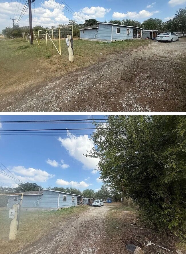
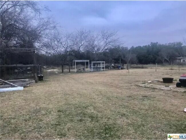
Property Record
21750 Us Highway 281 S, San Antonio, TX 78264
Current Lease Availabilities
NEARBY LISTINGS FOR SALE OR LEASE
Property Detail
21750 Us Highway 281 S
San Antonio-New Braunfels, TX
Gregorio Uriegas
04011-003-1831
Bexar
Sfr
Texas
X
0.25 AC
48493C0250C
South
1,216 SF
San Antonio
DEMOGRAPHICS near 21750 Us Highway 281 S
1 Mile
3 Mile
5 Mile
2024 Total Population
440
10,359
24,179
2029 Population
476
11,088
25,749
Pop Growth 2024-2029
+ 8.18%
+ 7.04%
+ 6.49%
Average Age
36
37
37
2024 Total Households
131
3,131
7,360
HH Growth 2024-2029
+ 8.40%
+ 7.09%
+ 6.59%
Median Household Inc
$34,562
$46,479
$52,097
Avg Household Size
3.20
3.20
3.20
2024 Avg HH Vehicles
2.00
2.00
2.00
Median Home Value
$165,305
$160,212
$164,161
Median Year Built
1998
1996
1996
Nearby Places
Map Layers
Map Styles
 Street
 Aerial
- Restaurants
- Banks
- Shops
- Fitness
- Groceries
PUBLIC TRANSPORTATION
AIRPORT
San Antonio International
DRIVE
WALK
Distance
San Antonio International
35 min
24.3 mi
Freight Ports
Port of Corpus Christi
DRIVE
WALK
Distance
Port of Corpus Christi
136 min
131.7 mi
Nearby Properties
Address
Land Use
TOTAL SIZE
Lot Size
Zoning
Address
Land Use
TOTAL SIZE
Lot Size
Zoning
5,753,521 SF
709.61 AC
Address
Land Use
TOTAL SIZE
Lot Size
Zoning
300.90 AC
Address
Land Use
TOTAL SIZE
Lot Size
Zoning
1,056 SF
304.42 AC
Address
Land Use
TOTAL SIZE
Lot Size
Zoning
246.25 AC
Address
Land Use
TOTAL SIZE
Lot Size
Zoning
271.41 AC
Address
Land Use
TOTAL SIZE
Lot Size
Zoning
179.87 AC
Address
Land Use
TOTAL SIZE
Lot Size
Zoning
181.82 AC
Address
Land Use
TOTAL SIZE
Lot Size
Zoning
143.57 AC
Address
Land Use
TOTAL SIZE
Lot Size
Zoning
29,400 SF
1.38 AC
Address
Land Use
TOTAL SIZE
Lot Size
Zoning
680 SF
10.78 AC
Address
Land Use
TOTAL SIZE
Lot Size
Zoning
2,770 SF
27.53 AC
Address
Land Use
TOTAL SIZE
Lot Size
Zoning
720 SF
48.47 AC
Address
Land Use
TOTAL SIZE
Lot Size
Zoning
8,296 SF
10 AC
Address
Land Use
TOTAL SIZE
Lot Size
Zoning
Address
Land Use
TOTAL SIZE
Lot Size
Zoning
9,034 SF
1.23 AC
Address
Land Use
TOTAL SIZE
Lot Size
Zoning
23,132 SF
7.14 AC
Address
Land Use
TOTAL SIZE
Lot Size
Zoning
322,050 SF
7.87 AC
Address
Land Use
TOTAL SIZE
Lot Size
Zoning
9,020 SF
1.73 AC
Address
Land Use
TOTAL SIZE
Lot Size
Zoning
151.60 AC
Address
Land Use
TOTAL SIZE
Lot Size
Zoning
14,597 SF
5.99 AC
Address
Land Use
TOTAL SIZE
Lot Size
Zoning
3,280 SF
186.35 AC
Address
Land Use
TOTAL SIZE
Lot Size
Zoning
Address
Land Use
TOTAL SIZE
Lot Size
Zoning
1,696 SF
149.02 AC
Address
Land Use
TOTAL SIZE
Lot Size
Zoning
10,441 SF
2 AC
Address
Land Use
TOTAL SIZE
Lot Size
Zoning
9.91 AC
Address
Land Use
TOTAL SIZE
Lot Size
Zoning
34,626 SF
0.60 AC
Address
Land Use
TOTAL SIZE
Lot Size
Zoning
29 SF
9.77 AC
Address
Land Use
TOTAL SIZE
Lot Size
Zoning
37.17 AC
Address
Land Use
TOTAL SIZE
Lot Size
Zoning
29.60 AC
Address
Land Use
TOTAL SIZE
Lot Size
Zoning
The World's #1 Commercial Real Estate Marketplace
Connect with us
© 2026 CoStar Group
The information above has been obtained from sources believed reliable. While we do not doubt its accuracy we have not verified it and make no guarantee, warranty or representation about it. It is your responsibility to independently confirm its accuracy and completeness. Any projections, opinions, assumptions, or estimates used are for example only and do not represent the current or future performance of the property. The value of this transaction to you depends on tax and other factors which should be evaluated by your tax, financial, and legal advisors. You and your advisors should conduct a careful, independent investigation of the property to determine to your satisfaction the suitability of the property for your needs.