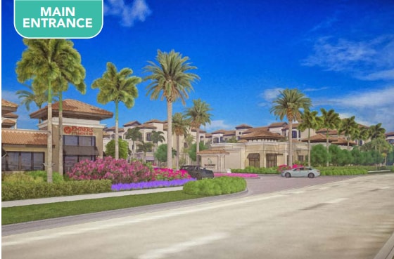
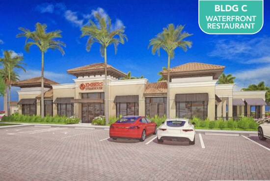
Property Record
21750 Via Coconut Pt, Estero, FL 33928
NEARBY LISTINGS FOR SALE OR LEASE
Property Detail
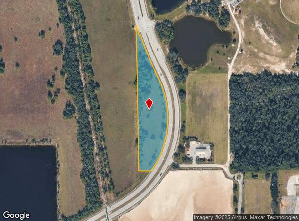
21750 Via Coconut Pt
Cape Coral-Fort Myers, FL
Corkscrew & I-75 / E
34-46-25-E4-0100C.0170
FLA.GULF LAND CO. BLK.C PB 1 PG 59 S 1/2 OF LOT 17 + POR OF LOT 16 DESC IN OR 4477/2118 LESS ROW OR 4558/4814 + OR 4565/499 + 4595 PG 2265 + OR 4595/2269 + INST#2007-177379
Pasture
Lee
AH
Florida
12071C0591H
17,16
2024
3.51 AC
2025
Estero
050210
Southwest Florida
DEMOGRAPHICS near 21750 Via Coconut Pt
1 Mile
3 Mile
5 Mile
2024 Total Population
5,592
48,793
95,089
2029 Population
6,269
54,212
105,305
Pop Growth 2024-2029
+ 12.11%
+ 11.11%
+ 10.74%
Average Age
55
53
50
2024 Total Households
2,566
23,052
42,059
HH Growth 2024-2029
+ 11.65%
+ 10.79%
+ 10.46%
Median Household Inc
$109,850
$92,553
$95,363
Avg Household Size
2.10
2.00
2.20
2024 Avg HH Vehicles
2.00
2.00
2.00
Median Home Value
$624,730
$474,776
$490,688
Median Year Built
2002
2002
2001
Nearby Places
Map Layers
Map Styles
 Street
 Aerial
- Restaurants
- Banks
- Shops
- Fitness
- Groceries
PUBLIC TRANSPORTATION
AIRPORT
Southwest Florida International
DRIVE
WALK
Distance
Southwest Florida International
23 min
14.4 mi
Freight Ports
Port Manatee
DRIVE
WALK
Distance
Port Manatee
131 min
114.1 mi
Nearby Properties
Address
Land Use
TOTAL SIZE
Lot Size
Zoning
Address
Land Use
TOTAL SIZE
Lot Size
Zoning
785,522 SF
70.04 AC
MPD
Address
Land Use
TOTAL SIZE
Lot Size
Zoning
177,930 SF
20.74 AC
MPD
Address
Land Use
TOTAL SIZE
Lot Size
Zoning
687,668 SF
27.19 AC
CPD
Address
Land Use
TOTAL SIZE
Lot Size
Zoning
20.19 AC
MPD
Address
Land Use
TOTAL SIZE
Lot Size
Zoning
395,259 SF
16.56 AC
MPD
Address
Land Use
TOTAL SIZE
Lot Size
Zoning
369,577 SF
16.39 AC
RPD
Address
Land Use
TOTAL SIZE
Lot Size
Zoning
482,782 SF
27.98 AC
CPD
Address
Land Use
TOTAL SIZE
Lot Size
Zoning
294,689 SF
17.95 AC
MPD
Address
Land Use
TOTAL SIZE
Lot Size
Zoning
345,170 SF
21.32 AC
RPD
Address
Land Use
TOTAL SIZE
Lot Size
Zoning
291,157 SF
23.38 AC
RPD
Address
Land Use
TOTAL SIZE
Lot Size
Zoning
540,648 SF
19.75 AC
MPD
Address
Land Use
TOTAL SIZE
Lot Size
Zoning
293,332 SF
7.03 AC
CPD
Address
Land Use
TOTAL SIZE
Lot Size
Zoning
320,574 SF
16.10 AC
MPD
Address
Land Use
TOTAL SIZE
Lot Size
Zoning
245,356 SF
12.54 AC
MPD
Address
Land Use
TOTAL SIZE
Lot Size
Zoning
274,691 SF
6.62 AC
MPD
Address
Land Use
TOTAL SIZE
Lot Size
Zoning
348,757 SF
69.01 AC
CF-2
Address
Land Use
TOTAL SIZE
Lot Size
Zoning
Address
Land Use
TOTAL SIZE
Lot Size
Zoning
240,044 SF
14.19 AC
MPD
Address
Land Use
TOTAL SIZE
Lot Size
Zoning
69.37 AC
RPD
Address
Land Use
TOTAL SIZE
Lot Size
Zoning
14.42 AC
RPD
Address
Land Use
TOTAL SIZE
Lot Size
Zoning
5.39 AC
RPD
Address
Land Use
TOTAL SIZE
Lot Size
Zoning
236,456 SF
27.05 AC
MPD
Address
Land Use
TOTAL SIZE
Lot Size
Zoning
239.40 AC
Address
Land Use
TOTAL SIZE
Lot Size
Zoning
166,672 SF
8.58 AC
CPD
Address
Land Use
TOTAL SIZE
Lot Size
Zoning
174,712 SF
9.70 AC
MPD
Address
Land Use
TOTAL SIZE
Lot Size
Zoning
139,174 SF
4.73 AC
CPD
Address
Land Use
TOTAL SIZE
Lot Size
Zoning
151,366 SF
15.47 AC
CPD
Address
Land Use
TOTAL SIZE
Lot Size
Zoning
48,538 SF
4.46 AC
CC
Address
Land Use
TOTAL SIZE
Lot Size
Zoning
120,254 SF
5.32 AC
CPD
Address
Land Use
TOTAL SIZE
Lot Size
Zoning
181,680 SF
9.89 AC
MPD
The World's #1 Commercial Real Estate Marketplace
Connect with us
© 2025 CoStar Group
The information above has been obtained from sources believed reliable. While we do not doubt its accuracy we have not verified it and make no guarantee, warranty or representation about it. It is your responsibility to independently confirm its accuracy and completeness. Any projections, opinions, assumptions, or estimates used are for example only and do not represent the current or future performance of the property. The value of this transaction to you depends on tax and other factors which should be evaluated by your tax, financial, and legal advisors. You and your advisors should conduct a careful, independent investigation of the property to determine to your satisfaction the suitability of the property for your needs.