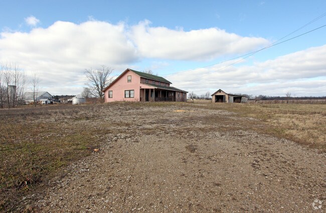
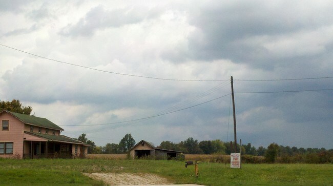
Property Record
2183 Hebron Rd, Heath, OH 43056


Property Detail
2183 Hebron Rd
Columbus, OH
113.767 AC LOT 3 (OLD LOT 10 PT) R12 T1 Q2 + Q3
080-334326-00.000
Licking
Vehiclerentalsvehiclesales
Ohio
AE The base floodplain where base flood elevations are provided. AE Zones are now used on new format FIRMs instead of A1-A30 Zones.
3
2025
113.76 AC
2025
Licking County
753100
Columbus
187,286 SF
NEARBY LISTINGS FOR SALE OR LEASE
DEMOGRAPHICS near 2183 Hebron Rd
1 mile
3 mile
5 mile
2025 Total Population
429
9,263
41,539
2030 Population
439
9,543
42,575
Pop Growth 2025-2030
+ 2.33%
+ 3.02%
+ 2.49%
Average Age
45
43
42
2025 Total Households
187
3,897
17,211
HH Growth 2025-2030
+ 2.14%
+ 3.03%
+ 2.53%
Median Household Inc
$80,720
$67,211
$69,223
Avg Household Size
2.30
2.30
2.30
2025 Avg HH Vehicles
3.00
2.00
2.00
Median Home Value
$273,636
$240,841
$242,056
Median Year Built
1994
1982
1971
Nearby Places
Map Layers
Map Styles
 Street
 Aerial
Layers
 Traffic
 Biking
Places
Listings with unknown addresses are not visible on the map
- Restaurants
- Banks
- Shops
- Fitness
- Groceries
PUBLIC TRANSPORTATION
AIRPORT
John Glenn Columbus International
Drive
Walk
Distance
John Glenn Columbus International
41 min
32.2 mi
Rickenbacker International
Drive
Walk
Distance
Rickenbacker International
44 min
34.4 mi
Freight Ports
Port of Toledo
Drive
Walk
Distance
Port of Toledo
202 min
166.1 mi
Nearby Properties
Address
Land Use
TOTAL SIZE
Lot Size
Zoning
Address
Land Use
TOTAL SIZE
Lot Size
Zoning
750,000 SF
50.61 AC
Address
Land Use
TOTAL SIZE
Lot Size
Zoning
332,516 SF
44.81 AC
Address
Land Use
TOTAL SIZE
Lot Size
Zoning
2,200 SF
226.33 AC
Address
Land Use
TOTAL SIZE
Lot Size
Zoning
401,863 SF
22.18 AC
Address
Land Use
TOTAL SIZE
Lot Size
Zoning
50,871 SF
51.13 AC
Address
Land Use
TOTAL SIZE
Lot Size
Zoning
68,954 SF
64.81 AC
Address
Land Use
TOTAL SIZE
Lot Size
Zoning
248,400 SF
12.08 AC
Address
Land Use
TOTAL SIZE
Lot Size
Zoning
223,436 SF
19.22 AC
Address
Land Use
TOTAL SIZE
Lot Size
Zoning
4,018,110 SF
19.93 AC
Address
Land Use
TOTAL SIZE
Lot Size
Zoning
172,603 SF
15.88 AC
Address
Land Use
TOTAL SIZE
Lot Size
Zoning
59,992 SF
118.45 AC
Address
Land Use
TOTAL SIZE
Lot Size
Zoning
19,200 SF
14.56 AC
Address
Land Use
TOTAL SIZE
Lot Size
Zoning
398,678 SF
12.04 AC
Address
Land Use
TOTAL SIZE
Lot Size
Zoning
150,000 SF
11.18 AC
Address
Land Use
TOTAL SIZE
Lot Size
Zoning
399,520 SF
21.62 AC
Address
Land Use
TOTAL SIZE
Lot Size
Zoning
18,198 SF
12.83 AC
Address
Land Use
TOTAL SIZE
Lot Size
Zoning
1,936 SF
130.89 AC
Address
Land Use
TOTAL SIZE
Lot Size
Zoning
112,430 SF
15.33 AC
Address
Land Use
TOTAL SIZE
Lot Size
Zoning
523,249 SF
40 AC
Address
Land Use
TOTAL SIZE
Lot Size
Zoning
570,284 SF
56.17 AC
Address
Land Use
TOTAL SIZE
Lot Size
Zoning
210.02 AC
Address
Land Use
TOTAL SIZE
Lot Size
Zoning
192,701 SF
10.28 AC
Address
Land Use
TOTAL SIZE
Lot Size
Zoning
960 SF
56.60 AC
Address
Land Use
TOTAL SIZE
Lot Size
Zoning
135,148 SF
14.94 AC
Address
Land Use
TOTAL SIZE
Lot Size
Zoning
1,165 SF
141.30 AC
Address
Land Use
TOTAL SIZE
Lot Size
Zoning
73,372 SF
21.86 AC
Address
Land Use
TOTAL SIZE
Lot Size
Zoning
Address
Land Use
TOTAL SIZE
Lot Size
Zoning
61,570 SF
5.35 AC
Address
Land Use
TOTAL SIZE
Lot Size
Zoning
91.99 AC
The World's #1 Commercial Real Estate Marketplace
Connect with us
© 2026 CoStar Group
The information above has been obtained from sources believed reliable. While we do not doubt its accuracy we have not verified it and make no guarantee, warranty or representation about it. It is your responsibility to independently confirm its accuracy and completeness. Any projections, opinions, assumptions, or estimates used are for example only and do not represent the current or future performance of the property. The value of this transaction to you depends on tax and other factors which should be evaluated by your tax, financial, and legal advisors. You and your advisors should conduct a careful, independent investigation of the property to determine to your satisfaction the suitability of the property for your needs.