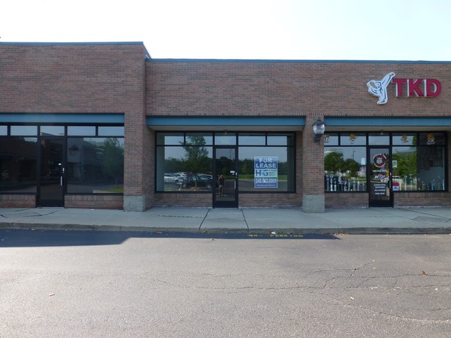
Property Record
21840 23 Mile Rd, Macomb, MI 48042


NEARBY LISTINGS FOR SALE OR LEASE
Property Detail
21840 23 Mile Rd
20-08-23-100-029
T3N, R13E, SEC 23, COMM AT NW COR SEC 23, TH N88*36'35"E 661.08 FT TO POB, TH N88*36'35"E 347.17 FT, TH S01*37'55"E 231.52
Commercialnec
Macomb
A
Michigan
26099C0245G
7.22 AC
2025
Macomb East
2025
Detroit
223401
Detroit-Warren-Dearborn, MI
39,816 SF
DEMOGRAPHICS near 21840 23 Mile Rd
1 Mile
3 Mile
5 Mile
2024 Total Population
6,678
54,675
159,957
2029 Population
6,630
54,188
158,359
Pop Growth 2024-2029
(0.72%)
(0.89%)
(1.00%)
Average Age
38
39
40
2024 Total Households
2,099
18,601
60,131
HH Growth 2024-2029
(0.67%)
(0.85%)
(1.03%)
Median Household Inc
$127,640
$108,251
$88,712
Avg Household Size
3.20
2.90
2.60
2024 Avg HH Vehicles
2.00
2.00
2.00
Median Home Value
$357,056
$326,006
$288,372
Median Year Built
2004
2000
1995
Nearby Places
Map Layers
Map Styles
 Street
 Aerial
- Restaurants
- Banks
- Shops
- Fitness
- Groceries
PUBLIC TRANSPORTATION
AIRPORT
Windsor International
DRIVE
WALK
Distance
Windsor International
66 min
42.1 mi
Freight Ports
Port of Toledo
DRIVE
WALK
Distance
Port of Toledo
116 min
92.5 mi
SALE & LEASE HISTORY
LISTING DATE
SALE/LEASE

Sep 25, 2016
For Lease
Nearby Properties
Address
Land Use
TOTAL SIZE
Lot Size
Zoning
Address
Land Use
TOTAL SIZE
Lot Size
Zoning
20,891 SF
289.61 AC
R3
Address
Land Use
TOTAL SIZE
Lot Size
Zoning
89,559 SF
44.54 AC
O2
Address
Land Use
TOTAL SIZE
Lot Size
Zoning
118,343 SF
7.33 AC
R1
Address
Land Use
TOTAL SIZE
Lot Size
Zoning
600 SF
18.79 AC
R2L
Address
Land Use
TOTAL SIZE
Lot Size
Zoning
115,349 SF
14.39 AC
C3
Address
Land Use
TOTAL SIZE
Lot Size
Zoning
45,864 SF
4.60 AC
C2
Address
Land Use
TOTAL SIZE
Lot Size
Zoning
99,619 SF
8.24 AC
M1
Address
Land Use
TOTAL SIZE
Lot Size
Zoning
679,606 SF
29.98 AC
M2 GEN
Address
Land Use
TOTAL SIZE
Lot Size
Zoning
218,662 SF
16.61 AC
M2 GEN
Address
Land Use
TOTAL SIZE
Lot Size
Zoning
37.96 AC
AG
Address
Land Use
TOTAL SIZE
Lot Size
Zoning
312,087 SF
25.65 AC
M1
Address
Land Use
TOTAL SIZE
Lot Size
Zoning
16.46 AC
R2L
Address
Land Use
TOTAL SIZE
Lot Size
Zoning
127,552 SF
13.29 AC
C2
Address
Land Use
TOTAL SIZE
Lot Size
Zoning
78,805 SF
4.94 AC
M2 GEN
Address
Land Use
TOTAL SIZE
Lot Size
Zoning
28,746 SF
10.70 AC
C3
Address
Land Use
TOTAL SIZE
Lot Size
Zoning
313,174 SF
22.23 AC
M2 GEN
Address
Land Use
TOTAL SIZE
Lot Size
Zoning
128,187 SF
8.79 AC
M2 GEN
Address
Land Use
TOTAL SIZE
Lot Size
Zoning
161,123 SF
31.11 AC
M1 LIG
Address
Land Use
TOTAL SIZE
Lot Size
Zoning
103,800 SF
2.44 AC
M1
Address
Land Use
TOTAL SIZE
Lot Size
Zoning
14.71 AC
R2L
Address
Land Use
TOTAL SIZE
Lot Size
Zoning
121,821 SF
8.85 AC
M1 LIG
Address
Land Use
TOTAL SIZE
Lot Size
Zoning
102,808 SF
5 AC
M1 LIG
Address
Land Use
TOTAL SIZE
Lot Size
Zoning
63,912 SF
3 AC
M1
Address
Land Use
TOTAL SIZE
Lot Size
Zoning
104,098 SF
11.07 AC
C2
Address
Land Use
TOTAL SIZE
Lot Size
Zoning
270,052 SF
15.09 AC
M2 GEN
Address
Land Use
TOTAL SIZE
Lot Size
Zoning
81,204 SF
8.96 AC
C.JDMT
Address
Land Use
TOTAL SIZE
Lot Size
Zoning
36,485 SF
M1
Address
Land Use
TOTAL SIZE
Lot Size
Zoning
151,772 SF
22.11 AC
M1
Address
Land Use
TOTAL SIZE
Lot Size
Zoning
86,210 SF
6.95 AC
M2 GEN
The World's #1 Commercial Real Estate Marketplace
Connect with us
© 2025 CoStar Group
The information above has been obtained from sources believed reliable. While we do not doubt its accuracy we have not verified it and make no guarantee, warranty or representation about it. It is your responsibility to independently confirm its accuracy and completeness. Any projections, opinions, assumptions, or estimates used are for example only and do not represent the current or future performance of the property. The value of this transaction to you depends on tax and other factors which should be evaluated by your tax, financial, and legal advisors. You and your advisors should conduct a careful, independent investigation of the property to determine to your satisfaction the suitability of the property for your needs.