Property Record
21848 S County Road 325, Hawthorne, FL 32640


This Property Is For Sale
NEARBY LISTINGS FOR SALE OR LEASE
-
-
View all Hawthorne listings for sale on LoopNet.com
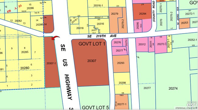
Property Detail
21848 S County Road 325
Gainesville, FL
Capstone Quarters
20307-001-000
COM NE COR SEC W 315.48 FT M/L TO C/L OF RR S 752.40 FT M/L W 245.52 FT POB W 798.60 FT S 617.76 FT E 834.24 FT N 588.72 FT POB THAT PART LYING W OF US 301 OF THE ABOVE DESC PARCEL LESS R/W US 301) OR 4051/0402
Departmentstore
Alachua
X
Florida
12083C0155D
2
2025
1.59 AC
2025
Gainesville
002101
Other Market Areas
2,440 SF
DEMOGRAPHICS near 21848 S County Road 325
1 Mile
3 Mile
5 Mile
2024 Total Population
143
884
4,986
2029 Population
153
993
5,605
Pop Growth 2024-2029
+ 6.99%
+ 12.33%
+ 12.41%
Average Age
46
43
44
2024 Total Households
59
357
2,031
HH Growth 2024-2029
+ 6.78%
+ 12.32%
+ 12.26%
Median Household Inc
$65,192
$28,775
$40,038
Avg Household Size
2.30
2.40
2.40
2024 Avg HH Vehicles
2.00
2.00
2.00
Median Home Value
$304,167
$303,053
$191,419
Median Year Built
1983
1983
1984
Nearby Places
Map Layers
Map Styles
 Street
 Aerial
- Restaurants
- Banks
- Shops
- Fitness
- Groceries
PUBLIC TRANSPORTATION
AIRPORT
Gainesville Regional
DRIVE
WALK
Distance
Gainesville Regional
41 min
29.2 mi
Freight Ports
Jacksonville Port
DRIVE
WALK
Distance
Jacksonville Port
108 min
85.9 mi
Nearby Properties
Address
Land Use
TOTAL SIZE
Lot Size
Zoning
Address
Land Use
TOTAL SIZE
Lot Size
Zoning
22,080 SF
3.05 AC
B4
Address
Land Use
TOTAL SIZE
Lot Size
Zoning
8,320 SF
1.09 AC
B4
Address
Land Use
TOTAL SIZE
Lot Size
Zoning
1,216 SF
613.18 AC
A
Address
Land Use
TOTAL SIZE
Lot Size
Zoning
Address
Land Use
TOTAL SIZE
Lot Size
Zoning
4,965 SF
1.53 AC
B4
Address
Land Use
TOTAL SIZE
Lot Size
Zoning
3,360 SF
0.65 AC
B4
Address
Land Use
TOTAL SIZE
Lot Size
Zoning
6,224 SF
10 AC
M1
Address
Land Use
TOTAL SIZE
Lot Size
Zoning
8,000 SF
1 AC
B4
Address
Land Use
TOTAL SIZE
Lot Size
Zoning
390.19 AC
A
Address
Land Use
TOTAL SIZE
Lot Size
Zoning
2,881 SF
55.39 AC
A
Address
Land Use
TOTAL SIZE
Lot Size
Zoning
2,060 SF
9.22 AC
A1
Address
Land Use
TOTAL SIZE
Lot Size
Zoning
6,238 SF
2.38 AC
B4
Address
Land Use
TOTAL SIZE
Lot Size
Zoning
3,540 SF
61.68 AC
A
Address
Land Use
TOTAL SIZE
Lot Size
Zoning
1,044 SF
3.32 AC
PRV
Address
Land Use
TOTAL SIZE
Lot Size
Zoning
3,242 SF
3.30 AC
B4
Address
Land Use
TOTAL SIZE
Lot Size
Zoning
5,593 SF
4.11 AC
A1
Address
Land Use
TOTAL SIZE
Lot Size
Zoning
5,900 SF
65.09 AC
A1
Address
Land Use
TOTAL SIZE
Lot Size
Zoning
3,408 SF
0.70 AC
B4
Address
Land Use
TOTAL SIZE
Lot Size
Zoning
546 SF
35.29 AC
A1
Address
Land Use
TOTAL SIZE
Lot Size
Zoning
2,469 SF
2.69 AC
A3
Address
Land Use
TOTAL SIZE
Lot Size
Zoning
4,528 SF
1.49 AC
A
Address
Land Use
TOTAL SIZE
Lot Size
Zoning
3,791 SF
17.46 AC
A
Address
Land Use
TOTAL SIZE
Lot Size
Zoning
5,073 SF
3.04 AC
B4
Address
Land Use
TOTAL SIZE
Lot Size
Zoning
1,658 SF
3.01 AC
A1
Address
Land Use
TOTAL SIZE
Lot Size
Zoning
3,542 SF
0.90 AC
B4
Address
Land Use
TOTAL SIZE
Lot Size
Zoning
11,705 SF
3.36 AC
M1
Address
Land Use
TOTAL SIZE
Lot Size
Zoning
1,921 SF
3 AC
A1
Address
Land Use
TOTAL SIZE
Lot Size
Zoning
1,800 SF
30.40 AC
A
The World's #1 Commercial Real Estate Marketplace
Connect with us
© 2026 CoStar Group
The information above has been obtained from sources believed reliable. While we do not doubt its accuracy we have not verified it and make no guarantee, warranty or representation about it. It is your responsibility to independently confirm its accuracy and completeness. Any projections, opinions, assumptions, or estimates used are for example only and do not represent the current or future performance of the property. The value of this transaction to you depends on tax and other factors which should be evaluated by your tax, financial, and legal advisors. You and your advisors should conduct a careful, independent investigation of the property to determine to your satisfaction the suitability of the property for your needs.