Property Record
2185 Lester Rd, Nesbit, MS 38651
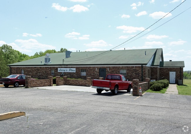

Property Detail
2185 Lester Rd
2078280000000710
PT NW1/4 NW1/4
Commercialnec
Desoto
A-R
Mississippi
B and X Area of moderate flood hazard, usually the area between the limits of the 100-year and 500-year floods.
7
2025
3.28 AC
2025
Outlying DeSoto Cnty
071124
Memphis
6,005 SF
Memphis, TN-MS-AR
NEARBY LISTINGS FOR SALE OR LEASE
-
-
View all Nesbit listings for sale on LoopNet.com
DEMOGRAPHICS near 2185 Lester Rd
1 mile
3 mile
5 mile
2025 Total Population
962
18,782
54,118
2030 Population
995
19,768
56,848
Pop Growth 2025-2030
+ 3.43%
+ 5.25%
+ 5.04%
Average Age
41
39
39
2025 Total Households
334
6,428
19,769
HH Growth 2025-2030
+ 3.29%
+ 5.26%
+ 5.02%
Median Household Inc
$129,250
$115,411
$95,203
Avg Household Size
2.90
2.90
2.70
2025 Avg HH Vehicles
2.00
2.00
2.00
Median Home Value
$392,528
$363,068
$333,120
Median Year Built
2002
2004
2001
Nearby Places
Map Layers
Map Styles
 Street
 Aerial
Transit
 Traffic
 Biking
Places
Listings with unknown addresses are not visible on the map
- Restaurants
- Banks
- Shops
- Fitness
- Groceries
PUBLIC TRANSPORTATION
AIRPORT
Memphis International
Drive
Walk
Distance
Memphis International
24 min
16.2 mi
Freight Ports
Port of Shreveport
Drive
Walk
Distance
Port of Shreveport
426 min
389.8 mi
Nearby Properties
Address
Land Use
TOTAL SIZE
Lot Size
Zoning
Address
Land Use
TOTAL SIZE
Lot Size
Zoning
29,738 SF
15 AC
C-2
Address
Land Use
TOTAL SIZE
Lot Size
Zoning
64,797 SF
13.91 AC
M-1
Address
Land Use
TOTAL SIZE
Lot Size
Zoning
61,429 SF
4.18 AC
PUD
Address
Land Use
TOTAL SIZE
Lot Size
Zoning
15.10 AC
C-2
Address
Land Use
TOTAL SIZE
Lot Size
Zoning
23,530 SF
9.35 AC
M-1
Address
Land Use
TOTAL SIZE
Lot Size
Zoning
35,000 SF
4.72 AC
PUD
Address
Land Use
TOTAL SIZE
Lot Size
Zoning
20,120 SF
3.43 AC
PUD
Address
Land Use
TOTAL SIZE
Lot Size
Zoning
10,200 SF
3.69 AC
C-2
Address
Land Use
TOTAL SIZE
Lot Size
Zoning
5,518 SF
128.60 AC
PUD
Address
Land Use
TOTAL SIZE
Lot Size
Zoning
7,500 SF
3.90 AC
C-4
Address
Land Use
TOTAL SIZE
Lot Size
Zoning
987 SF
41.70 AC
A-R
Address
Land Use
TOTAL SIZE
Lot Size
Zoning
3,611 SF
1.01 AC
C-2
Address
Land Use
TOTAL SIZE
Lot Size
Zoning
4,959 SF
1 AC
C-2
Address
Land Use
TOTAL SIZE
Lot Size
Zoning
4,335 SF
1.50 AC
PUD
Address
Land Use
TOTAL SIZE
Lot Size
Zoning
7,150 SF
3.08 AC
A
Address
Land Use
TOTAL SIZE
Lot Size
Zoning
2,836 SF
32.27 AC
A
Address
Land Use
TOTAL SIZE
Lot Size
Zoning
5,640 SF
3.25 AC
PUD
Address
Land Use
TOTAL SIZE
Lot Size
Zoning
15,178 SF
3.18 AC
M-1
Address
Land Use
TOTAL SIZE
Lot Size
Zoning
8,862 SF
5.25 AC
C-4
Address
Land Use
TOTAL SIZE
Lot Size
Zoning
10,988 SF
1.64 AC
M-1
Address
Land Use
TOTAL SIZE
Lot Size
Zoning
2,880 SF
0.51 AC
C-2
Address
Land Use
TOTAL SIZE
Lot Size
Zoning
3,918 SF
1.50 AC
A-R
Address
Land Use
TOTAL SIZE
Lot Size
Zoning
10,000 SF
1.57 AC
M-1
Address
Land Use
TOTAL SIZE
Lot Size
Zoning
5,123 SF
3.50 AC
A
Address
Land Use
TOTAL SIZE
Lot Size
Zoning
14.48 AC
PUD
Address
Land Use
TOTAL SIZE
Lot Size
Zoning
9,167 SF
0.99 AC
C-4
Address
Land Use
TOTAL SIZE
Lot Size
Zoning
7,250 SF
7.30 AC
C-2
Address
Land Use
TOTAL SIZE
Lot Size
Zoning
5,740 SF
0.31 AC
C-1
Address
Land Use
TOTAL SIZE
Lot Size
Zoning
6,752 SF
1 AC
C-2
Address
Land Use
TOTAL SIZE
Lot Size
Zoning
5,025 SF
7 AC
C-2
The World's #1 Commercial Real Estate Marketplace
Connect with us
© 2026 CoStar Group
The information above has been obtained from sources believed reliable. While we do not doubt its accuracy we have not verified it and make no guarantee, warranty or representation about it. It is your responsibility to independently confirm its accuracy and completeness. Any projections, opinions, assumptions, or estimates used are for example only and do not represent the current or future performance of the property. The value of this transaction to you depends on tax and other factors which should be evaluated by your tax, financial, and legal advisors. You and your advisors should conduct a careful, independent investigation of the property to determine to your satisfaction the suitability of the property for your needs.