Property Record
219 14Th St W, Hardin, MT 59034

NEARBY LISTINGS FOR SALE OR LEASE
-
-
View all Hardin listings for sale on LoopNet.com
Property Detail
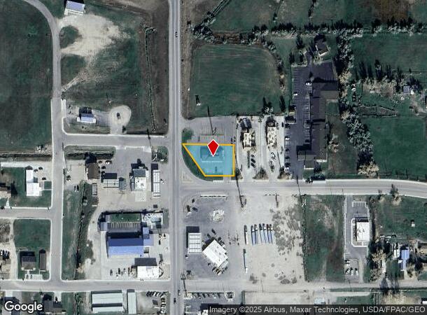
219 14Th St W
Other Market Areas
Hardin Center Subdivision
22093414426020000
HARDIN CENTER SUBDIVISION, S14, T01 S, R33 E, BLOCK 1, LOT 2, 20923 SQUARE FEET
Restaurantdrivein
Big Horn
2025
Montana
2025
2
000100
0.48 AC
3,080 SF
Montana Other Areas
DEMOGRAPHICS near 219 14Th St W
1 Mile
3 Mile
5 Mile
2024 Total Population
2,833
5,442
5,461
2029 Population
2,846
5,423
5,442
Pop Growth 2024-2029
+ 0.46%
(0.35%)
(0.35%)
Average Age
37
37
37
2024 Total Households
951
1,820
1,827
HH Growth 2024-2029
+ 0.63%
(0.27%)
(0.22%)
Median Household Inc
$55,815
$54,626
$54,602
Avg Household Size
2.70
2.80
2.80
2024 Avg HH Vehicles
2.00
2.00
2.00
Median Home Value
$145,744
$145,388
$145,758
Median Year Built
1968
1971
1971
Nearby Places
Map Layers
Map Styles
 Street
 Aerial
- Restaurants
- Banks
- Shops
- Fitness
- Groceries
SALE & LEASE HISTORY
LISTING DATE
SALE/LEASE

Oct 17, 2022
For Sale
Nearby Properties
Address
Land Use
TOTAL SIZE
Lot Size
Zoning
Address
Land Use
TOTAL SIZE
Lot Size
Zoning
81,868 SF
34.51 AC
Address
Land Use
TOTAL SIZE
Lot Size
Zoning
2,880 SF
11.25 AC
Address
Land Use
TOTAL SIZE
Lot Size
Zoning
5,000 SF
25.40 AC
Address
Land Use
TOTAL SIZE
Lot Size
Zoning
11,774 SF
23.73 AC
Address
Land Use
TOTAL SIZE
Lot Size
Zoning
45,062 SF
1.61 AC
Address
Land Use
TOTAL SIZE
Lot Size
Zoning
18,941 SF
3.41 AC
Address
Land Use
TOTAL SIZE
Lot Size
Zoning
43,384 SF
6.72 AC
Address
Land Use
TOTAL SIZE
Lot Size
Zoning
2,100 SF
Address
Land Use
TOTAL SIZE
Lot Size
Zoning
48,224 SF
0.96 AC
Address
Land Use
TOTAL SIZE
Lot Size
Zoning
38,125 SF
0.96 AC
1
Address
Land Use
TOTAL SIZE
Lot Size
Zoning
10,093 SF
118.86 AC
Address
Land Use
TOTAL SIZE
Lot Size
Zoning
8,316 SF
24.27 AC
Address
Land Use
TOTAL SIZE
Lot Size
Zoning
28,056 SF
3.35 AC
Address
Land Use
TOTAL SIZE
Lot Size
Zoning
13,672 SF
13.01 AC
8
Address
Land Use
TOTAL SIZE
Lot Size
Zoning
2,400 SF
202.48 AC
Address
Land Use
TOTAL SIZE
Lot Size
Zoning
5,459 SF
1.69 AC
Address
Land Use
TOTAL SIZE
Lot Size
Zoning
35,370 SF
3.28 AC
Address
Land Use
TOTAL SIZE
Lot Size
Zoning
12,538 SF
0.64 AC
Address
Land Use
TOTAL SIZE
Lot Size
Zoning
20,820 SF
3.47 AC
Address
Land Use
TOTAL SIZE
Lot Size
Zoning
7,842 SF
1.23 AC
Address
Land Use
TOTAL SIZE
Lot Size
Zoning
13,500 SF
13.50 AC
1
Address
Land Use
TOTAL SIZE
Lot Size
Zoning
4,000 SF
62.48 AC
Address
Land Use
TOTAL SIZE
Lot Size
Zoning
10,858 SF
0.32 AC
6
Address
Land Use
TOTAL SIZE
Lot Size
Zoning
10,752 SF
19.75 AC
Address
Land Use
TOTAL SIZE
Lot Size
Zoning
9,712 SF
0.54 AC
1
Address
Land Use
TOTAL SIZE
Lot Size
Zoning
10,044 SF
1.51 AC
Address
Land Use
TOTAL SIZE
Lot Size
Zoning
3,950 SF
1.32 AC
1
Address
Land Use
TOTAL SIZE
Lot Size
Zoning
11,317 SF
1.27 AC
Address
Land Use
TOTAL SIZE
Lot Size
Zoning
9,082 SF
1.23 AC
Address
Land Use
TOTAL SIZE
Lot Size
Zoning
16,992 SF
1.23 AC
The World's #1 Commercial Real Estate Marketplace
Connect with us
© 2026 CoStar Group
The information above has been obtained from sources believed reliable. While we do not doubt its accuracy we have not verified it and make no guarantee, warranty or representation about it. It is your responsibility to independently confirm its accuracy and completeness. Any projections, opinions, assumptions, or estimates used are for example only and do not represent the current or future performance of the property. The value of this transaction to you depends on tax and other factors which should be evaluated by your tax, financial, and legal advisors. You and your advisors should conduct a careful, independent investigation of the property to determine to your satisfaction the suitability of the property for your needs.