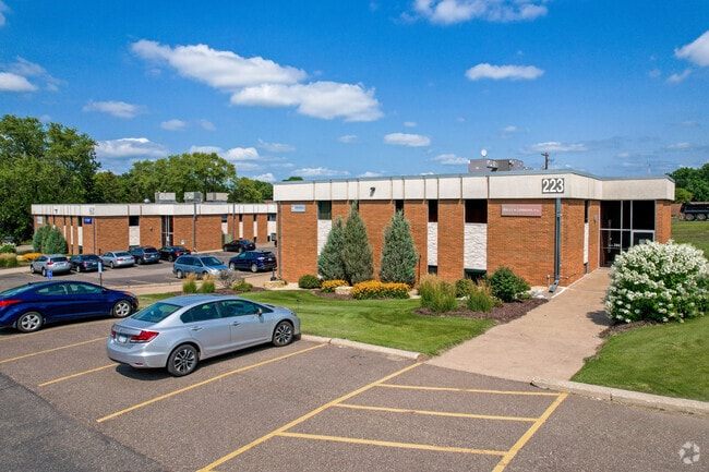
Property Record
219 Little Canada Rd E, Saint Paul, MN 55117


NEARBY LISTINGS FOR SALE OR LEASE
Property Detail
219 Little Canada Rd E
Minneapolis-St. Paul-Bloomington, MN-WI
Quicksilver
06-29-22-44-0041
QUICKSILVER LOT 2 BLK 1
Officebuilding
Ramsey
X
Minnesota
27003C0450E
2
2024
1.90 AC
2025
Suburban St Paul
042101
Minneapolis/St Paul
29,968 SF
DEMOGRAPHICS near 219 Little Canada Rd E
1 Mile
3 Mile
5 Mile
2024 Total Population
9,813
72,005
250,818
2029 Population
9,581
69,950
243,400
Pop Growth 2024-2029
(2.36%)
(2.85%)
(2.96%)
Average Age
41
40
38
2024 Total Households
4,350
28,422
94,051
HH Growth 2024-2029
(2.71%)
(3.09%)
(3.10%)
Median Household Inc
$61,560
$72,670
$71,283
Avg Household Size
2.20
2.40
2.50
2024 Avg HH Vehicles
2.00
2.00
2.00
Median Home Value
$290,487
$295,785
$277,285
Median Year Built
1979
1973
1969
Nearby Places
Map Layers
Map Styles
 Street
 Aerial
- Restaurants
- Banks
- Shops
- Fitness
- Groceries
PUBLIC TRANSPORTATION
COMMUTER RAIL
St. Paul-Minneapolis (Empire Builder - Amtrak)
DRIVE
WALK
Distance
St. Paul-Minneapolis (Empire Builder - Amtrak)
8 min
5.5 mi
AIRPORT
Minneapolis-St Paul International/Wold-Chamberlain
DRIVE
WALK
Distance
Minneapolis-St Paul International/Wold-Chamberlain
23 min
14.9 mi
Freight Ports
Port Milwaukee
DRIVE
WALK
Distance
Port Milwaukee
368 min
333.9 mi
SALE & LEASE HISTORY
LISTING DATE
SALE/LEASE

Sep 24, 2016
For Sale
Oct 15, 2019
For Lease
Oct 04, 2022
For Lease
Jun 29, 2023
For Lease
Jun 10, 2019
For Lease
Jan 13, 2022
For Sale
Feb 20, 2019
For Lease
Aug 02, 2018
For Lease
Nearby Properties
Address
Land Use
TOTAL SIZE
Lot Size
Zoning
Address
Land Use
TOTAL SIZE
Lot Size
Zoning
404,491 SF
27.01 AC
Address
Land Use
TOTAL SIZE
Lot Size
Zoning
267,576 SF
18.95 AC
Address
Land Use
TOTAL SIZE
Lot Size
Zoning
3,050 SF
58.60 AC
Address
Land Use
TOTAL SIZE
Lot Size
Zoning
2.39 AC
Address
Land Use
TOTAL SIZE
Lot Size
Zoning
220 SF
19.66 AC
Address
Land Use
TOTAL SIZE
Lot Size
Zoning
4,800 SF
20.36 AC
Address
Land Use
TOTAL SIZE
Lot Size
Zoning
233,419 SF
5.67 AC
Address
Land Use
TOTAL SIZE
Lot Size
Zoning
74,082 SF
12.10 AC
Address
Land Use
TOTAL SIZE
Lot Size
Zoning
212,663 SF
3.50 AC
Address
Land Use
TOTAL SIZE
Lot Size
Zoning
159.37 AC
Address
Land Use
TOTAL SIZE
Lot Size
Zoning
90,293 SF
9.33 AC
Address
Land Use
TOTAL SIZE
Lot Size
Zoning
313,546 SF
7.33 AC
Address
Land Use
TOTAL SIZE
Lot Size
Zoning
272,002 SF
8.16 AC
Address
Land Use
TOTAL SIZE
Lot Size
Zoning
278,392 SF
8.04 AC
Address
Land Use
TOTAL SIZE
Lot Size
Zoning
Address
Land Use
TOTAL SIZE
Lot Size
Zoning
35.93 AC
W7PUBLC
Address
Land Use
TOTAL SIZE
Lot Size
Zoning
1,500 SF
25.38 AC
Address
Land Use
TOTAL SIZE
Lot Size
Zoning
1.77 AC
Address
Land Use
TOTAL SIZE
Lot Size
Zoning
157,404 SF
40.84 AC
Address
Land Use
TOTAL SIZE
Lot Size
Zoning
17.16 AC
Address
Land Use
TOTAL SIZE
Lot Size
Zoning
90,080 SF
12.81 AC
Address
Land Use
TOTAL SIZE
Lot Size
Zoning
195,048 SF
5.33 AC
Address
Land Use
TOTAL SIZE
Lot Size
Zoning
126,852 SF
11.86 AC
Address
Land Use
TOTAL SIZE
Lot Size
Zoning
67,693 SF
7.30 AC
Address
Land Use
TOTAL SIZE
Lot Size
Zoning
211 SF
4.99 AC
Address
Land Use
TOTAL SIZE
Lot Size
Zoning
127,207 SF
3.49 AC
Address
Land Use
TOTAL SIZE
Lot Size
Zoning
145,458 SF
2.30 AC
Address
Land Use
TOTAL SIZE
Lot Size
Zoning
140,785 SF
26.78 AC
Address
Land Use
TOTAL SIZE
Lot Size
Zoning
209,830 SF
10.06 AC
Address
Land Use
TOTAL SIZE
Lot Size
Zoning
167,134 SF
6.70 AC
The World's #1 Commercial Real Estate Marketplace
Connect with us
© 2026 CoStar Group
The information above has been obtained from sources believed reliable. While we do not doubt its accuracy we have not verified it and make no guarantee, warranty or representation about it. It is your responsibility to independently confirm its accuracy and completeness. Any projections, opinions, assumptions, or estimates used are for example only and do not represent the current or future performance of the property. The value of this transaction to you depends on tax and other factors which should be evaluated by your tax, financial, and legal advisors. You and your advisors should conduct a careful, independent investigation of the property to determine to your satisfaction the suitability of the property for your needs.