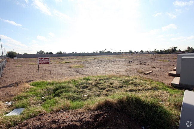
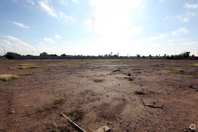
Property Record
219 E Mckellips Rd, Mesa, AZ 85201


Property Detail
219 E Mckellips Rd
136-23-005C
W2 OF W2 OF E 32 RODS OF NW4 NE4 NE4 SEC 10 EX N 55F RD TOG-WI TH POR SD NW4 NE4 NE4 SEC 10 LY WLY OF W LN OF TH E 32 RODS EX W 30F RD EX N 55F RD EX RD P/F 97-411472 & EX 10F ROW LOC WI-IN PT NW4 NE4 NE4 SEC 10 DAF COM NE 1/16 COR SD SEC TH E 397.13
Publicstorage
MARICOPA
ID2
Arizona
C and X Area of minimal flood hazard, usually depicted on FIRMs as above the 500-year flood level.
3.23 AC
2025
Mesa East
2025
Phoenix
420505
Phoenix-Mesa-Chandler, AZ
68,944 SF
NEARBY LISTINGS FOR SALE OR LEASE
DEMOGRAPHICS near 219 E Mckellips Rd
1 mile
3 mile
5 mile
2025 Total Population
18,967
98,726
269,871
2030 Population
20,044
103,123
280,430
Pop Growth 2025-2030
+ 5.68%
+ 4.45%
+ 3.91%
Average Age
36
37
37
2025 Total Households
6,962
35,455
101,495
HH Growth 2025-2030
+ 5.54%
+ 4.61%
+ 4.14%
Median Household Inc
$66,613
$69,244
$67,595
Avg Household Size
2.60
2.70
2.50
2025 Avg HH Vehicles
2.00
2.00
2.00
Median Home Value
$383,676
$429,506
$389,674
Median Year Built
1986
1981
1981
Nearby Places
Map Layers
Map Styles
 Street
 Aerial
Layers
 Traffic
 Biking
Places
Listings with unknown addresses are not visible on the map
- Restaurants
- Banks
- Shops
- Fitness
- Groceries
PUBLIC TRANSPORTATION
AIRPORT
Phoenix Sky Harbor International
Drive
Walk
Distance
Phoenix Sky Harbor International
17 min
11.1 mi
Phoenix-Mesa Gateway
Drive
Walk
Distance
Phoenix-Mesa Gateway
31 min
19.2 mi
Freight Ports
Port of San Diego
Drive
Walk
Distance
Port of San Diego
413 min
370.4 mi
Nearby Properties
Address
Land Use
TOTAL SIZE
Lot Size
Zoning
Address
Land Use
TOTAL SIZE
Lot Size
Zoning
377,442 SF
0.21 AC
C-DT
Address
Land Use
TOTAL SIZE
Lot Size
Zoning
267,023 SF
19.58 AC
PEP
Address
Land Use
TOTAL SIZE
Lot Size
Zoning
579,506 SF
17.78 AC
PF
Address
Land Use
TOTAL SIZE
Lot Size
Zoning
407,570 SF
6.22 AC
PEP
Address
Land Use
TOTAL SIZE
Lot Size
Zoning
454,015 SF
10.03 AC
DB1
Address
Land Use
TOTAL SIZE
Lot Size
Zoning
1.46 AC
C-G
Address
Land Use
TOTAL SIZE
Lot Size
Zoning
478,411 SF
4.07 AC
CDT
Address
Land Use
TOTAL SIZE
Lot Size
Zoning
199,472 SF
4.79 AC
C-DT
Address
Land Use
TOTAL SIZE
Lot Size
Zoning
152,199 SF
21.96 AC
C-G
Address
Land Use
TOTAL SIZE
Lot Size
Zoning
79,452 SF
37.59 AC
PF
Address
Land Use
TOTAL SIZE
Lot Size
Zoning
107,519 SF
9.96 AC
M-H
Address
Land Use
TOTAL SIZE
Lot Size
Zoning
169,128 SF
27.30 AC
R-9
Address
Land Use
TOTAL SIZE
Lot Size
Zoning
536,470 SF
28.81 AC
M-H
Address
Land Use
TOTAL SIZE
Lot Size
Zoning
205,331 SF
20.73 AC
C-G
Address
Land Use
TOTAL SIZE
Lot Size
Zoning
142,260 SF
17.92 AC
PF
Address
Land Use
TOTAL SIZE
Lot Size
Zoning
305,624 SF
18.53 AC
Address
Land Use
TOTAL SIZE
Lot Size
Zoning
126,164 SF
25.41 AC
C-G
Address
Land Use
TOTAL SIZE
Lot Size
Zoning
108,672 SF
1.59 AC
CDT
Address
Land Use
TOTAL SIZE
Lot Size
Zoning
65,192 SF
11.36 AC
C-G
Address
Land Use
TOTAL SIZE
Lot Size
Zoning
403,809 SF
9.68 AC
C-DT
Address
Land Use
TOTAL SIZE
Lot Size
Zoning
203,299 SF
3.63 AC
C-DT
Address
Land Use
TOTAL SIZE
Lot Size
Zoning
167,497 SF
12.08 AC
C-G
Address
Land Use
TOTAL SIZE
Lot Size
Zoning
103,086 SF
31.49 AC
PF
Address
Land Use
TOTAL SIZE
Lot Size
Zoning
113,276 SF
1.25 AC
C-DT
Address
Land Use
TOTAL SIZE
Lot Size
Zoning
180,910 SF
11.85 AC
M-H
Address
Land Use
TOTAL SIZE
Lot Size
Zoning
93,685 SF
2.60 AC
PEP
Address
Land Use
TOTAL SIZE
Lot Size
Zoning
918 SF
2.22 AC
R-TC
Address
Land Use
TOTAL SIZE
Lot Size
Zoning
89,043 SF
1.97 AC
M-H
Address
Land Use
TOTAL SIZE
Lot Size
Zoning
108,184 SF
11.95 AC
C-G
Address
Land Use
TOTAL SIZE
Lot Size
Zoning
189,043 SF
2.99 AC
M-H
The World's #1 Commercial Real Estate Marketplace
Connect with us
© 2026 CoStar Group
The information above has been obtained from sources believed reliable. While we do not doubt its accuracy we have not verified it and make no guarantee, warranty or representation about it. It is your responsibility to independently confirm its accuracy and completeness. Any projections, opinions, assumptions, or estimates used are for example only and do not represent the current or future performance of the property. The value of this transaction to you depends on tax and other factors which should be evaluated by your tax, financial, and legal advisors. You and your advisors should conduct a careful, independent investigation of the property to determine to your satisfaction the suitability of the property for your needs.