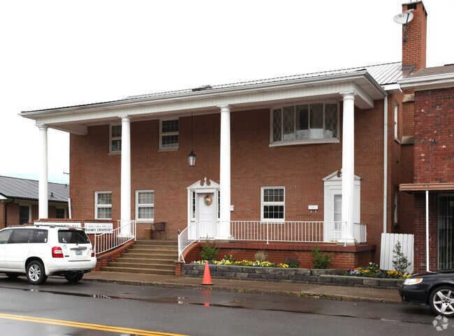
Property Record
219 Main St, Greenup, KY 41144


Property Detail
219 Main St
Huntington-Ashland, WV-KY-OH
MAIN ST LT 38
138-30-01-036.00
Greenup
Transientlodging
Kentucky
AE The base floodplain where base flood elevations are provided. AE Zones are now used on new format FIRMs instead of A1-A30 Zones.
38
2025
0.18 AC
2025
Greenup County
040502
Huntington/Ashland
2,880 SF
NEARBY LISTINGS FOR SALE OR LEASE
-
-
View all Greenup listings for sale on LoopNet.com
DEMOGRAPHICS near 219 Main St
1 mile
3 mile
5 mile
2025 Total Population
1,099
4,279
10,976
2030 Population
1,086
4,264
10,950
Pop Growth 2025-2030
(1.18%)
(0.35%)
(0.24%)
Average Age
43
43
43
2025 Total Households
417
1,623
4,235
HH Growth 2025-2030
(1.44%)
(0.43%)
(0.26%)
Median Household Inc
$57,884
$63,552
$63,000
Avg Household Size
2.40
2.40
2.40
2025 Avg HH Vehicles
2.00
2.00
2.00
Median Home Value
$151,578
$150,888
$151,742
Median Year Built
1968
1977
1981
Nearby Places
Map Layers
Map Styles
 Street
 Aerial
Layers
 Traffic
 Biking
Places
Listings with unknown addresses are not visible on the map
- Restaurants
- Banks
- Shops
- Fitness
- Groceries
PUBLIC TRANSPORTATION
AIRPORT
Tri-State/Milton J Ferguson Field
Drive
Walk
Distance
Tri-State/Milton J Ferguson Field
41 min
25.9 mi
Freight Ports
Port of Toledo
Drive
Walk
Distance
Port of Toledo
321 min
246.6 mi
SALE & LEASE HISTORY
LISTING DATE
SALE/LEASE

Oct 08, 2021
For Sale
Dec 17, 2018
For Sale
Nearby Properties
Address
Land Use
TOTAL SIZE
Lot Size
Zoning
Address
Land Use
TOTAL SIZE
Lot Size
Zoning
Address
Land Use
TOTAL SIZE
Lot Size
Zoning
60.39 AC
Address
Land Use
TOTAL SIZE
Lot Size
Zoning
181,336 SF
10.97 AC
Address
Land Use
TOTAL SIZE
Lot Size
Zoning
0.93 AC
Address
Land Use
TOTAL SIZE
Lot Size
Zoning
Address
Land Use
TOTAL SIZE
Lot Size
Zoning
6.38 AC
Address
Land Use
TOTAL SIZE
Lot Size
Zoning
31.10 AC
Address
Land Use
TOTAL SIZE
Lot Size
Zoning
12.26 AC
Address
Land Use
TOTAL SIZE
Lot Size
Zoning
1.29 AC
Address
Land Use
TOTAL SIZE
Lot Size
Zoning
18,560 SF
Address
Land Use
TOTAL SIZE
Lot Size
Zoning
Address
Land Use
TOTAL SIZE
Lot Size
Zoning
227.46 AC
Address
Land Use
TOTAL SIZE
Lot Size
Zoning
85,406 SF
44.17 AC
Address
Land Use
TOTAL SIZE
Lot Size
Zoning
3.59 AC
Address
Land Use
TOTAL SIZE
Lot Size
Zoning
15 AC
Address
Land Use
TOTAL SIZE
Lot Size
Zoning
4.60 AC
Address
Land Use
TOTAL SIZE
Lot Size
Zoning
1.04 AC
Address
Land Use
TOTAL SIZE
Lot Size
Zoning
1,980 SF
10.23 AC
Address
Land Use
TOTAL SIZE
Lot Size
Zoning
Address
Land Use
TOTAL SIZE
Lot Size
Zoning
10,640 SF
Address
Land Use
TOTAL SIZE
Lot Size
Zoning
Address
Land Use
TOTAL SIZE
Lot Size
Zoning
20,916 SF
4.50 AC
Address
Land Use
TOTAL SIZE
Lot Size
Zoning
105,628 SF
190.73 AC
Address
Land Use
TOTAL SIZE
Lot Size
Zoning
0.29 AC
Address
Land Use
TOTAL SIZE
Lot Size
Zoning
10,748 SF
1.91 AC
Address
Land Use
TOTAL SIZE
Lot Size
Zoning
7,200 SF
0.21 AC
Address
Land Use
TOTAL SIZE
Lot Size
Zoning
125,790 SF
11.79 AC
Address
Land Use
TOTAL SIZE
Lot Size
Zoning
5,625 SF
0.62 AC
Address
Land Use
TOTAL SIZE
Lot Size
Zoning
3,404 SF
1.34 AC
Address
Land Use
TOTAL SIZE
Lot Size
Zoning
8,296 SF
3.61 AC
The World's #1 Commercial Real Estate Marketplace
Connect with us
© 2026 CoStar Group
The information above has been obtained from sources believed reliable. While we do not doubt its accuracy we have not verified it and make no guarantee, warranty or representation about it. It is your responsibility to independently confirm its accuracy and completeness. Any projections, opinions, assumptions, or estimates used are for example only and do not represent the current or future performance of the property. The value of this transaction to you depends on tax and other factors which should be evaluated by your tax, financial, and legal advisors. You and your advisors should conduct a careful, independent investigation of the property to determine to your satisfaction the suitability of the property for your needs.