Property Record
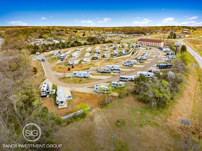
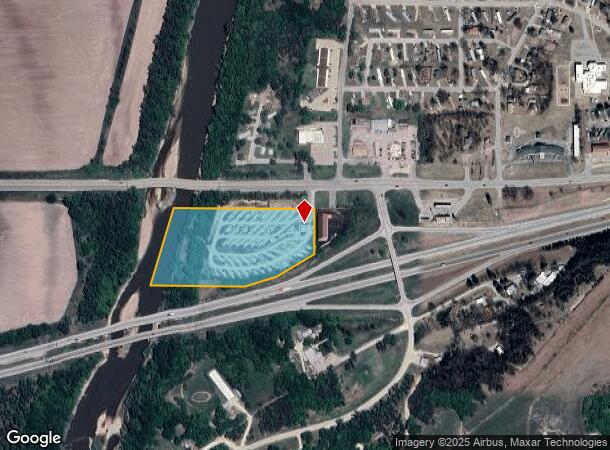
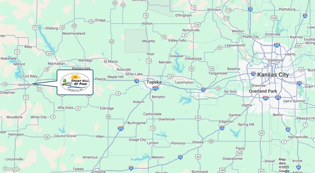
219 W Flint Hills Blvd, Junction City, KS 66441
NEARBY LISTINGS FOR SALE OR LEASE
-
-
View all Junction City listings for sale on LoopNet.com
Property Detail
219 W Flint Hills Blvd
103-07-0-10-04-002.00-0
Grandview Plz
Clubslodgesprofessionalassociations
GRANDVIEW PLZ, S07, T12, R06, ACRES 9.23, POB SW CORNER GRANDVIEW PLAZA, NE 220 TO SOUTH ROW, E857, S 270, SW ALONG ROW 271,
AE
Geary
20061C0095D
Kansas
2024
9.23 AC
2025
I-70 Corridor
000700
Other Market Areas
1,615 SF
Manhattan, KS
DEMOGRAPHICS near 219 W Flint Hills Blvd
1 Mile
3 Mile
5 Mile
2024 Total Population
1,125
17,725
38,774
2029 Population
1,108
17,333
37,295
Pop Growth 2024-2029
(1.51%)
(2.21%)
(3.81%)
Average Age
34
34
31
2024 Total Households
497
7,058
12,759
HH Growth 2024-2029
(2.01%)
(2.73%)
(4.39%)
Median Household Inc
$43,536
$48,631
$51,630
Avg Household Size
2.20
2.30
2.60
2024 Avg HH Vehicles
2.00
2.00
2.00
Median Home Value
$66,278
$128,909
$150,480
Median Year Built
1992
1974
1989
Nearby Places
Map Layers
Map Styles
 Street
 Aerial
- Restaurants
- Banks
- Shops
- Fitness
- Groceries
PUBLIC TRANSPORTATION
AIRPORT
Manhattan Regional
DRIVE
WALK
Distance
Manhattan Regional
19 min
12.4 mi
SALE & LEASE HISTORY
LISTING DATE
SALE/LEASE

Apr 22, 2025
For Sale
Nearby Properties
Address
Land Use
TOTAL SIZE
Lot Size
Zoning
Address
Land Use
TOTAL SIZE
Lot Size
Zoning
67,133 SF
15.71 AC
RG
Address
Land Use
TOTAL SIZE
Lot Size
Zoning
126,667 SF
3.17 AC
RM
Address
Land Use
TOTAL SIZE
Lot Size
Zoning
18,321 SF
0.67 AC
Address
Land Use
TOTAL SIZE
Lot Size
Zoning
16,850 SF
0.59 AC
CCS
Address
Land Use
TOTAL SIZE
Lot Size
Zoning
11,679 SF
49.73 AC
Address
Land Use
TOTAL SIZE
Lot Size
Zoning
62,043 SF
3.17 AC
CS
Address
Land Use
TOTAL SIZE
Lot Size
Zoning
34,700 SF
1.51 AC
RM
Address
Land Use
TOTAL SIZE
Lot Size
Zoning
17,388 SF
0.44 AC
Address
Land Use
TOTAL SIZE
Lot Size
Zoning
56,546 SF
7.39 AC
RG
Address
Land Use
TOTAL SIZE
Lot Size
Zoning
20,898 SF
5.87 AC
CR
Address
Land Use
TOTAL SIZE
Lot Size
Zoning
29,248 SF
6.20 AC
RS
Address
Land Use
TOTAL SIZE
Lot Size
Zoning
15,452 SF
0.42 AC
Address
Land Use
TOTAL SIZE
Lot Size
Zoning
58,662 SF
3.34 AC
Address
Land Use
TOTAL SIZE
Lot Size
Zoning
16,235 SF
5.90 AC
Address
Land Use
TOTAL SIZE
Lot Size
Zoning
36,456 SF
2.72 AC
CS
Address
Land Use
TOTAL SIZE
Lot Size
Zoning
93,469 SF
12.98 AC
Address
Land Use
TOTAL SIZE
Lot Size
Zoning
35,825 SF
6.14 AC
RS
Address
Land Use
TOTAL SIZE
Lot Size
Zoning
43,404 SF
2.80 AC
Address
Land Use
TOTAL SIZE
Lot Size
Zoning
35,160 SF
2.30 AC
RS
Address
Land Use
TOTAL SIZE
Lot Size
Zoning
13,920 SF
1.47 AC
CCS
Address
Land Use
TOTAL SIZE
Lot Size
Zoning
41,330 SF
3.22 AC
RD
Address
Land Use
TOTAL SIZE
Lot Size
Zoning
832 SF
189 AC
AP
Address
Land Use
TOTAL SIZE
Lot Size
Zoning
609.95 AC
A
Address
Land Use
TOTAL SIZE
Lot Size
Zoning
607.85 AC
A
Address
Land Use
TOTAL SIZE
Lot Size
Zoning
23,328 SF
10 AC
RD
Address
Land Use
TOTAL SIZE
Lot Size
Zoning
20,827 SF
4.20 AC
Address
Land Use
TOTAL SIZE
Lot Size
Zoning
23,365 SF
4.80 AC
Address
Land Use
TOTAL SIZE
Lot Size
Zoning
542 AC
A
Address
Land Use
TOTAL SIZE
Lot Size
Zoning
28,478 SF
3.22 AC
CSR
Address
Land Use
TOTAL SIZE
Lot Size
Zoning
7,384 SF
7.57 AC
CG
The World's #1 Commercial Real Estate Marketplace
Connect with us
© 2026 CoStar Group
The information above has been obtained from sources believed reliable. While we do not doubt its accuracy we have not verified it and make no guarantee, warranty or representation about it. It is your responsibility to independently confirm its accuracy and completeness. Any projections, opinions, assumptions, or estimates used are for example only and do not represent the current or future performance of the property. The value of this transaction to you depends on tax and other factors which should be evaluated by your tax, financial, and legal advisors. You and your advisors should conduct a careful, independent investigation of the property to determine to your satisfaction the suitability of the property for your needs.