Property Record
2190 Interstate 10 S, Beaumont, TX 77707
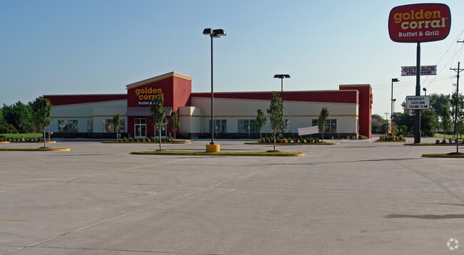

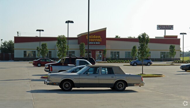
Property Detail
2190 Interstate 10 S
Beaumont-Port Arthur, TX
STONE HAUS TRS I & II 2.889AC
062305-000-000200-00000
Jefferson
Commercialnec
Texas
2024
2.89 AC
2025
Beaumont
001301
Beaumont/Port Arthur
14,257 SF
NEARBY LISTINGS FOR SALE OR LEASE
DEMOGRAPHICS near 2190 Interstate 10 S
1 mile
3 mile
5 mile
2025 Total Population
3,228
46,302
97,881
2030 Population
3,318
46,304
97,722
Pop Growth 2025-2030
+ 2.79%
0.00%
(0.16%)
Average Age
42
39
39
2025 Total Households
1,276
17,958
38,445
HH Growth 2025-2030
+ 2.90%
(0.06%)
(0.20%)
Median Household Inc
$35,454
$58,836
$56,718
Avg Household Size
2.30
2.40
2.40
2025 Avg HH Vehicles
1.00
2.00
2.00
Median Home Value
$170,353
$151,011
$162,611
Median Year Built
1977
1969
1975
Nearby Places
Map Layers
Map Styles
 Street
 Aerial
Layers
 Traffic
 Biking
Places
Listings with unknown addresses are not visible on the map
- Restaurants
- Banks
- Shops
- Fitness
- Groceries
PUBLIC TRANSPORTATION
COMMUTER RAIL
Drive
Walk
Distance
5 min
2.1 mi
Freight Ports
Port Beaumont
Drive
Walk
Distance
Port Beaumont
8 min
3.8 mi
Nearby Properties
Address
Land Use
TOTAL SIZE
Lot Size
Zoning
Address
Land Use
TOTAL SIZE
Lot Size
Zoning
373,397 SF
21.07 AC
Address
Land Use
TOTAL SIZE
Lot Size
Zoning
163,287 SF
5.46 AC
Address
Land Use
TOTAL SIZE
Lot Size
Zoning
104,163 SF
12.77 AC
Address
Land Use
TOTAL SIZE
Lot Size
Zoning
130,658 SF
8.03 AC
Address
Land Use
TOTAL SIZE
Lot Size
Zoning
213,450 SF
7.39 AC
Address
Land Use
TOTAL SIZE
Lot Size
Zoning
185,378 SF
2.76 AC
Address
Land Use
TOTAL SIZE
Lot Size
Zoning
96,502 SF
1.46 AC
Address
Land Use
TOTAL SIZE
Lot Size
Zoning
56,223 SF
1.93 AC
Address
Land Use
TOTAL SIZE
Lot Size
Zoning
110,109 SF
6 AC
Address
Land Use
TOTAL SIZE
Lot Size
Zoning
31,914 SF
2.80 AC
Address
Land Use
TOTAL SIZE
Lot Size
Zoning
266,107 SF
10.38 AC
Address
Land Use
TOTAL SIZE
Lot Size
Zoning
48,600 SF
4.87 AC
Address
Land Use
TOTAL SIZE
Lot Size
Zoning
35,901 SF
2.71 AC
Address
Land Use
TOTAL SIZE
Lot Size
Zoning
57,326 SF
2.32 AC
Address
Land Use
TOTAL SIZE
Lot Size
Zoning
127,040 SF
8.79 AC
Address
Land Use
TOTAL SIZE
Lot Size
Zoning
250,157 SF
17.65 AC
Address
Land Use
TOTAL SIZE
Lot Size
Zoning
14,691 SF
2.50 AC
Address
Land Use
TOTAL SIZE
Lot Size
Zoning
56,916 SF
13.76 AC
Address
Land Use
TOTAL SIZE
Lot Size
Zoning
79,125 SF
8.09 AC
Address
Land Use
TOTAL SIZE
Lot Size
Zoning
112,290 SF
4.22 AC
Address
Land Use
TOTAL SIZE
Lot Size
Zoning
124,800 SF
9.34 AC
Address
Land Use
TOTAL SIZE
Lot Size
Zoning
61,175 SF
4.38 AC
Address
Land Use
TOTAL SIZE
Lot Size
Zoning
81,868 SF
8.05 AC
Address
Land Use
TOTAL SIZE
Lot Size
Zoning
65,335 SF
11.51 AC
Address
Land Use
TOTAL SIZE
Lot Size
Zoning
61,010 SF
5.28 AC
Address
Land Use
TOTAL SIZE
Lot Size
Zoning
132,319 SF
13.24 AC
Address
Land Use
TOTAL SIZE
Lot Size
Zoning
124,838 SF
11.80 AC
Address
Land Use
TOTAL SIZE
Lot Size
Zoning
49,034 SF
5.32 AC
Address
Land Use
TOTAL SIZE
Lot Size
Zoning
83,490 SF
10.93 AC
Address
Land Use
TOTAL SIZE
Lot Size
Zoning
72,224 SF
1.46 AC
The World's #1 Commercial Real Estate Marketplace
Connect with us
© 2026 CoStar Group
The information above has been obtained from sources believed reliable. While we do not doubt its accuracy we have not verified it and make no guarantee, warranty or representation about it. It is your responsibility to independently confirm its accuracy and completeness. Any projections, opinions, assumptions, or estimates used are for example only and do not represent the current or future performance of the property. The value of this transaction to you depends on tax and other factors which should be evaluated by your tax, financial, and legal advisors. You and your advisors should conduct a careful, independent investigation of the property to determine to your satisfaction the suitability of the property for your needs.