Property Record
2195 Fulton St, San Francisco, CA 94117


NEARBY LISTINGS FOR SALE OR LEASE
Property Detail
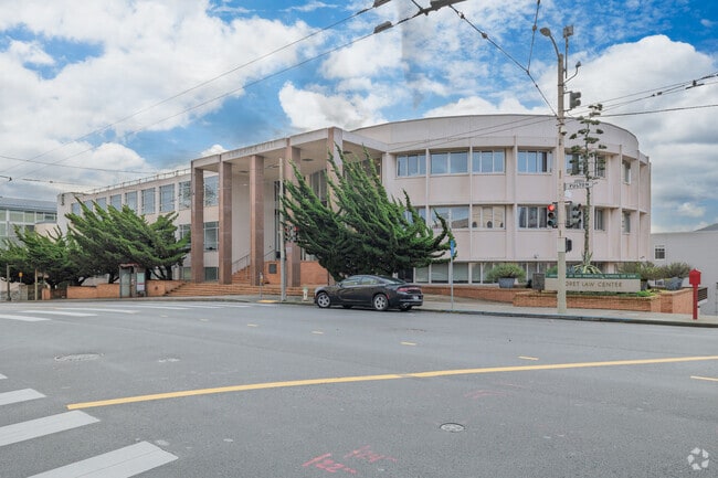
2195 Fulton St
San Francisco-Redwood City-South San Francisco, CA
Part Western Addition Block #687
1190-001
San Francisco
Publicschool
California
0
1
2025
1.47 AC
016601
West of Van Ness
63,579 SF
San Francisco
DEMOGRAPHICS near 2195 Fulton St
1 Mile
3 Mile
5 Mile
2024 Total Population
71,333
523,179
794,136
2029 Population
66,276
485,711
734,223
Pop Growth 2024-2029
(7.09%)
(7.16%)
(7.54%)
Average Age
40
43
42
2024 Total Households
31,140
240,473
337,114
HH Growth 2024-2029
(7.67%)
(7.68%)
(7.87%)
Median Household Inc
$157,687
$128,783
$126,495
Avg Household Size
2.10
2.00
2.20
2024 Avg HH Vehicles
1.00
1.00
1.00
Median Home Value
$1,109,461
$1,110,957
$1,098,641
Median Year Built
1947
1948
1949
Nearby Places
Map Layers
Map Styles
 Street
 Aerial
- Restaurants
- Banks
- Shops
- Fitness
- Groceries
PUBLIC TRANSPORTATION
TRANSIT/SUBWAY
Carl St & Cole St (JUDAH - San Francisco Municipal Transportation Agency)
DRIVE
WALK
Distance
Carl St & Cole St (JUDAH - San Francisco Municipal Transportation Agency)
2 min
13 min
0.7 mi
Carl And Cole (N Judah - San Francisco Municipal Railway (MUNI Metro))
DRIVE
WALK
Distance
Carl And Cole (N Judah - San Francisco Municipal Railway (MUNI Metro))
2 min
14 min
0.7 mi
Carl And Stanyan (JUDAH - San Francisco Municipal Railway (MUNI Metro), N Judah - San Francisco Municipal Railway (MUNI Metro))
DRIVE
WALK
Distance
Carl And Stanyan (JUDAH - San Francisco Municipal Railway (MUNI Metro), N Judah - San Francisco Municipal Railway (MUNI Metro))
1 min
14 min
0.8 mi
Carl Street And Hillway Avenue (JUDAH - San Francisco Municipal Railway (MUNI Metro), N Judah - San Francisco Municipal Railway (MUNI Metro))
DRIVE
WALK
Distance
Carl Street And Hillway Avenue (JUDAH - San Francisco Municipal Railway (MUNI Metro), N Judah - San Francisco Municipal Railway (MUNI Metro))
2 min
19 min
1.0 mi
Ucsf (JUDAH - San Francisco Municipal Railway (MUNI Metro), N Judah - San Francisco Municipal Railway (MUNI Metro))
DRIVE
WALK
Distance
Ucsf (JUDAH - San Francisco Municipal Railway (MUNI Metro), N Judah - San Francisco Municipal Railway (MUNI Metro))
2 min
19 min
1.0 mi
COMMUTER RAIL
San Francisco 4Th & King (Caltrain - Caltrain (Caltrain))
DRIVE
WALK
Distance
San Francisco 4Th & King (Caltrain - Caltrain (Caltrain))
8 min
4.3 mi
San Francisco Caltrain Station Southbound (Express - Caltrain (Caltrain), Limited - Caltrain (Caltrain), Local Weekday - Caltrain (Caltrain), Local Weekend - Caltrain (Caltrain))
DRIVE
WALK
Distance
San Francisco Caltrain Station Southbound (Express - Caltrain (Caltrain), Limited - Caltrain (Caltrain), Local Weekday - Caltrain (Caltrain), Local Weekend - Caltrain (Caltrain))
9 min
4.3 mi
AIRPORT
San Francisco International
DRIVE
WALK
Distance
San Francisco International
25 min
15.2 mi
Metro Oakland International
DRIVE
WALK
Distance
Metro Oakland International
35 min
22.6 mi
Freight Ports
Port of San Francisco
DRIVE
WALK
Distance
Port of San Francisco
11 min
4.3 mi
Nearby Properties
Address
Land Use
TOTAL SIZE
Lot Size
Zoning
Address
Land Use
TOTAL SIZE
Lot Size
Zoning
1,015,000 SF
2.43 AC
RC4
Address
Land Use
TOTAL SIZE
Lot Size
Zoning
1,471,929 SF
1.93 AC
C3O
Address
Land Use
TOTAL SIZE
Lot Size
Zoning
248,303 SF
4.35 AC
Address
Land Use
TOTAL SIZE
Lot Size
Zoning
717,234 SF
3.47 AC
UMU
Address
Land Use
TOTAL SIZE
Lot Size
Zoning
750,491 SF
0.51 AC
C3O
Address
Land Use
TOTAL SIZE
Lot Size
Zoning
266,143 SF
4 AC
C-3-R
Address
Land Use
TOTAL SIZE
Lot Size
Zoning
508,714 SF
1.29 AC
C3R
Address
Land Use
TOTAL SIZE
Lot Size
Zoning
696,431 SF
0.97 AC
C3G
Address
Land Use
TOTAL SIZE
Lot Size
Zoning
139,070 SF
0.64 AC
C3O
Address
Land Use
TOTAL SIZE
Lot Size
Zoning
1.52 AC
C3G
Address
Land Use
TOTAL SIZE
Lot Size
Zoning
1,424,230 SF
2.60 AC
C3G
Address
Land Use
TOTAL SIZE
Lot Size
Zoning
385,000 SF
0.81 AC
C3O
Address
Land Use
TOTAL SIZE
Lot Size
Zoning
263,640 SF
0.72 AC
C3R
Address
Land Use
TOTAL SIZE
Lot Size
Zoning
519,235 SF
0.74 AC
C3O
Address
Land Use
TOTAL SIZE
Lot Size
Zoning
2.74 AC
Address
Land Use
TOTAL SIZE
Lot Size
Zoning
313,306 SF
1.23 AC
WMUG
Address
Land Use
TOTAL SIZE
Lot Size
Zoning
922,758 SF
1.94 AC
C3R
Address
Land Use
TOTAL SIZE
Lot Size
Zoning
461,138 SF
0.60 AC
C3O
Address
Land Use
TOTAL SIZE
Lot Size
Zoning
393,918 SF
3.36 AC
WMUG
Address
Land Use
TOTAL SIZE
Lot Size
Zoning
403,629 SF
0.73 AC
C3O
Address
Land Use
TOTAL SIZE
Lot Size
Zoning
24.37 AC
Address
Land Use
TOTAL SIZE
Lot Size
Zoning
342,574 SF
0.54 AC
C3O
Address
Land Use
TOTAL SIZE
Lot Size
Zoning
379,330 SF
0.58 AC
C3O
Address
Land Use
TOTAL SIZE
Lot Size
Zoning
674,317 SF
3.36 AC
UMU
Address
Land Use
TOTAL SIZE
Lot Size
Zoning
649,376 SF
0.93 AC
C3S
Address
Land Use
TOTAL SIZE
Lot Size
Zoning
428,295 SF
0.47 AC
C3O
Address
Land Use
TOTAL SIZE
Lot Size
Zoning
2.93 AC
Address
Land Use
TOTAL SIZE
Lot Size
Zoning
1.75 AC
C-3-O
Address
Land Use
TOTAL SIZE
Lot Size
Zoning
342,727 SF
1.36 AC
C3G
Address
Land Use
TOTAL SIZE
Lot Size
Zoning
291,522 SF
6.66 AC
CM
The World's #1 Commercial Real Estate Marketplace
Connect with us
© 2026 CoStar Group
The information above has been obtained from sources believed reliable. While we do not doubt its accuracy we have not verified it and make no guarantee, warranty or representation about it. It is your responsibility to independently confirm its accuracy and completeness. Any projections, opinions, assumptions, or estimates used are for example only and do not represent the current or future performance of the property. The value of this transaction to you depends on tax and other factors which should be evaluated by your tax, financial, and legal advisors. You and your advisors should conduct a careful, independent investigation of the property to determine to your satisfaction the suitability of the property for your needs.