Property Record
21955 Loudoun County Pkwy, Ashburn, VA 20147

NEARBY LISTINGS FOR SALE OR LEASE
Property Detail
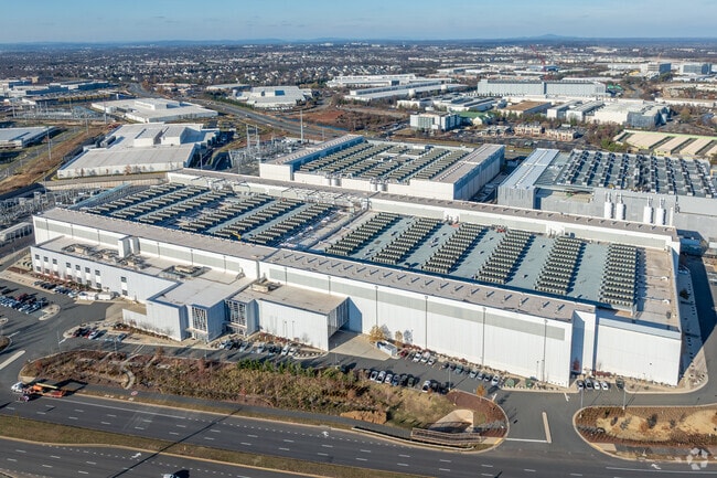
21955 Loudoun County Pkwy
Washington-Arlington-Alexandria, DC-VA-MD-WV
Lc1 Land Condominium
061-17-7666-001
Loudoun
Notresolvable
Virginia
X
Rt 28/Dulles North
51107C0265E
Washington, DC
521,784 SF
DEMOGRAPHICS near 21955 Loudoun County Pkwy
1 Mile
3 Mile
5 Mile
2024 Total Population
1,786
76,462
237,417
2029 Population
2,064
82,888
253,444
Pop Growth 2024-2029
+ 15.57%
+ 8.40%
+ 6.75%
Average Age
35
38
37
2024 Total Households
543
27,383
80,813
HH Growth 2024-2029
+ 15.84%
+ 8.73%
+ 7.01%
Median Household Inc
$114,772
$134,362
$143,914
Avg Household Size
3.30
2.70
2.90
2024 Avg HH Vehicles
2.00
2.00
2.00
Median Home Value
$712,890
$642,379
$644,222
Median Year Built
2010
2001
2000
Nearby Places
Map Layers
Map Styles
 Street
 Aerial
- Restaurants
- Banks
- Shops
- Fitness
- Groceries
PUBLIC TRANSPORTATION
AIRPORT
Washington Dulles International
DRIVE
WALK
Distance
Washington Dulles International
17 min
7.7 mi
Ronald Reagan Washington Ntl
DRIVE
WALK
Distance
Ronald Reagan Washington Ntl
49 min
32.6 mi
Freight Ports
Port of Baltimore
DRIVE
WALK
Distance
Port of Baltimore
89 min
64.6 mi
Nearby Properties
Address
Land Use
TOTAL SIZE
Lot Size
Zoning
Address
Land Use
TOTAL SIZE
Lot Size
Zoning
2,735,138 SF
123.03 AC
PDAAAR
Address
Land Use
TOTAL SIZE
Lot Size
Zoning
431.05 AC
LB:PRC
Address
Land Use
TOTAL SIZE
Lot Size
Zoning
125.80 AC
TRC
Address
Land Use
TOTAL SIZE
Lot Size
Zoning
624,852 SF
22.54 AC
R24
Address
Land Use
TOTAL SIZE
Lot Size
Zoning
549,027 SF
21.01 AC
R16
Address
Land Use
TOTAL SIZE
Lot Size
Zoning
119,087 SF
339.95 AC
PDIP
Address
Land Use
TOTAL SIZE
Lot Size
Zoning
378,278 SF
112.87 AC
PDGI
Address
Land Use
TOTAL SIZE
Lot Size
Zoning
100,121 SF
2.20 AC
PDIP
Address
Land Use
TOTAL SIZE
Lot Size
Zoning
396,198 SF
5.84 AC
PDMUB
Address
Land Use
TOTAL SIZE
Lot Size
Zoning
498,598 SF
21.89 AC
R16
Address
Land Use
TOTAL SIZE
Lot Size
Zoning
316,325 SF
18.08 AC
R16
Address
Land Use
TOTAL SIZE
Lot Size
Zoning
264,155 SF
10.95 AC
PDTRC
Address
Land Use
TOTAL SIZE
Lot Size
Zoning
29,800 SF
43.29 AC
IP
Address
Land Use
TOTAL SIZE
Lot Size
Zoning
230.43 AC
PDGI
Address
Land Use
TOTAL SIZE
Lot Size
Zoning
454,700 SF
54.92 AC
PDGI
Address
Land Use
TOTAL SIZE
Lot Size
Zoning
164,455 SF
14.15 AC
PDIP
Address
Land Use
TOTAL SIZE
Lot Size
Zoning
320,609 SF
2.02 AC
PDTRC
Address
Land Use
TOTAL SIZE
Lot Size
Zoning
198,672 SF
21.41 AC
R16
Address
Land Use
TOTAL SIZE
Lot Size
Zoning
152,394 SF
10.73 AC
PDIP
Address
Land Use
TOTAL SIZE
Lot Size
Zoning
308,805 SF
34.45 AC
PDCCRC
Address
Land Use
TOTAL SIZE
Lot Size
Zoning
61,692 SF
19.86 AC
PDH4
Address
Land Use
TOTAL SIZE
Lot Size
Zoning
218,277 SF
14.54 AC
PDH3
Address
Land Use
TOTAL SIZE
Lot Size
Zoning
135,513 SF
8.49 AC
PDIP
Address
Land Use
TOTAL SIZE
Lot Size
Zoning
287,050 SF
11.05 AC
R24
Address
Land Use
TOTAL SIZE
Lot Size
Zoning
1,026,767 SF
71 AC
PDSC
Address
Land Use
TOTAL SIZE
Lot Size
Zoning
238,594 SF
50.64 AC
PDGI
Address
Land Use
TOTAL SIZE
Lot Size
Zoning
29.72 AC
OP
Address
Land Use
TOTAL SIZE
Lot Size
Zoning
141.53 AC
PDGI
Address
Land Use
TOTAL SIZE
Lot Size
Zoning
29.66 AC
OP
The World's #1 Commercial Real Estate Marketplace
Connect with us
© 2026 CoStar Group
The information above has been obtained from sources believed reliable. While we do not doubt its accuracy we have not verified it and make no guarantee, warranty or representation about it. It is your responsibility to independently confirm its accuracy and completeness. Any projections, opinions, assumptions, or estimates used are for example only and do not represent the current or future performance of the property. The value of this transaction to you depends on tax and other factors which should be evaluated by your tax, financial, and legal advisors. You and your advisors should conduct a careful, independent investigation of the property to determine to your satisfaction the suitability of the property for your needs.