Property Record
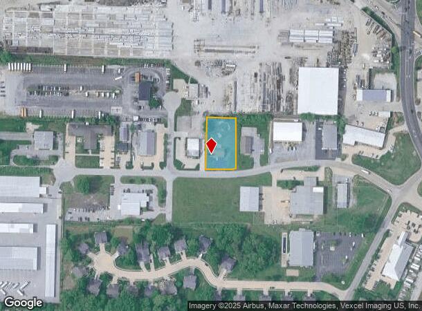
21A Kettle River Dr, Glen Carbon, IL 62034


NEARBY LISTINGS FOR SALE OR LEASE
Property Detail
21A Kettle River Dr
St. Louis
Kettle River Ii
St. Louis, MO-IL
PLAT OF RESUB LOTS KETTLE RIVER II & KETTLE RIVER III LOT 21A 132.07X233IRR
14-2-15-23-03-301-009
Madison
Religious
Illinois
2019
21a
2024
0.69 AC
403121
Illinois
1,920 SF
DEMOGRAPHICS near 21A Kettle River Dr
1 Mile
3 Mile
5 Mile
2024 Total Population
6,595
40,927
60,657
2029 Population
6,482
40,644
60,117
Pop Growth 2024-2029
(1.71%)
(0.69%)
(0.89%)
Average Age
39
38
39
2024 Total Households
2,530
15,192
22,938
HH Growth 2024-2029
(1.78%)
(0.65%)
(0.91%)
Median Household Inc
$97,368
$88,229
$87,113
Avg Household Size
2.50
2.40
2.40
2024 Avg HH Vehicles
2.00
2.00
2.00
Median Home Value
$277,290
$257,977
$239,630
Median Year Built
1989
1986
1988
Nearby Places
Map Layers
Map Styles
 Street
 Aerial
- Restaurants
- Banks
- Shops
- Fitness
- Groceries
PUBLIC TRANSPORTATION
AIRPORT
St Louis Lambert International
DRIVE
WALK
Distance
St Louis Lambert International
36 min
25.7 mi
Scott AFB/Midamerica St Louis
DRIVE
WALK
Distance
Scott AFB/Midamerica St Louis
44 min
26.5 mi
Freight Ports
Port Milwaukee
DRIVE
WALK
Distance
Port Milwaukee
397 min
351.0 mi
Nearby Properties
Address
Land Use
TOTAL SIZE
Lot Size
Zoning
Address
Land Use
TOTAL SIZE
Lot Size
Zoning
149,417 SF
26.44 AC
Address
Land Use
TOTAL SIZE
Lot Size
Zoning
4.40 AC
Address
Land Use
TOTAL SIZE
Lot Size
Zoning
75,367 SF
12.25 AC
Address
Land Use
TOTAL SIZE
Lot Size
Zoning
28,164 SF
9.31 AC
Address
Land Use
TOTAL SIZE
Lot Size
Zoning
56,126 SF
10 AC
Address
Land Use
TOTAL SIZE
Lot Size
Zoning
126,578 SF
3.74 AC
Address
Land Use
TOTAL SIZE
Lot Size
Zoning
117,072 SF
2.90 AC
Address
Land Use
TOTAL SIZE
Lot Size
Zoning
3,209 SF
8.62 AC
Address
Land Use
TOTAL SIZE
Lot Size
Zoning
218,837 SF
4.81 AC
Address
Land Use
TOTAL SIZE
Lot Size
Zoning
50,968 SF
4.23 AC
Address
Land Use
TOTAL SIZE
Lot Size
Zoning
16,274 SF
19.78 AC
Address
Land Use
TOTAL SIZE
Lot Size
Zoning
22,486 SF
2.69 AC
Address
Land Use
TOTAL SIZE
Lot Size
Zoning
187,818 SF
12.47 AC
Address
Land Use
TOTAL SIZE
Lot Size
Zoning
85,519 SF
10.09 AC
Address
Land Use
TOTAL SIZE
Lot Size
Zoning
13,104 SF
5.80 AC
Address
Land Use
TOTAL SIZE
Lot Size
Zoning
58,359 SF
5 AC
Address
Land Use
TOTAL SIZE
Lot Size
Zoning
77,411 SF
9.11 AC
Address
Land Use
TOTAL SIZE
Lot Size
Zoning
53,192 SF
1.10 AC
Address
Land Use
TOTAL SIZE
Lot Size
Zoning
127,592 SF
11.63 AC
Address
Land Use
TOTAL SIZE
Lot Size
Zoning
12.02 AC
Address
Land Use
TOTAL SIZE
Lot Size
Zoning
131,853 SF
14.60 AC
Address
Land Use
TOTAL SIZE
Lot Size
Zoning
55,292 SF
13.31 AC
Address
Land Use
TOTAL SIZE
Lot Size
Zoning
37,432 SF
2 AC
Address
Land Use
TOTAL SIZE
Lot Size
Zoning
33,495 SF
0.72 AC
Address
Land Use
TOTAL SIZE
Lot Size
Zoning
56,935 SF
0.61 AC
Address
Land Use
TOTAL SIZE
Lot Size
Zoning
30,968 SF
6.32 AC
Address
Land Use
TOTAL SIZE
Lot Size
Zoning
57,114 SF
1.57 AC
Address
Land Use
TOTAL SIZE
Lot Size
Zoning
70,484 SF
9.26 AC
Address
Land Use
TOTAL SIZE
Lot Size
Zoning
36,186 SF
0.69 AC
Address
Land Use
TOTAL SIZE
Lot Size
Zoning
65,894 SF
9.08 AC
The World's #1 Commercial Real Estate Marketplace
Connect with us
© 2025 CoStar Group
The information above has been obtained from sources believed reliable. While we do not doubt its accuracy we have not verified it and make no guarantee, warranty or representation about it. It is your responsibility to independently confirm its accuracy and completeness. Any projections, opinions, assumptions, or estimates used are for example only and do not represent the current or future performance of the property. The value of this transaction to you depends on tax and other factors which should be evaluated by your tax, financial, and legal advisors. You and your advisors should conduct a careful, independent investigation of the property to determine to your satisfaction the suitability of the property for your needs.