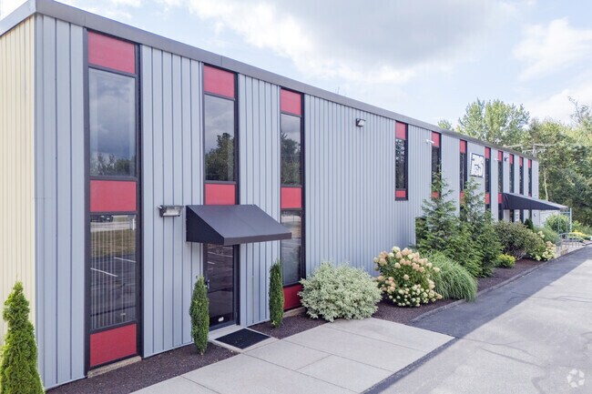
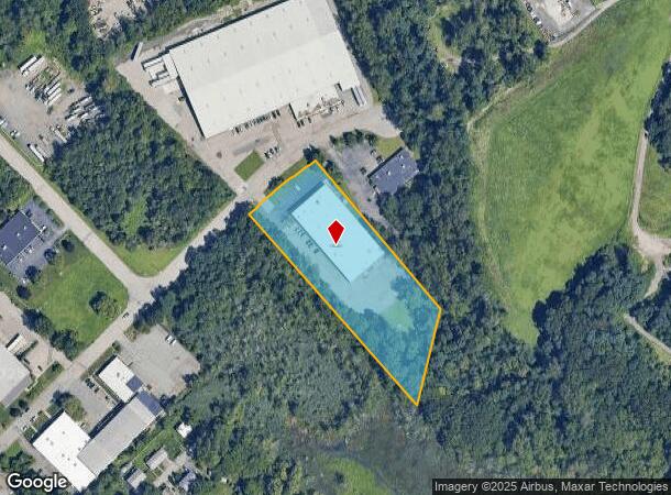
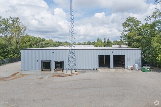
Property Record
22 Almeida Ave, East Providence, RI 02914
NEARBY LISTINGS FOR SALE OR LEASE
Property Detail
22 Almeida Ave
EPRO-000606-000002-000002
Providence
Industrialgeneral
Rhode Island
AE
2
44007C0329H
3.03 AC
2025
East Providence
2025
Providence
010300
Providence-Warwick, RI-MA
31,800 SF
DEMOGRAPHICS near 22 Almeida Ave
1 Mile
3 Mile
5 Mile
2024 Total Population
5,910
61,292
256,023
2029 Population
5,876
61,060
253,953
Pop Growth 2024-2029
(0.58%)
(0.38%)
(0.81%)
Average Age
41
42
39
2024 Total Households
2,409
26,807
103,295
HH Growth 2024-2029
(0.58%)
(0.47%)
(0.74%)
Median Household Inc
$65,541
$73,163
$64,861
Avg Household Size
2.40
2.20
2.30
2024 Avg HH Vehicles
2.00
2.00
1.00
Median Home Value
$341,931
$350,505
$326,814
Median Year Built
1964
1953
1949
Nearby Places
Map Layers
Map Styles
 Street
 Aerial
- Restaurants
- Banks
- Shops
- Fitness
- Groceries
PUBLIC TRANSPORTATION
COMMUTER RAIL
Providence (Providence/Stoughton Line - Massachusetts Bay Transportation Authority Commuter Rail (Purple Line))
DRIVE
WALK
Distance
Providence (Providence/Stoughton Line - Massachusetts Bay Transportation Authority Commuter Rail (Purple Line))
9 min
4.5 mi
DRIVE
WALK
Distance
13 min
6.6 mi
AIRPORT
Rhode Island Tf Green International
DRIVE
WALK
Distance
Rhode Island Tf Green International
22 min
11.4 mi
Worcester Regional
DRIVE
WALK
Distance
Worcester Regional
64 min
48.7 mi
Freight Ports
Port of Davisville, RI
DRIVE
WALK
Distance
Port of Davisville, RI
38 min
23.8 mi
SALE & LEASE HISTORY
LISTING DATE
SALE/LEASE

Jan 06, 2020
For Sale
Nearby Properties
Address
Land Use
TOTAL SIZE
Lot Size
Zoning
Address
Land Use
TOTAL SIZE
Lot Size
Zoning
317,728 SF
28.20 AC
O1
Address
Land Use
TOTAL SIZE
Lot Size
Zoning
79.57 AC
O1
Address
Land Use
TOTAL SIZE
Lot Size
Zoning
4.21 AC
I-2
Address
Land Use
TOTAL SIZE
Lot Size
Zoning
95,064 SF
1.38 AC
I-2
Address
Land Use
TOTAL SIZE
Lot Size
Zoning
255,438 SF
174 SF
I-1-75
Address
Land Use
TOTAL SIZE
Lot Size
Zoning
Address
Land Use
TOTAL SIZE
Lot Size
Zoning
1.67 AC
I-2
Address
Land Use
TOTAL SIZE
Lot Size
Zoning
7.53 AC
I-2
Address
Land Use
TOTAL SIZE
Lot Size
Zoning
2.20 AC
I-2
Address
Land Use
TOTAL SIZE
Lot Size
Zoning
15.20 AC
R5
Address
Land Use
TOTAL SIZE
Lot Size
Zoning
38.09 AC
CD
Address
Land Use
TOTAL SIZE
Lot Size
Zoning
455.47 AC
I3
Address
Land Use
TOTAL SIZE
Lot Size
Zoning
139.58 AC
O1
Address
Land Use
TOTAL SIZE
Lot Size
Zoning
16.48 AC
W-3
Address
Land Use
TOTAL SIZE
Lot Size
Zoning
225,067 SF
40.70 AC
HB
Address
Land Use
TOTAL SIZE
Lot Size
Zoning
6.48 AC
R-1
Address
Land Use
TOTAL SIZE
Lot Size
Zoning
8.05 AC
C1
Address
Land Use
TOTAL SIZE
Lot Size
Zoning
1.44 AC
I-2
Address
Land Use
TOTAL SIZE
Lot Size
Zoning
Address
Land Use
TOTAL SIZE
Lot Size
Zoning
18.01 AC
C3
Address
Land Use
TOTAL SIZE
Lot Size
Zoning
4.62 AC
R5
Address
Land Use
TOTAL SIZE
Lot Size
Zoning
12.67 AC
R5
Address
Land Use
TOTAL SIZE
Lot Size
Zoning
170,345 SF
3.76 AC
R6
Address
Land Use
TOTAL SIZE
Lot Size
Zoning
171,290 SF
27.80 AC
R2
Address
Land Use
TOTAL SIZE
Lot Size
Zoning
53.20 AC
C1
Address
Land Use
TOTAL SIZE
Lot Size
Zoning
225,458 SF
24.95 AC
I1
Address
Land Use
TOTAL SIZE
Lot Size
Zoning
339,222 SF
32.67 AC
PA
Address
Land Use
TOTAL SIZE
Lot Size
Zoning
223,374 SF
14 AC
O1
Address
Land Use
TOTAL SIZE
Lot Size
Zoning
200,200 SF
11.64 AC
I1
Address
Land Use
TOTAL SIZE
Lot Size
Zoning
87,544 SF
5.05 AC
KP
The World's #1 Commercial Real Estate Marketplace
Connect with us
© 2025 CoStar Group
The information above has been obtained from sources believed reliable. While we do not doubt its accuracy we have not verified it and make no guarantee, warranty or representation about it. It is your responsibility to independently confirm its accuracy and completeness. Any projections, opinions, assumptions, or estimates used are for example only and do not represent the current or future performance of the property. The value of this transaction to you depends on tax and other factors which should be evaluated by your tax, financial, and legal advisors. You and your advisors should conduct a careful, independent investigation of the property to determine to your satisfaction the suitability of the property for your needs.