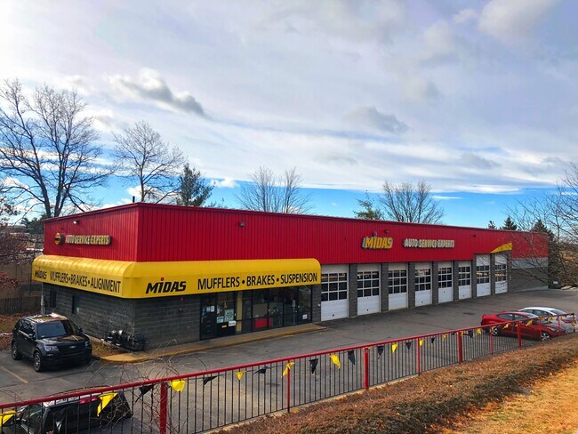
Property Record
22 Auto Center Rd, Manchester, NH 03103

NEARBY LISTINGS FOR SALE OR LEASE
Property Detail
22 Auto Center Rd
MNCH-000874-000000-000005
Hillsborough
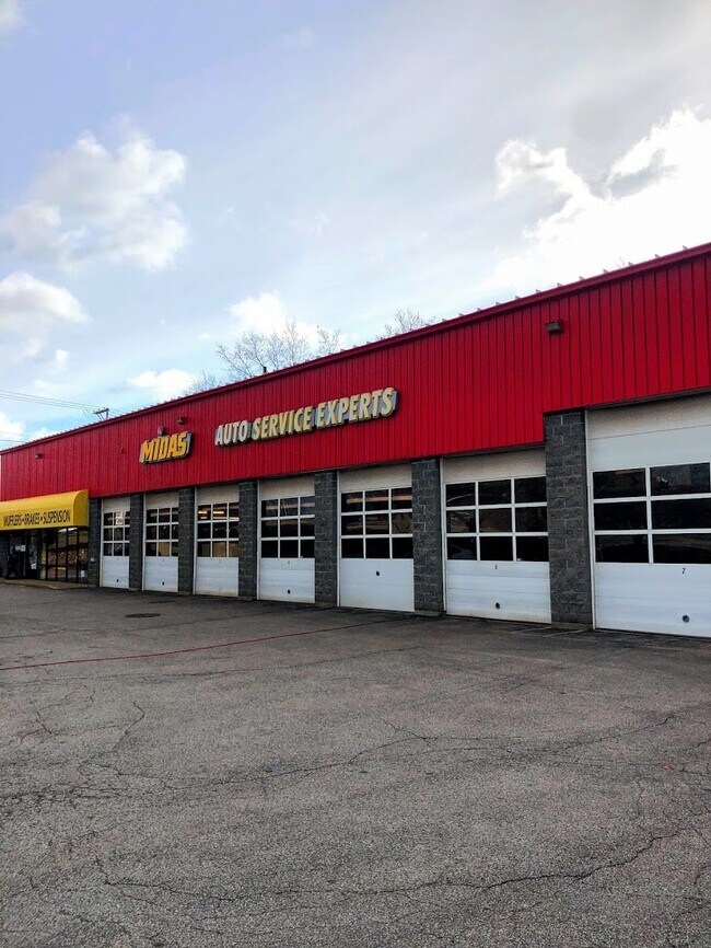
Autorepair
New Hampshire
X
5
33011C0383D
1.17 AC
2024
Hillsborough
2024
Boston
002600
Manchester-Nashua, NH
7,440 SF
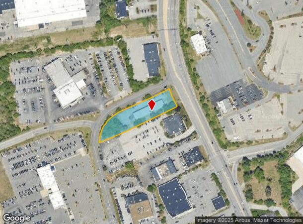
DEMOGRAPHICS near 22 Auto Center Rd
1 Mile
3 Mile
5 Mile
2024 Total Population
5,172
63,927
137,993
2029 Population
5,266
64,852
140,610
Pop Growth 2024-2029
+ 1.82%
+ 1.45%
+ 1.90%
Average Age
41
40
40
2024 Total Households
2,279
26,317
56,554
HH Growth 2024-2029
+ 1.71%
+ 1.47%
+ 1.91%
Median Household Inc
$71,332
$71,805
$77,348
Avg Household Size
2.20
2.30
2.30
2024 Avg HH Vehicles
2.00
2.00
2.00
Median Home Value
$261,326
$295,141
$331,313
Median Year Built
1975
1963
1970
Nearby Places
Map Layers
Map Styles
 Street
 Aerial
- Restaurants
- Banks
- Shops
- Fitness
- Groceries
PUBLIC TRANSPORTATION
AIRPORT
Manchester Boston Regional
DRIVE
WALK
Distance
Manchester Boston Regional
11 min
3.8 mi
Freight Ports
Port of Boston
DRIVE
WALK
Distance
Port of Boston
80 min
52.7 mi
SALE & LEASE HISTORY
LISTING DATE
SALE/LEASE

Apr 23, 2021
For Sale
Nearby Properties
Address
Land Use
TOTAL SIZE
Lot Size
Zoning
Address
Land Use
TOTAL SIZE
Lot Size
Zoning
446,957 SF
24.16 AC
Address
Land Use
TOTAL SIZE
Lot Size
Zoning
383,493 SF
34.51 AC
Address
Land Use
TOTAL SIZE
Lot Size
Zoning
603,357 SF
45.12 AC
GB
Address
Land Use
TOTAL SIZE
Lot Size
Zoning
256,041 SF
6.69 AC
Address
Land Use
TOTAL SIZE
Lot Size
Zoning
8,064 SF
34.29 AC
Address
Land Use
TOTAL SIZE
Lot Size
Zoning
46,906 SF
552.35 AC
Address
Land Use
TOTAL SIZE
Lot Size
Zoning
29,803 SF
31.46 AC
PZ
Address
Land Use
TOTAL SIZE
Lot Size
Zoning
3,748 SF
14.69 AC
Address
Land Use
TOTAL SIZE
Lot Size
Zoning
0.60 AC
PZ
Address
Land Use
TOTAL SIZE
Lot Size
Zoning
217,697 SF
43.25 AC
Address
Land Use
TOTAL SIZE
Lot Size
Zoning
135,879 SF
2.36 AC
Address
Land Use
TOTAL SIZE
Lot Size
Zoning
42,228 SF
15.58 AC
PZ
Address
Land Use
TOTAL SIZE
Lot Size
Zoning
50.47 AC
GB
Address
Land Use
TOTAL SIZE
Lot Size
Zoning
22,101 SF
8.33 AC
Address
Land Use
TOTAL SIZE
Lot Size
Zoning
723,875 SF
38.08 AC
Address
Land Use
TOTAL SIZE
Lot Size
Zoning
49,788 SF
34.73 AC
Address
Land Use
TOTAL SIZE
Lot Size
Zoning
207,701 SF
4.16 AC
Address
Land Use
TOTAL SIZE
Lot Size
Zoning
116,763 SF
7 AC
PZ
Address
Land Use
TOTAL SIZE
Lot Size
Zoning
201,831 SF
18.46 AC
IND-II
Address
Land Use
TOTAL SIZE
Lot Size
Zoning
2,656 SF
16.01 AC
Address
Land Use
TOTAL SIZE
Lot Size
Zoning
151,002 SF
6.95 AC
PZ
Address
Land Use
TOTAL SIZE
Lot Size
Zoning
139,616 SF
18.47 AC
PZ
Address
Land Use
TOTAL SIZE
Lot Size
Zoning
119,139 SF
25.87 AC
IND-I
Address
Land Use
TOTAL SIZE
Lot Size
Zoning
165,000 SF
3.38 AC
Address
Land Use
TOTAL SIZE
Lot Size
Zoning
142,318 SF
26.13 AC
GB
Address
Land Use
TOTAL SIZE
Lot Size
Zoning
180,474 SF
18.60 AC
Address
Land Use
TOTAL SIZE
Lot Size
Zoning
230,582 SF
0.31 AC
Address
Land Use
TOTAL SIZE
Lot Size
Zoning
2,218 SF
17.11 AC
Address
Land Use
TOTAL SIZE
Lot Size
Zoning
148,880 SF
2.38 AC
Address
Land Use
TOTAL SIZE
Lot Size
Zoning
227,589 SF
GB
The World's #1 Commercial Real Estate Marketplace
Connect with us
© 2025 CoStar Group
The information above has been obtained from sources believed reliable. While we do not doubt its accuracy we have not verified it and make no guarantee, warranty or representation about it. It is your responsibility to independently confirm its accuracy and completeness. Any projections, opinions, assumptions, or estimates used are for example only and do not represent the current or future performance of the property. The value of this transaction to you depends on tax and other factors which should be evaluated by your tax, financial, and legal advisors. You and your advisors should conduct a careful, independent investigation of the property to determine to your satisfaction the suitability of the property for your needs.