Property Record
22 Bridge Rd, Haddam, CT 06438


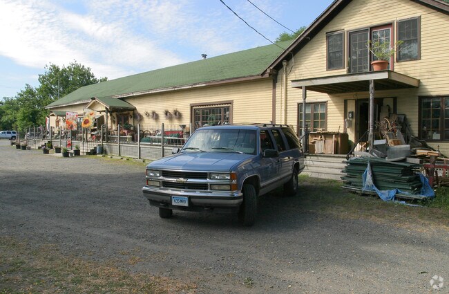
Property Detail
22 Bridge Rd
Storebuilding
Lower Ct River Vly
COMM
Connecticut
AE The base floodplain where base flood elevations are provided. AE Zones are now used on new format FIRMs instead of A1-A30 Zones.
0.46 AC
2025
SW Midlsx/Old Saybrk/Rt 9
2025
Hartford
590101
Hartford-West Hartford-East Hartford, CT
3,610 SF
HADD-000049-000000-000019
NEARBY LISTINGS FOR SALE OR LEASE
DEMOGRAPHICS near 22 Bridge Rd
1 mile
3 mile
5 mile
2025 Total Population
1,077
5,053
15,565
2030 Population
1,112
5,164
15,748
Pop Growth 2025-2030
+ 3.25%
+ 2.20%
+ 1.18%
Average Age
46
47
46
2025 Total Households
436
2,066
6,526
HH Growth 2025-2030
+ 3.44%
+ 2.23%
+ 1.15%
Median Household Inc
$118,902
$117,682
$102,399
Avg Household Size
2.40
2.30
2.30
2025 Avg HH Vehicles
2.00
2.00
2.00
Median Home Value
$382,300
$402,406
$386,232
Median Year Built
1972
1970
1970
Nearby Places
Map Layers
Map Styles
 Street
 Aerial
Transit
 Traffic
 Biking
Places
Listings with unknown addresses are not visible on the map
- Restaurants
- Banks
- Shops
- Fitness
- Groceries
PUBLIC TRANSPORTATION
AIRPORT
Tweed/New Haven
Drive
Walk
Distance
Tweed/New Haven
54 min
36.9 mi
Freight Ports
Port of New Haven
Drive
Walk
Distance
Port of New Haven
54 min
37.6 mi
Nearby Properties
Address
Land Use
TOTAL SIZE
Lot Size
Zoning
Address
Land Use
TOTAL SIZE
Lot Size
Zoning
544.80 AC
R-2
Address
Land Use
TOTAL SIZE
Lot Size
Zoning
12.29 AC
COMM
Address
Land Use
TOTAL SIZE
Lot Size
Zoning
23.16 AC
Address
Land Use
TOTAL SIZE
Lot Size
Zoning
16,008 SF
1.50 AC
C
Address
Land Use
TOTAL SIZE
Lot Size
Zoning
16,804 SF
2.63 AC
COMM
Address
Land Use
TOTAL SIZE
Lot Size
Zoning
19,653 SF
19.89 AC
R2
Address
Land Use
TOTAL SIZE
Lot Size
Zoning
34,574 SF
1.60 AC
COMM
Address
Land Use
TOTAL SIZE
Lot Size
Zoning
14,016 SF
16.03 AC
R-1
Address
Land Use
TOTAL SIZE
Lot Size
Zoning
28,170 SF
19.65 AC
R-2A
Address
Land Use
TOTAL SIZE
Lot Size
Zoning
1,157.55 AC
R-2
Address
Land Use
TOTAL SIZE
Lot Size
Zoning
880 SF
7.64 AC
EHVD
Address
Land Use
TOTAL SIZE
Lot Size
Zoning
22.26 AC
R-1
Address
Land Use
TOTAL SIZE
Lot Size
Zoning
11.06 AC
R1
Address
Land Use
TOTAL SIZE
Lot Size
Zoning
6.69 AC
R1/2
Address
Land Use
TOTAL SIZE
Lot Size
Zoning
11,472 SF
0.27 AC
EHVD
Address
Land Use
TOTAL SIZE
Lot Size
Zoning
3 AC
COMM
Address
Land Use
TOTAL SIZE
Lot Size
Zoning
6,978 SF
164.08 AC
R-2
Address
Land Use
TOTAL SIZE
Lot Size
Zoning
2.99 AC
IND
Address
Land Use
TOTAL SIZE
Lot Size
Zoning
8,309 SF
2.30 AC
R-2
Address
Land Use
TOTAL SIZE
Lot Size
Zoning
21,905 SF
3.02 AC
C
Address
Land Use
TOTAL SIZE
Lot Size
Zoning
3.20 AC
COMM
Address
Land Use
TOTAL SIZE
Lot Size
Zoning
1,026 SF
46.70 AC
R-2A
Address
Land Use
TOTAL SIZE
Lot Size
Zoning
5.13 AC
I-1
Address
Land Use
TOTAL SIZE
Lot Size
Zoning
13.52 AC
R-2
Address
Land Use
TOTAL SIZE
Lot Size
Zoning
Address
Land Use
TOTAL SIZE
Lot Size
Zoning
12,599 SF
0.65 AC
EHVD
Address
Land Use
TOTAL SIZE
Lot Size
Zoning
35.65 AC
R2
Address
Land Use
TOTAL SIZE
Lot Size
Zoning
3.44 AC
R-2
Address
Land Use
TOTAL SIZE
Lot Size
Zoning
87.59 AC
R2
Address
Land Use
TOTAL SIZE
Lot Size
Zoning
2.21 AC
COMM
The World's #1 Commercial Real Estate Marketplace
Connect with us
© 2026 CoStar Group
The information above has been obtained from sources believed reliable. While we do not doubt its accuracy we have not verified it and make no guarantee, warranty or representation about it. It is your responsibility to independently confirm its accuracy and completeness. Any projections, opinions, assumptions, or estimates used are for example only and do not represent the current or future performance of the property. The value of this transaction to you depends on tax and other factors which should be evaluated by your tax, financial, and legal advisors. You and your advisors should conduct a careful, independent investigation of the property to determine to your satisfaction the suitability of the property for your needs.