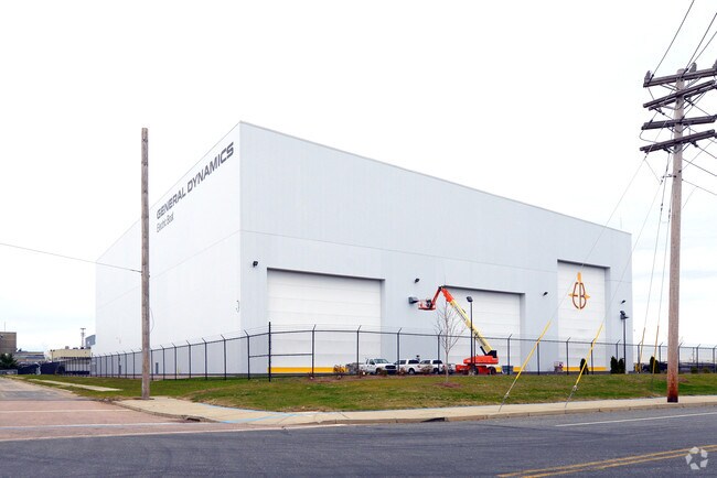
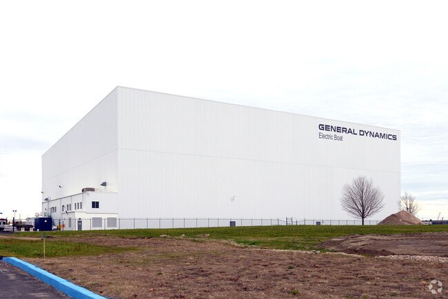
Property Record
22 Conway Ave, North Kingstown, RI 02852

Property Detail
22 Conway Ave
Taxexempt
WASHINGTON
QBPD
Rhode Island
C and X Area of minimal flood hazard, usually depicted on FIRMs as above the 500-year flood level.
13.50 AC
0
Washington County
2025
Providence
050102
Providence-Warwick, RI-MA
121,016 SF
184 018
NEARBY LISTINGS FOR SALE OR LEASE
DEMOGRAPHICS near 22 Conway Ave
1 mile
3 mile
5 mile
2025 Total Population
835
12,332
33,274
2030 Population
824
12,070
32,834
Pop Growth 2025-2030
(1.32%)
(2.12%)
(1.32%)
Average Age
42
45
45
2025 Total Households
334
5,397
13,880
HH Growth 2025-2030
(1.50%)
(2.50%)
(1.57%)
Median Household Inc
$120,694
$111,508
$114,540
Avg Household Size
2.40
2.20
2.30
2025 Avg HH Vehicles
2.00
2.00
2.00
Median Home Value
$661,638
$482,262
$564,360
Median Year Built
1976
1967
1968
Nearby Places
Map Layers
Map Styles
 Street
 Aerial
Layers
 Traffic
 Biking
Places
Listings with unknown addresses are not visible on the map
- Restaurants
- Banks
- Shops
- Fitness
- Groceries
PUBLIC TRANSPORTATION
COMMUTER RAIL
Drive
Walk
Distance
13 min
6.6 mi
AIRPORT
Rhode Island Tf Green International
Drive
Walk
Distance
Rhode Island Tf Green International
27 min
15.0 mi
Freight Ports
Port of Davisville, RI
Drive
Walk
Distance
Port of Davisville, RI
7 min
2.8 mi
Nearby Properties
Address
Land Use
TOTAL SIZE
Lot Size
Zoning
Address
Land Use
TOTAL SIZE
Lot Size
Zoning
556,793 SF
56.95 AC
QBPD
Address
Land Use
TOTAL SIZE
Lot Size
Zoning
122,785 SF
43.80 AC
QBPD
Address
Land Use
TOTAL SIZE
Lot Size
Zoning
39.12 AC
P
Address
Land Use
TOTAL SIZE
Lot Size
Zoning
72.28 AC
QBPD
Address
Land Use
TOTAL SIZE
Lot Size
Zoning
175.70 AC
QBPD
Address
Land Use
TOTAL SIZE
Lot Size
Zoning
32.58 AC
QBPD
Address
Land Use
TOTAL SIZE
Lot Size
Zoning
461,128 SF
21.54 AC
QBPD
Address
Land Use
TOTAL SIZE
Lot Size
Zoning
39.16 AC
QBPD
Address
Land Use
TOTAL SIZE
Lot Size
Zoning
61,984 SF
14.46 AC
QBPD
Address
Land Use
TOTAL SIZE
Lot Size
Zoning
466,871 SF
17.96 AC
QBPD
Address
Land Use
TOTAL SIZE
Lot Size
Zoning
8.10 AC
PR
Address
Land Use
TOTAL SIZE
Lot Size
Zoning
28,800 SF
18.70 AC
QBPD
Address
Land Use
TOTAL SIZE
Lot Size
Zoning
63,014 SF
167.39 AC
QBPD
Address
Land Use
TOTAL SIZE
Lot Size
Zoning
196,759 SF
33.67 AC
QBPD
Address
Land Use
TOTAL SIZE
Lot Size
Zoning
27.90 AC
QBPD
Address
Land Use
TOTAL SIZE
Lot Size
Zoning
4,288 SF
33.30 AC
PVD
Address
Land Use
TOTAL SIZE
Lot Size
Zoning
3,417 SF
7.13 AC
PR
Address
Land Use
TOTAL SIZE
Lot Size
Zoning
8.73 AC
PR
Address
Land Use
TOTAL SIZE
Lot Size
Zoning
97,308 SF
9.36 AC
P
Address
Land Use
TOTAL SIZE
Lot Size
Zoning
92,700 SF
9.90 AC
QBPD
Address
Land Use
TOTAL SIZE
Lot Size
Zoning
8.92 AC
PR
Address
Land Use
TOTAL SIZE
Lot Size
Zoning
18.60 AC
QBPD
Address
Land Use
TOTAL SIZE
Lot Size
Zoning
25.10 AC
QBPD
Address
Land Use
TOTAL SIZE
Lot Size
Zoning
12.68 AC
PR
Address
Land Use
TOTAL SIZE
Lot Size
Zoning
15.50 AC
PVD
Address
Land Use
TOTAL SIZE
Lot Size
Zoning
9.35 AC
PR
Address
Land Use
TOTAL SIZE
Lot Size
Zoning
8.85 AC
PR
Address
Land Use
TOTAL SIZE
Lot Size
Zoning
25.97 AC
QBPD
Address
Land Use
TOTAL SIZE
Lot Size
Zoning
15.90 AC
QBPD
The World's #1 Commercial Real Estate Marketplace
Connect with us
© 2026 CoStar Group
The information above has been obtained from sources believed reliable. While we do not doubt its accuracy we have not verified it and make no guarantee, warranty or representation about it. It is your responsibility to independently confirm its accuracy and completeness. Any projections, opinions, assumptions, or estimates used are for example only and do not represent the current or future performance of the property. The value of this transaction to you depends on tax and other factors which should be evaluated by your tax, financial, and legal advisors. You and your advisors should conduct a careful, independent investigation of the property to determine to your satisfaction the suitability of the property for your needs.