Property Record
22 Deerfield Rd, Windsor, CT 06095
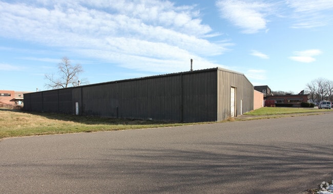


Property Detail
22 Deerfield Rd
Hartford-West Hartford-East Hartford, CT
Capitol
WIND-000080-000024-000558
Connecticut
Industrialgeneral
558
C and X Area of minimal flood hazard, usually depicted on FIRMs as above the 500-year flood level.
14.35 AC
2024
Windsor
2025
Hartford
473700
NEARBY LISTINGS FOR SALE OR LEASE
DEMOGRAPHICS near 22 Deerfield Rd
1 mile
3 mile
5 mile
2025 Total Population
4,908
55,735
176,839
2030 Population
4,929
56,658
180,592
Pop Growth 2025-2030
+ 0.43%
+ 1.66%
+ 2.12%
Average Age
41
40
39
2025 Total Households
1,840
20,857
71,330
HH Growth 2025-2030
+ 0.27%
+ 1.60%
+ 2.29%
Median Household Inc
$86,878
$67,634
$60,758
Avg Household Size
2.60
2.50
2.30
2025 Avg HH Vehicles
2.00
2.00
1.00
Median Home Value
$248,005
$253,412
$273,323
Median Year Built
1952
1958
1961
Nearby Places
Map Layers
Map Styles
 Street
 Aerial
Transit
 Traffic
 Biking
Places
Listings with unknown addresses are not visible on the map
- Restaurants
- Banks
- Shops
- Fitness
- Groceries
PUBLIC TRANSPORTATION
COMMUTER RAIL
Windsor (Hartford Line - CONN DOT)
Drive
Walk
Distance
Windsor (Hartford Line - CONN DOT)
9 min
3.1 mi
Hartford (Hartford Line - CONN DOT)
Drive
Walk
Distance
Hartford (Hartford Line - CONN DOT)
11 min
4.4 mi
AIRPORT
Bradley International
Drive
Walk
Distance
Bradley International
29 min
14.0 mi
Freight Ports
Port of New Haven
Drive
Walk
Distance
Port of New Haven
60 min
43.2 mi
Nearby Properties
Address
Land Use
TOTAL SIZE
Lot Size
Zoning
Address
Land Use
TOTAL SIZE
Lot Size
Zoning
13,680 SF
240.83 AC
Address
Land Use
TOTAL SIZE
Lot Size
Zoning
584 AC
OS
Address
Land Use
TOTAL SIZE
Lot Size
Zoning
7.45 AC
CAMP
Address
Land Use
TOTAL SIZE
Lot Size
Zoning
14.56 AC
SDD/BG
Address
Land Use
TOTAL SIZE
Lot Size
Zoning
10.74 AC
ID-1
Address
Land Use
TOTAL SIZE
Lot Size
Zoning
132,110 SF
1 AC
I
Address
Land Use
TOTAL SIZE
Lot Size
Zoning
43,711 SF
1 AC
I
Address
Land Use
TOTAL SIZE
Lot Size
Zoning
Address
Land Use
TOTAL SIZE
Lot Size
Zoning
23.99 AC
ID-1
Address
Land Use
TOTAL SIZE
Lot Size
Zoning
6.50 AC
Address
Land Use
TOTAL SIZE
Lot Size
Zoning
421,152 SF
45.95 AC
CD
Address
Land Use
TOTAL SIZE
Lot Size
Zoning
356,062 SF
23.10 AC
ID-2
Address
Land Use
TOTAL SIZE
Lot Size
Zoning
35.05 AC
FP
Address
Land Use
TOTAL SIZE
Lot Size
Zoning
66.09 AC
CX-2
Address
Land Use
TOTAL SIZE
Lot Size
Zoning
122,329 SF
4.49 AC
MX-2
Address
Land Use
TOTAL SIZE
Lot Size
Zoning
109,206 SF
4.27 AC
MX-2
Address
Land Use
TOTAL SIZE
Lot Size
Zoning
177,630 SF
32.64 AC
Address
Land Use
TOTAL SIZE
Lot Size
Zoning
247,428 SF
35.46 AC
Address
Land Use
TOTAL SIZE
Lot Size
Zoning
57,140 SF
1 AC
I
Address
Land Use
TOTAL SIZE
Lot Size
Zoning
101,317 SF
24.91 AC
RR
Address
Land Use
TOTAL SIZE
Lot Size
Zoning
209,744 SF
25.67 AC
CD
Address
Land Use
TOTAL SIZE
Lot Size
Zoning
259,600 SF
25.58 AC
CD
Address
Land Use
TOTAL SIZE
Lot Size
Zoning
122.44 AC
OS
Address
Land Use
TOTAL SIZE
Lot Size
Zoning
67,092 SF
1 AC
I
Address
Land Use
TOTAL SIZE
Lot Size
Zoning
149,762 SF
1 AC
I
Address
Land Use
TOTAL SIZE
Lot Size
Zoning
182,628 SF
15.94 AC
CD
Address
Land Use
TOTAL SIZE
Lot Size
Zoning
63,423 SF
I
Address
Land Use
TOTAL SIZE
Lot Size
Zoning
20.78 AC
CAMP
Address
Land Use
TOTAL SIZE
Lot Size
Zoning
14.90 AC
R-15
Address
Land Use
TOTAL SIZE
Lot Size
Zoning
416,640 SF
30 AC
I
The World's #1 Commercial Real Estate Marketplace
Connect with us
© 2026 CoStar Group
The information above has been obtained from sources believed reliable. While we do not doubt its accuracy we have not verified it and make no guarantee, warranty or representation about it. It is your responsibility to independently confirm its accuracy and completeness. Any projections, opinions, assumptions, or estimates used are for example only and do not represent the current or future performance of the property. The value of this transaction to you depends on tax and other factors which should be evaluated by your tax, financial, and legal advisors. You and your advisors should conduct a careful, independent investigation of the property to determine to your satisfaction the suitability of the property for your needs.