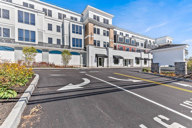
Property Record
22 Everett St, Westwood, MA 02090


Property Detail
22 Everett St
WWOO-000023-000000-000226
Norfolk
Manufacturinglight
Massachusetts
AE The base floodplain where base flood elevations are provided. AE Zones are now used on new format FIRMs instead of A1-A30 Zones.
226
2025
1.92 AC
2025
Route 1 South
412300
Boston
25,457 SF
Boston-Cambridge-Newton, MA-NH
NEARBY LISTINGS FOR SALE OR LEASE
DEMOGRAPHICS near 22 Everett St
1 mile
3 mile
5 mile
2025 Total Population
6,417
60,067
161,175
2030 Population
6,585
61,438
165,019
Pop Growth 2025-2030
+ 2.62%
+ 2.28%
+ 2.38%
Average Age
43
43
42
2025 Total Households
2,359
23,372
60,961
HH Growth 2025-2030
+ 2.76%
+ 2.33%
+ 2.50%
Median Household Inc
$122,689
$129,022
$127,856
Avg Household Size
2.60
2.50
2.50
2025 Avg HH Vehicles
2.00
2.00
2.00
Median Home Value
$779,040
$778,967
$779,193
Median Year Built
1960
1958
1960
Nearby Places
Map Layers
Map Styles
 Street
 Aerial
Layers
 Traffic
 Biking
Places
Listings with unknown addresses are not visible on the map
- Restaurants
- Banks
- Shops
- Fitness
- Groceries
PUBLIC TRANSPORTATION
COMMUTER RAIL
Islington (Franklin Line - Massachusetts Bay Transportation Authority Commuter Rail (Purple Line))
Drive
Walk
Distance
Islington (Franklin Line - Massachusetts Bay Transportation Authority Commuter Rail (Purple Line))
2 min
15 min
0.8 mi
Dedham Corporate Center (Franklin Line - Massachusetts Bay Transportation Authority Commuter Rail (Purple Line))
Drive
Walk
Distance
Dedham Corporate Center (Franklin Line - Massachusetts Bay Transportation Authority Commuter Rail (Purple Line))
4 min
2.4 mi
AIRPORT
General Edward Lawrence Logan International
Drive
Walk
Distance
General Edward Lawrence Logan International
32 min
16.9 mi
Freight Ports
Port of Boston
Drive
Walk
Distance
Port of Boston
30 min
15.3 mi
Nearby Properties
Address
Land Use
TOTAL SIZE
Lot Size
Zoning
Address
Land Use
TOTAL SIZE
Lot Size
Zoning
380,030 SF
24.87 AC
Address
Land Use
TOTAL SIZE
Lot Size
Zoning
413,827 SF
9.49 AC
RDO
Address
Land Use
TOTAL SIZE
Lot Size
Zoning
11.66 AC
LM
Address
Land Use
TOTAL SIZE
Lot Size
Zoning
380,030 SF
24.87 AC
Address
Land Use
TOTAL SIZE
Lot Size
Zoning
45,836 SF
23.25 AC
Address
Land Use
TOTAL SIZE
Lot Size
Zoning
34.93 AC
LM
Address
Land Use
TOTAL SIZE
Lot Size
Zoning
221,803 SF
36.46 AC
Address
Land Use
TOTAL SIZE
Lot Size
Zoning
226,304 SF
2.89 AC
Address
Land Use
TOTAL SIZE
Lot Size
Zoning
18,451 SF
19.07 AC
Address
Land Use
TOTAL SIZE
Lot Size
Zoning
8.18 AC
B
Address
Land Use
TOTAL SIZE
Lot Size
Zoning
351,699 SF
27.36 AC
Address
Land Use
TOTAL SIZE
Lot Size
Zoning
5,349 SF
8.74 AC
Address
Land Use
TOTAL SIZE
Lot Size
Zoning
132,917 SF
24 AC
RE
Address
Land Use
TOTAL SIZE
Lot Size
Zoning
267,103 SF
20.23 AC
10
Address
Land Use
TOTAL SIZE
Lot Size
Zoning
180,022 SF
3.74 AC
Address
Land Use
TOTAL SIZE
Lot Size
Zoning
45.72 AC
LM
Address
Land Use
TOTAL SIZE
Lot Size
Zoning
141,322 SF
36.84 AC
Address
Land Use
TOTAL SIZE
Lot Size
Zoning
242,198 SF
53.28 AC
Address
Land Use
TOTAL SIZE
Lot Size
Zoning
81,796 SF
11.87 AC
Address
Land Use
TOTAL SIZE
Lot Size
Zoning
195,690 SF
14.98 AC
NV
Address
Land Use
TOTAL SIZE
Lot Size
Zoning
185,592 SF
37.21 AC
Address
Land Use
TOTAL SIZE
Lot Size
Zoning
294,771 SF
17.85 AC
Address
Land Use
TOTAL SIZE
Lot Size
Zoning
61,044 SF
5.60 AC
Address
Land Use
TOTAL SIZE
Lot Size
Zoning
62,043 SF
10.68 AC
6
Address
Land Use
TOTAL SIZE
Lot Size
Zoning
130,344 SF
8.18 AC
Address
Land Use
TOTAL SIZE
Lot Size
Zoning
18.01 AC
GB
Address
Land Use
TOTAL SIZE
Lot Size
Zoning
11.39 AC
B
Address
Land Use
TOTAL SIZE
Lot Size
Zoning
150,802 SF
3.09 AC
LM
Address
Land Use
TOTAL SIZE
Lot Size
Zoning
205.75 AC
Address
Land Use
TOTAL SIZE
Lot Size
Zoning
15.40 AC
LM
The World's #1 Commercial Real Estate Marketplace
Connect with us
© 2026 CoStar Group
The information above has been obtained from sources believed reliable. While we do not doubt its accuracy we have not verified it and make no guarantee, warranty or representation about it. It is your responsibility to independently confirm its accuracy and completeness. Any projections, opinions, assumptions, or estimates used are for example only and do not represent the current or future performance of the property. The value of this transaction to you depends on tax and other factors which should be evaluated by your tax, financial, and legal advisors. You and your advisors should conduct a careful, independent investigation of the property to determine to your satisfaction the suitability of the property for your needs.