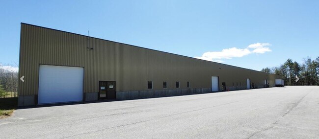
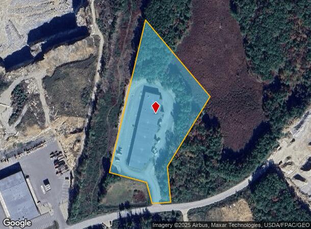
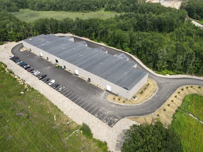
Property Record
22 Gendron Dr, Lewiston, ME 04240
NEARBY LISTINGS FOR SALE OR LEASE
-
-
View all Lewiston listings for lease on LoopNet.com
Property Detail
22 Gendron Dr
LEWI-000154-000000-000022
Androscoggin
Commercialbuilding
Maine
X
22
23001C0341E
6.46 AC
2025
Maine South & Augusta
2025
Other Market Areas
020600
Lewiston-Auburn, ME
DEMOGRAPHICS near 22 Gendron Dr
1 Mile
3 Mile
5 Mile
2024 Total Population
166
22,448
64,383
2029 Population
168
22,874
65,795
Pop Growth 2024-2029
+ 1.20%
+ 1.90%
+ 2.19%
Average Age
45
40
41
2024 Total Households
74
9,346
26,127
HH Growth 2024-2029
+ 2.70%
+ 1.97%
+ 2.19%
Median Household Inc
$49,999
$55,000
$56,706
Avg Household Size
2.20
2.30
2.20
2024 Avg HH Vehicles
2.00
1.00
2.00
Median Home Value
$232,000
$238,846
$248,833
Median Year Built
1956
1954
1957
Nearby Places
Map Layers
Map Styles
 Street
 Aerial
- Restaurants
- Banks
- Shops
- Fitness
- Groceries
PUBLIC TRANSPORTATION
AIRPORT
Portland International Jetport
DRIVE
WALK
Distance
Portland International Jetport
47 min
37.0 mi
Freight Ports
Portland, ME
DRIVE
WALK
Distance
Portland, ME
49 min
36.7 mi
SALE & LEASE HISTORY
LISTING DATE
SALE/LEASE

Dec 07, 2021
For Lease
Nearby Properties
Address
Land Use
TOTAL SIZE
Lot Size
Zoning
Address
Land Use
TOTAL SIZE
Lot Size
Zoning
489,464 SF
117.19 AC
Address
Land Use
TOTAL SIZE
Lot Size
Zoning
Address
Land Use
TOTAL SIZE
Lot Size
Zoning
50,000 SF
86.08 AC
Address
Land Use
TOTAL SIZE
Lot Size
Zoning
49,842 SF
23 AC
Address
Land Use
TOTAL SIZE
Lot Size
Zoning
144,650 SF
16.19 AC
Address
Land Use
TOTAL SIZE
Lot Size
Zoning
187,994 SF
0.96 AC
Address
Land Use
TOTAL SIZE
Lot Size
Zoning
93.04 AC
Address
Land Use
TOTAL SIZE
Lot Size
Zoning
66,622 SF
6.18 AC
Address
Land Use
TOTAL SIZE
Lot Size
Zoning
109,282 SF
20.80 AC
Address
Land Use
TOTAL SIZE
Lot Size
Zoning
33,954 SF
Address
Land Use
TOTAL SIZE
Lot Size
Zoning
21.19 AC
Address
Land Use
TOTAL SIZE
Lot Size
Zoning
133,040 SF
22.70 AC
Address
Land Use
TOTAL SIZE
Lot Size
Zoning
67,291 SF
5.78 AC
Address
Land Use
TOTAL SIZE
Lot Size
Zoning
78,484 SF
7.95 AC
Address
Land Use
TOTAL SIZE
Lot Size
Zoning
Address
Land Use
TOTAL SIZE
Lot Size
Zoning
11,954 SF
11.33 AC
Address
Land Use
TOTAL SIZE
Lot Size
Zoning
191,520 SF
1.25 AC
Address
Land Use
TOTAL SIZE
Lot Size
Zoning
64,446 SF
53.50 AC
Address
Land Use
TOTAL SIZE
Lot Size
Zoning
102,075 SF
12.52 AC
Address
Land Use
TOTAL SIZE
Lot Size
Zoning
87,296 SF
14.31 AC
Address
Land Use
TOTAL SIZE
Lot Size
Zoning
137,988 SF
36.94 AC
Address
Land Use
TOTAL SIZE
Lot Size
Zoning
0.37 AC
Address
Land Use
TOTAL SIZE
Lot Size
Zoning
118,908 SF
22.27 AC
Address
Land Use
TOTAL SIZE
Lot Size
Zoning
150,720 SF
8.30 AC
Address
Land Use
TOTAL SIZE
Lot Size
Zoning
Address
Land Use
TOTAL SIZE
Lot Size
Zoning
88,034 SF
7.31 AC
Address
Land Use
TOTAL SIZE
Lot Size
Zoning
91,075 SF
9.91 AC
Address
Land Use
TOTAL SIZE
Lot Size
Zoning
63,639 SF
Address
Land Use
TOTAL SIZE
Lot Size
Zoning
137,088 SF
1.01 AC
Address
Land Use
TOTAL SIZE
Lot Size
Zoning
92,771 SF
1.81 AC
The World's #1 Commercial Real Estate Marketplace
Connect with us
© 2026 CoStar Group
The information above has been obtained from sources believed reliable. While we do not doubt its accuracy we have not verified it and make no guarantee, warranty or representation about it. It is your responsibility to independently confirm its accuracy and completeness. Any projections, opinions, assumptions, or estimates used are for example only and do not represent the current or future performance of the property. The value of this transaction to you depends on tax and other factors which should be evaluated by your tax, financial, and legal advisors. You and your advisors should conduct a careful, independent investigation of the property to determine to your satisfaction the suitability of the property for your needs.