Property Record
22 Lonergan Rd, Middleton, MA 01949
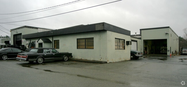


Property Detail
22 Lonergan Rd
MIDD-000033-000000-000005
Essex
Autorepair
Massachusetts
M1
5
AE The base floodplain where base flood elevations are provided. AE Zones are now used on new format FIRMs instead of A1-A30 Zones.
1.69 AC
2025
Danvers/Beverly
2025
Boston
212102
Boston-Cambridge-Newton, MA-NH
13,700 SF
NEARBY LISTINGS FOR SALE OR LEASE
DEMOGRAPHICS near 22 Lonergan Rd
1 mile
3 mile
5 mile
2025 Total Population
2,530
47,798
121,204
2030 Population
2,606
49,191
124,557
Pop Growth 2025-2030
+ 3.00%
+ 2.91%
+ 2.77%
Average Age
45
46
44
2025 Total Households
966
18,805
46,820
HH Growth 2025-2030
+ 3.00%
+ 2.99%
+ 2.76%
Median Household Inc
$129,125
$119,569
$116,903
Avg Household Size
2.50
2.40
2.50
2025 Avg HH Vehicles
2.00
2.00
2.00
Median Home Value
$726,958
$698,164
$723,939
Median Year Built
1988
1977
1969
Nearby Places
Map Layers
Map Styles
 Street
 Aerial
Layers
 Traffic
 Biking
Places
Listings with unknown addresses are not visible on the map
- Restaurants
- Banks
- Shops
- Fitness
- Groceries
PUBLIC TRANSPORTATION
COMMUTER RAIL
Salem (Newburyport/Rockport Line - Massachusetts Bay Transportation Authority Commuter Rail (Purple Line))
Drive
Walk
Distance
Salem (Newburyport/Rockport Line - Massachusetts Bay Transportation Authority Commuter Rail (Purple Line))
16 min
7.0 mi
North Beverly (Newburyport/Rockport Line - Massachusetts Bay Transportation Authority Commuter Rail (Purple Line))
Drive
Walk
Distance
North Beverly (Newburyport/Rockport Line - Massachusetts Bay Transportation Authority Commuter Rail (Purple Line))
14 min
7.2 mi
AIRPORT
General Edward Lawrence Logan International
Drive
Walk
Distance
General Edward Lawrence Logan International
30 min
17.8 mi
Manchester Boston Regional
Drive
Walk
Distance
Manchester Boston Regional
66 min
41.4 mi
Nearby Properties
Address
Land Use
TOTAL SIZE
Lot Size
Zoning
Address
Land Use
TOTAL SIZE
Lot Size
Zoning
747,237 SF
36.70 AC
HW
Address
Land Use
TOTAL SIZE
Lot Size
Zoning
17 AC
R4
Address
Land Use
TOTAL SIZE
Lot Size
Zoning
198.74 AC
R3
Address
Land Use
TOTAL SIZE
Lot Size
Zoning
13.04 AC
HC
Address
Land Use
TOTAL SIZE
Lot Size
Zoning
49.85 AC
R1B
Address
Land Use
TOTAL SIZE
Lot Size
Zoning
101,389 SF
20 AC
I
Address
Land Use
TOTAL SIZE
Lot Size
Zoning
65.79 AC
I1
Address
Land Use
TOTAL SIZE
Lot Size
Zoning
40.20 AC
R1B
Address
Land Use
TOTAL SIZE
Lot Size
Zoning
206.65 AC
R1B
Address
Land Use
TOTAL SIZE
Lot Size
Zoning
54,302 SF
83.70 AC
R3
Address
Land Use
TOTAL SIZE
Lot Size
Zoning
93,789 SF
8.22 AC
HW
Address
Land Use
TOTAL SIZE
Lot Size
Zoning
111.24 AC
R3
Address
Land Use
TOTAL SIZE
Lot Size
Zoning
19.10 AC
R114
Address
Land Use
TOTAL SIZE
Lot Size
Zoning
15.32 AC
HC
Address
Land Use
TOTAL SIZE
Lot Size
Zoning
71.68 AC
R3
Address
Land Use
TOTAL SIZE
Lot Size
Zoning
15.16 AC
I2
Address
Land Use
TOTAL SIZE
Lot Size
Zoning
12.57 AC
IH
Address
Land Use
TOTAL SIZE
Lot Size
Zoning
15.88 AC
BR
Address
Land Use
TOTAL SIZE
Lot Size
Zoning
24.54 AC
M1
Address
Land Use
TOTAL SIZE
Lot Size
Zoning
36,156 SF
754.25 AC
R1A
Address
Land Use
TOTAL SIZE
Lot Size
Zoning
81,746 SF
10.50 AC
R1A
Address
Land Use
TOTAL SIZE
Lot Size
Zoning
4.26 AC
R114
Address
Land Use
TOTAL SIZE
Lot Size
Zoning
24.87 AC
R3
Address
Land Use
TOTAL SIZE
Lot Size
Zoning
181,659 SF
11.57 AC
R114
Address
Land Use
TOTAL SIZE
Lot Size
Zoning
83,916 SF
15 AC
R3
Address
Land Use
TOTAL SIZE
Lot Size
Zoning
89,742 SF
10.78 AC
RC
Address
Land Use
TOTAL SIZE
Lot Size
Zoning
30.70 AC
R2
Address
Land Use
TOTAL SIZE
Lot Size
Zoning
175,699 SF
22.91 AC
R3
Address
Land Use
TOTAL SIZE
Lot Size
Zoning
115,348 SF
16.40 AC
HCD
Address
Land Use
TOTAL SIZE
Lot Size
Zoning
127,748 SF
13.64 AC
HC
The World's #1 Commercial Real Estate Marketplace
Connect with us
© 2026 CoStar Group
The information above has been obtained from sources believed reliable. While we do not doubt its accuracy we have not verified it and make no guarantee, warranty or representation about it. It is your responsibility to independently confirm its accuracy and completeness. Any projections, opinions, assumptions, or estimates used are for example only and do not represent the current or future performance of the property. The value of this transaction to you depends on tax and other factors which should be evaluated by your tax, financial, and legal advisors. You and your advisors should conduct a careful, independent investigation of the property to determine to your satisfaction the suitability of the property for your needs.