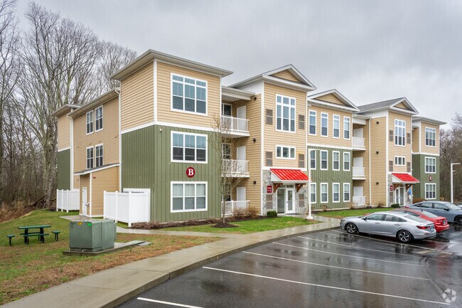
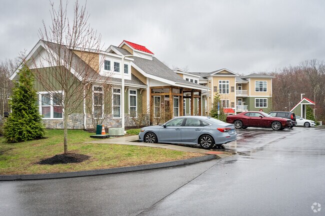
Property Record
22 Miner Ln, Waterford, CT 06385
NEARBY LISTINGS FOR SALE OR LEASE
Property Detail
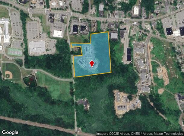
22 Miner Ln
WATE-000139-000000-004756
New London
Commercialofficeresidentialmixeduse
Connecticut
A
4756
09011C0503J
11.06 AC
2025
New London
2025
Hartford
693400
Norwich-New London, CT
2,328 SF
DEMOGRAPHICS near 22 Miner Ln
1 Mile
3 Mile
5 Mile
2024 Total Population
6,755
47,829
77,646
2029 Population
6,769
47,734
77,739
Pop Growth 2024-2029
+ 0.21%
(0.20%)
+ 0.12%
Average Age
41
40
40
2024 Total Households
2,765
19,535
32,440
HH Growth 2024-2029
+ 0.25%
(0.14%)
+ 0.17%
Median Household Inc
$53,722
$65,214
$70,932
Avg Household Size
2.20
2.20
2.20
2024 Avg HH Vehicles
2.00
2.00
2.00
Median Home Value
$194,274
$263,034
$268,967
Median Year Built
1955
1958
1965
Nearby Places
Map Layers
Map Styles
 Street
 Aerial
- Restaurants
- Banks
- Shops
- Fitness
- Groceries
PUBLIC TRANSPORTATION
COMMUTER RAIL
New London (Shore Line East - Shore Line East)
DRIVE
WALK
Distance
New London (Shore Line East - Shore Line East)
4 min
2.2 mi
Freight Ports
Port of New Haven
DRIVE
WALK
Distance
Port of New Haven
57 min
44.6 mi
Nearby Properties
Address
Land Use
TOTAL SIZE
Lot Size
Zoning
Address
Land Use
TOTAL SIZE
Lot Size
Zoning
525.72 AC
I-G
Address
Land Use
TOTAL SIZE
Lot Size
Zoning
Address
Land Use
TOTAL SIZE
Lot Size
Zoning
24.41 AC
WCI-2
Address
Land Use
TOTAL SIZE
Lot Size
Zoning
45,582 SF
39.40 AC
WCI-1
Address
Land Use
TOTAL SIZE
Lot Size
Zoning
296,000 SF
46.82 AC
C-T
Address
Land Use
TOTAL SIZE
Lot Size
Zoning
35.69 AC
SPD
Address
Land Use
TOTAL SIZE
Lot Size
Zoning
Address
Land Use
TOTAL SIZE
Lot Size
Zoning
49.32 AC
R-3
Address
Land Use
TOTAL SIZE
Lot Size
Zoning
50 AC
OS
Address
Land Use
TOTAL SIZE
Lot Size
Zoning
59,264 SF
54.53 AC
I/T
Address
Land Use
TOTAL SIZE
Lot Size
Zoning
21.84 AC
C-2
Address
Land Use
TOTAL SIZE
Lot Size
Zoning
178,385 SF
5.42 AC
LI-O
Address
Land Use
TOTAL SIZE
Lot Size
Zoning
12.03 AC
INST
Address
Land Use
TOTAL SIZE
Lot Size
Zoning
26.44 AC
C-G
Address
Land Use
TOTAL SIZE
Lot Size
Zoning
55,766 SF
1.33 AC
R-4
Address
Land Use
TOTAL SIZE
Lot Size
Zoning
68,774 SF
53.34 AC
C-T
Address
Land Use
TOTAL SIZE
Lot Size
Zoning
68,331 SF
9.50 AC
R-20
Address
Land Use
TOTAL SIZE
Lot Size
Zoning
Address
Land Use
TOTAL SIZE
Lot Size
Zoning
79,535 SF
3.03 AC
R-2
Address
Land Use
TOTAL SIZE
Lot Size
Zoning
135,113 SF
2.51 AC
LI-O
Address
Land Use
TOTAL SIZE
Lot Size
Zoning
9.41 AC
R-4
Address
Land Use
TOTAL SIZE
Lot Size
Zoning
129,890 SF
40.95 AC
R-20
Address
Land Use
TOTAL SIZE
Lot Size
Zoning
75,441 SF
40.56 AC
R52
Address
Land Use
TOTAL SIZE
Lot Size
Zoning
5.65 AC
R-2
Address
Land Use
TOTAL SIZE
Lot Size
Zoning
4.31 AC
WCI-2
Address
Land Use
TOTAL SIZE
Lot Size
Zoning
56.50 AC
C-R
Address
Land Use
TOTAL SIZE
Lot Size
Zoning
18.95 AC
INST
Address
Land Use
TOTAL SIZE
Lot Size
Zoning
70,318 SF
5.20 AC
C-G
Address
Land Use
TOTAL SIZE
Lot Size
Zoning
12.55 AC
C-2
Address
Land Use
TOTAL SIZE
Lot Size
Zoning
79,469 SF
17.98 AC
IP-1
The World's #1 Commercial Real Estate Marketplace
Connect with us
© 2026 CoStar Group
The information above has been obtained from sources believed reliable. While we do not doubt its accuracy we have not verified it and make no guarantee, warranty or representation about it. It is your responsibility to independently confirm its accuracy and completeness. Any projections, opinions, assumptions, or estimates used are for example only and do not represent the current or future performance of the property. The value of this transaction to you depends on tax and other factors which should be evaluated by your tax, financial, and legal advisors. You and your advisors should conduct a careful, independent investigation of the property to determine to your satisfaction the suitability of the property for your needs.