Property Record
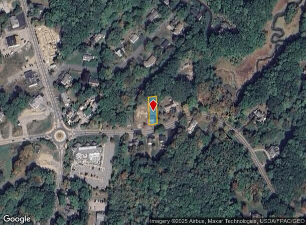
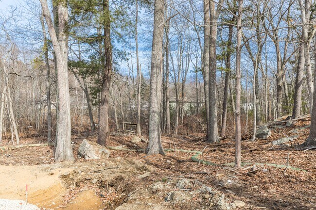
22 Pioneer Rd, Rye, NH 03870

NEARBY LISTINGS FOR SALE OR LEASE
Property Detail
22 Pioneer Rd
Commercialacreage
Rockingham
X
New Hampshire
23031C0740G
0.14 AC
2024
Rockingham
2024
Boston
071002
Boston-Cambridge-Newton, MA-NH
888 SF
RYEE-000024-000000-000094
DEMOGRAPHICS near 22 Pioneer Rd
1 Mile
3 Mile
5 Mile
2024 Total Population
1,512
25,152
42,262
2029 Population
1,577
26,294
44,106
Pop Growth 2024-2029
+ 4.30%
+ 4.54%
+ 4.36%
Average Age
47
45
45
2024 Total Households
639
11,685
19,287
HH Growth 2024-2029
+ 4.07%
+ 4.43%
+ 4.23%
Median Household Inc
$118,556
$106,915
$102,089
Avg Household Size
2.20
2.10
2.10
2024 Avg HH Vehicles
2.00
2.00
2.00
Median Home Value
$745,867
$688,225
$616,240
Median Year Built
1970
1958
1965
Nearby Places
Map Layers
Map Styles
 Street
 Aerial
- Restaurants
- Banks
- Shops
- Fitness
- Groceries
PUBLIC TRANSPORTATION
AIRPORT
Portsmouth International at Pease
DRIVE
WALK
Distance
Portsmouth International at Pease
16 min
6.4 mi
Manchester Boston Regional
DRIVE
WALK
Distance
Manchester Boston Regional
72 min
47.1 mi
Freight Ports
Portland, ME
DRIVE
WALK
Distance
Portland, ME
67 min
53.8 mi
SALE & LEASE HISTORY
LISTING DATE
SALE/LEASE

Mar 15, 2025
For Sale
Nearby Properties
Address
Land Use
TOTAL SIZE
Lot Size
Zoning
Address
Land Use
TOTAL SIZE
Lot Size
Zoning
54.20 AC
M
Address
Land Use
TOTAL SIZE
Lot Size
Zoning
6.20 AC
G1
Address
Land Use
TOTAL SIZE
Lot Size
Zoning
138,881 SF
7.54 AC
PD PL
Address
Land Use
TOTAL SIZE
Lot Size
Zoning
152,028 SF
CD5
Address
Land Use
TOTAL SIZE
Lot Size
Zoning
144,226 SF
5.72 AC
M
Address
Land Use
TOTAL SIZE
Lot Size
Zoning
Address
Land Use
TOTAL SIZE
Lot Size
Zoning
35.53 AC
GA/MH
Address
Land Use
TOTAL SIZE
Lot Size
Zoning
1,288 AC
GBW
Address
Land Use
TOTAL SIZE
Lot Size
Zoning
102,617 SF
1.27 AC
CD5
Address
Land Use
TOTAL SIZE
Lot Size
Zoning
28.05 AC
GA/MH
Address
Land Use
TOTAL SIZE
Lot Size
Zoning
57,711 SF
1.44 AC
CD4
Address
Land Use
TOTAL SIZE
Lot Size
Zoning
136,711 SF
1.85 AC
CD5
Address
Land Use
TOTAL SIZE
Lot Size
Zoning
4.73 AC
CD4-W
Address
Land Use
TOTAL SIZE
Lot Size
Zoning
15,546 SF
137.50 AC
P+C
Address
Land Use
TOTAL SIZE
Lot Size
Zoning
86,293 SF
0.64 AC
CD5
Address
Land Use
TOTAL SIZE
Lot Size
Zoning
114,194 SF
G1
Address
Land Use
TOTAL SIZE
Lot Size
Zoning
11.23 AC
OR
Address
Land Use
TOTAL SIZE
Lot Size
Zoning
25.08 AC
NRP
Address
Land Use
TOTAL SIZE
Lot Size
Zoning
15.20 AC
G1
Address
Land Use
TOTAL SIZE
Lot Size
Zoning
4,776 SF
19.32 AC
PREC
Address
Land Use
TOTAL SIZE
Lot Size
Zoning
77,523 SF
CD5
Address
Land Use
TOTAL SIZE
Lot Size
Zoning
190,444 SF
20.38 AC
G1
Address
Land Use
TOTAL SIZE
Lot Size
Zoning
69,457 SF
0.98 AC
CD5
Address
Land Use
TOTAL SIZE
Lot Size
Zoning
58,070 SF
0.53 AC
CD4
Address
Land Use
TOTAL SIZE
Lot Size
Zoning
61,496 SF
17.59 AC
M
Address
Land Use
TOTAL SIZE
Lot Size
Zoning
7.16 AC
GA/MH
Address
Land Use
TOTAL SIZE
Lot Size
Zoning
112,872 SF
9.43 AC
G1
Address
Land Use
TOTAL SIZE
Lot Size
Zoning
72,193 SF
G1
Address
Land Use
TOTAL SIZE
Lot Size
Zoning
2.67 AC
CD4-W
Address
Land Use
TOTAL SIZE
Lot Size
Zoning
89,689 SF
9.17 AC
G2
The World's #1 Commercial Real Estate Marketplace
Connect with us
© 2025 CoStar Group
The information above has been obtained from sources believed reliable. While we do not doubt its accuracy we have not verified it and make no guarantee, warranty or representation about it. It is your responsibility to independently confirm its accuracy and completeness. Any projections, opinions, assumptions, or estimates used are for example only and do not represent the current or future performance of the property. The value of this transaction to you depends on tax and other factors which should be evaluated by your tax, financial, and legal advisors. You and your advisors should conduct a careful, independent investigation of the property to determine to your satisfaction the suitability of the property for your needs.