Property Record
22 Reay St, Evanston, WY 82930

Property Detail
22 Reay St
Evanston, WY-UT
JAMISON INDUSTRIAL PARK NO 3 BLK 1 LT 1
14201220800100
UINTA
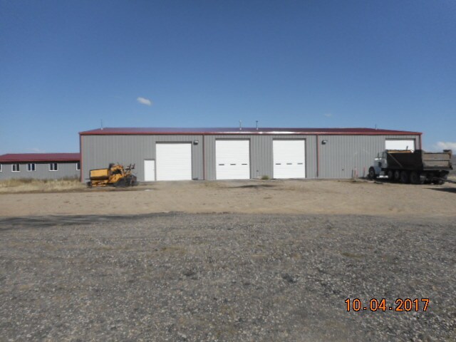
Warehouse
Wyoming
B and X Area of moderate flood hazard, usually the area between the limits of the 100-year and 500-year floods.
1
2024
3.46 AC
2025
I-80 Corridor/Cheyenne
975401
Other Market Areas
11,040 SF
NEARBY LISTINGS FOR SALE OR LEASE
-
-
View all Evanston listings for sale on LoopNet.com
DEMOGRAPHICS near 22 Reay St
1 mile
3 mile
5 mile
2024 Total Population
0
244
7,642
2029 Population
0
260
7,954
Pop Growth 2024-2029
0.00%
+ 6.56%
+ 4.08%
Average Age
0
37
37
2024 Total Households
0
94
2,814
HH Growth 2024-2029
0.00%
+ 5.32%
+ 3.98%
Median Household Inc
$0
$77,381
$71,423
Avg Household Size
.00
2.40
2.60
2024 Avg HH Vehicles
.00
3.00
2.00
Median Home Value
$0
$277,777
$227,043
Median Year Built
0
1986
1985
Nearby Places
Map Layers
Map Styles
 Street
 Aerial
Transit
 Traffic
 Biking
Places
Listings with unknown addresses are not visible on the map
- Restaurants
- Banks
- Shops
- Fitness
- Groceries
SALE & LEASE HISTORY
LISTING DATE
SALE/LEASE

Oct 26, 2017
For Sale
Nearby Properties
Address
Land Use
TOTAL SIZE
Lot Size
Zoning
Address
Land Use
TOTAL SIZE
Lot Size
Zoning
20,200 SF
1 AC
C
Address
Land Use
TOTAL SIZE
Lot Size
Zoning
12,480 SF
4.60 AC
I
Address
Land Use
TOTAL SIZE
Lot Size
Zoning
19,971 SF
3.70 AC
I
Address
Land Use
TOTAL SIZE
Lot Size
Zoning
6,400 SF
4.05 AC
I
Address
Land Use
TOTAL SIZE
Lot Size
Zoning
6,730 SF
877.88 AC
Address
Land Use
TOTAL SIZE
Lot Size
Zoning
18,532 SF
1.80 AC
C
Address
Land Use
TOTAL SIZE
Lot Size
Zoning
18,200 SF
1.24 AC
C
Address
Land Use
TOTAL SIZE
Lot Size
Zoning
6,091 SF
38.59 AC
Address
Land Use
TOTAL SIZE
Lot Size
Zoning
6,200 SF
1.40 AC
I
Address
Land Use
TOTAL SIZE
Lot Size
Zoning
144 SF
308.74 AC
Address
Land Use
TOTAL SIZE
Lot Size
Zoning
16,120 SF
18.52 AC
R
Address
Land Use
TOTAL SIZE
Lot Size
Zoning
6,350 SF
16.50 AC
Address
Land Use
TOTAL SIZE
Lot Size
Zoning
1,638 SF
4.60 AC
I
Address
Land Use
TOTAL SIZE
Lot Size
Zoning
3,200 SF
3.26 AC
Address
Land Use
TOTAL SIZE
Lot Size
Zoning
1,980 SF
3.48 AC
I
Address
Land Use
TOTAL SIZE
Lot Size
Zoning
3,360 SF
9.84 AC
Address
Land Use
TOTAL SIZE
Lot Size
Zoning
5,600 SF
3.51 AC
I
Address
Land Use
TOTAL SIZE
Lot Size
Zoning
10,164 SF
4.03 AC
I
Address
Land Use
TOTAL SIZE
Lot Size
Zoning
8.52 AC
Address
Land Use
TOTAL SIZE
Lot Size
Zoning
382.95 AC
Address
Land Use
TOTAL SIZE
Lot Size
Zoning
3,200 SF
1 AC
Address
Land Use
TOTAL SIZE
Lot Size
Zoning
2,270 SF
0.29 AC
Address
Land Use
TOTAL SIZE
Lot Size
Zoning
3,200 SF
2.49 AC
Address
Land Use
TOTAL SIZE
Lot Size
Zoning
2,832 SF
5 AC
Address
Land Use
TOTAL SIZE
Lot Size
Zoning
Address
Land Use
TOTAL SIZE
Lot Size
Zoning
38.59 AC
Address
Land Use
TOTAL SIZE
Lot Size
Zoning
4,000 SF
2.54 AC
I
Address
Land Use
TOTAL SIZE
Lot Size
Zoning
5,000 SF
1.75 AC
Address
Land Use
TOTAL SIZE
Lot Size
Zoning
1,488 SF
12.45 AC
The World's #1 Commercial Real Estate Marketplace
Connect with us
© 2026 CoStar Group
The information above has been obtained from sources believed reliable. While we do not doubt its accuracy we have not verified it and make no guarantee, warranty or representation about it. It is your responsibility to independently confirm its accuracy and completeness. Any projections, opinions, assumptions, or estimates used are for example only and do not represent the current or future performance of the property. The value of this transaction to you depends on tax and other factors which should be evaluated by your tax, financial, and legal advisors. You and your advisors should conduct a careful, independent investigation of the property to determine to your satisfaction the suitability of the property for your needs.