Property Record
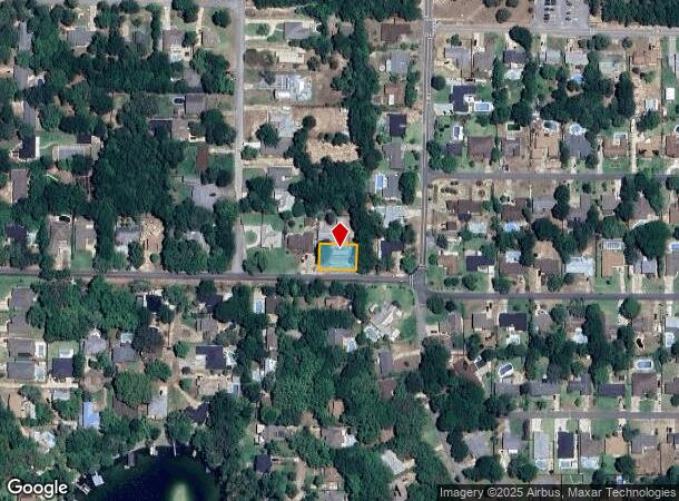
22 Sherwood Dr, Shalimar, FL 32579

NEARBY LISTINGS FOR SALE OR LEASE
Property Detail
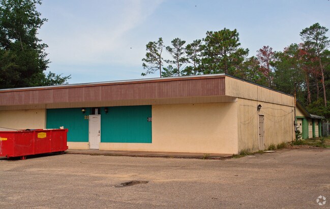
22 Sherwood Dr
Crestview-Fort Walton Beach-Destin, FL
Woodland Shores S/D
31-1S-23-2710-000E-010A
WOODLAND SHORES S/D E113 FT LOT 10 BLK E
Officebuilding
Okaloosa
X
Florida
12091C0454J
10
2023
0.20 AC
2024
Fort Walton Beach
021600
Other Market Areas
2,700 SF
DEMOGRAPHICS near 22 Sherwood Dr
1 Mile
3 Mile
5 Mile
2024 Total Population
3,227
35,213
72,195
2029 Population
3,367
36,730
75,827
Pop Growth 2024-2029
+ 4.34%
+ 4.31%
+ 5.03%
Average Age
49
39
40
2024 Total Households
1,447
14,503
30,715
HH Growth 2024-2029
+ 4.15%
+ 4.09%
+ 5.19%
Median Household Inc
$97,487
$61,723
$60,688
Avg Household Size
2.20
2.30
2.30
2024 Avg HH Vehicles
2.00
2.00
2.00
Median Home Value
$384,679
$307,762
$282,099
Median Year Built
1976
1980
1981
Nearby Places
Map Layers
Map Styles
 Street
 Aerial
- Restaurants
- Banks
- Shops
- Fitness
- Groceries
PUBLIC TRANSPORTATION
AIRPORT
Eglin AFB/Destin-Ft Walton Beach
DRIVE
WALK
Distance
Eglin AFB/Destin-Ft Walton Beach
24 min
7.1 mi
Nearby Properties
Address
Land Use
TOTAL SIZE
Lot Size
Zoning
Address
Land Use
TOTAL SIZE
Lot Size
Zoning
71,584 SF
3 AC
Address
Land Use
TOTAL SIZE
Lot Size
Zoning
560,800 SF
126.12 AC
Address
Land Use
TOTAL SIZE
Lot Size
Zoning
342,628 SF
14.83 AC
Address
Land Use
TOTAL SIZE
Lot Size
Zoning
48,449 SF
3.99 AC
Address
Land Use
TOTAL SIZE
Lot Size
Zoning
15.37 AC
Address
Land Use
TOTAL SIZE
Lot Size
Zoning
432.78 AC
Address
Land Use
TOTAL SIZE
Lot Size
Zoning
73,434 SF
2.40 AC
Address
Land Use
TOTAL SIZE
Lot Size
Zoning
85,571 SF
4.54 AC
Address
Land Use
TOTAL SIZE
Lot Size
Zoning
227,975 SF
24.24 AC
Address
Land Use
TOTAL SIZE
Lot Size
Zoning
59,257 SF
2.99 AC
Address
Land Use
TOTAL SIZE
Lot Size
Zoning
51,030 SF
1.82 AC
Address
Land Use
TOTAL SIZE
Lot Size
Zoning
68,966 SF
6.03 AC
Address
Land Use
TOTAL SIZE
Lot Size
Zoning
108,284 SF
5.47 AC
Address
Land Use
TOTAL SIZE
Lot Size
Zoning
88,509 SF
4.73 AC
Address
Land Use
TOTAL SIZE
Lot Size
Zoning
216,395 SF
4.99 AC
Address
Land Use
TOTAL SIZE
Lot Size
Zoning
70,119 SF
2.98 AC
Address
Land Use
TOTAL SIZE
Lot Size
Zoning
Address
Land Use
TOTAL SIZE
Lot Size
Zoning
56,833 SF
1.37 AC
Address
Land Use
TOTAL SIZE
Lot Size
Zoning
61,060 SF
16.25 AC
Address
Land Use
TOTAL SIZE
Lot Size
Zoning
65,995 SF
6.53 AC
Address
Land Use
TOTAL SIZE
Lot Size
Zoning
49,334 SF
1.67 AC
Address
Land Use
TOTAL SIZE
Lot Size
Zoning
184,310 SF
10.09 AC
Address
Land Use
TOTAL SIZE
Lot Size
Zoning
108,311 SF
6.59 AC
Address
Land Use
TOTAL SIZE
Lot Size
Zoning
44,592 SF
2.11 AC
Address
Land Use
TOTAL SIZE
Lot Size
Zoning
50,667 SF
5.21 AC
Address
Land Use
TOTAL SIZE
Lot Size
Zoning
69,801 SF
67.62 AC
Address
Land Use
TOTAL SIZE
Lot Size
Zoning
49,644 SF
6.17 AC
Address
Land Use
TOTAL SIZE
Lot Size
Zoning
133,065 SF
11.14 AC
Address
Land Use
TOTAL SIZE
Lot Size
Zoning
14,510 SF
1.53 AC
Address
Land Use
TOTAL SIZE
Lot Size
Zoning
The World's #1 Commercial Real Estate Marketplace
Connect with us
© 2025 CoStar Group
The information above has been obtained from sources believed reliable. While we do not doubt its accuracy we have not verified it and make no guarantee, warranty or representation about it. It is your responsibility to independently confirm its accuracy and completeness. Any projections, opinions, assumptions, or estimates used are for example only and do not represent the current or future performance of the property. The value of this transaction to you depends on tax and other factors which should be evaluated by your tax, financial, and legal advisors. You and your advisors should conduct a careful, independent investigation of the property to determine to your satisfaction the suitability of the property for your needs.