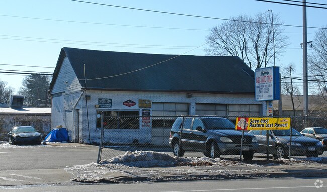
Property Record
22 Suffolk Ave, Patchogue, NY 11772


NEARBY LISTINGS FOR SALE OR LEASE
Property Detail
22 Suffolk Ave
Nassau County-Suffolk County, NY
X2219769Y206478 N011N00000000
0500-098-00-01-00-058-000
Suffolk
Shipyard
New York
X
100
36103C0665H
0.45 AC
0
Western Suffolk
2024
Long Island (New York)
158805
DEMOGRAPHICS near 22 Suffolk Ave
1 mile
3 mile
5 mile
2024 Total Population
20,690
106,767
245,629
2029 Population
20,139
103,579
239,246
Pop Growth 2024-2029
(2.66%)
(2.99%)
(2.60%)
Average Age
38
38
39
2024 Total Households
5,636
27,638
72,067
HH Growth 2024-2029
(2.63%)
(3.07%)
(2.64%)
Median Household Inc
$87,026
$107,630
$115,458
Avg Household Size
3.40
3.50
3.20
2024 Avg HH Vehicles
2.00
2.00
2.00
Median Home Value
$347,968
$411,363
$457,071
Median Year Built
1971
1967
1966
Nearby Places
Map Layers
Map Styles
 Street
 Aerial
Transit
 Traffic
 Biking
Places
Listings with unknown addresses are not visible on the map
- Restaurants
- Banks
- Shops
- Fitness
- Groceries
PUBLIC TRANSPORTATION
TRANSIT/SUBWAY
Central Islip Station (Ronkonkoma Branch - Long Island Rail Road)
Drive
Walk
Distance
Central Islip Station (Ronkonkoma Branch - Long Island Rail Road)
3 min
12 min
0.6 mi
COMMUTER RAIL
Central Islip Station (Ronkonkoma Branch - Long Island Rail Road)
Drive
Walk
Distance
Central Islip Station (Ronkonkoma Branch - Long Island Rail Road)
1 min
12 min
0.6 mi
Brentwood Station (Ronkonkoma Branch - Long Island Rail Road)
Drive
Walk
Distance
Brentwood Station (Ronkonkoma Branch - Long Island Rail Road)
6 min
2.6 mi
AIRPORT
Long Island MacArthur
Drive
Walk
Distance
Long Island MacArthur
13 min
6.5 mi
John F Kennedy International
Drive
Walk
Distance
John F Kennedy International
52 min
38.8 mi
Nearby Properties
Address
Land Use
TOTAL SIZE
Lot Size
Zoning
Address
Land Use
TOTAL SIZE
Lot Size
Zoning
301 SF
3.70 AC
Address
Land Use
TOTAL SIZE
Lot Size
Zoning
97.50 AC
AAA
Address
Land Use
TOTAL SIZE
Lot Size
Zoning
194.82 AC
AAA
Address
Land Use
TOTAL SIZE
Lot Size
Zoning
57.30 AC
AAA
Address
Land Use
TOTAL SIZE
Lot Size
Zoning
8,958 SF
1.44 AC
R60
Address
Land Use
TOTAL SIZE
Lot Size
Zoning
22.22 AC
AA
Address
Land Use
TOTAL SIZE
Lot Size
Zoning
17.70 AC
A
Address
Land Use
TOTAL SIZE
Lot Size
Zoning
8.05 AC
NULL
Address
Land Use
TOTAL SIZE
Lot Size
Zoning
52.73 AC
AAA
Address
Land Use
TOTAL SIZE
Lot Size
Zoning
170.87 AC
AAA
Address
Land Use
TOTAL SIZE
Lot Size
Zoning
24.10 AC
A
Address
Land Use
TOTAL SIZE
Lot Size
Zoning
83.41 AC
Address
Land Use
TOTAL SIZE
Lot Size
Zoning
27.38 AC
Address
Land Use
TOTAL SIZE
Lot Size
Zoning
2.79 AC
Address
Land Use
TOTAL SIZE
Lot Size
Zoning
36.66 AC
NULL
Address
Land Use
TOTAL SIZE
Lot Size
Zoning
24.96 AC
Address
Land Use
TOTAL SIZE
Lot Size
Zoning
24.70 AC
AAA
Address
Land Use
TOTAL SIZE
Lot Size
Zoning
360.60 AC
AAA
Address
Land Use
TOTAL SIZE
Lot Size
Zoning
13.06 AC
BUS3
Address
Land Use
TOTAL SIZE
Lot Size
Zoning
15.46 AC
PDDEC
Address
Land Use
TOTAL SIZE
Lot Size
Zoning
5,140 SF
23.39 AC
CA
Address
Land Use
TOTAL SIZE
Lot Size
Zoning
19.70 AC
A
Address
Land Use
TOTAL SIZE
Lot Size
Zoning
97.24 AC
AAA
Address
Land Use
TOTAL SIZE
Lot Size
Zoning
21.20 AC
AA
Address
Land Use
TOTAL SIZE
Lot Size
Zoning
5,078 SF
0.33 AC
VILLA
Address
Land Use
TOTAL SIZE
Lot Size
Zoning
15 AC
AA
Address
Land Use
TOTAL SIZE
Lot Size
Zoning
45.56 AC
Address
Land Use
TOTAL SIZE
Lot Size
Zoning
12.84 AC
NULL
Address
Land Use
TOTAL SIZE
Lot Size
Zoning
8.02 AC
NULL
Address
Land Use
TOTAL SIZE
Lot Size
Zoning
10.20 AC
B
The World's #1 Commercial Real Estate Marketplace
Connect with us
© 2026 CoStar Group
The information above has been obtained from sources believed reliable. While we do not doubt its accuracy we have not verified it and make no guarantee, warranty or representation about it. It is your responsibility to independently confirm its accuracy and completeness. Any projections, opinions, assumptions, or estimates used are for example only and do not represent the current or future performance of the property. The value of this transaction to you depends on tax and other factors which should be evaluated by your tax, financial, and legal advisors. You and your advisors should conduct a careful, independent investigation of the property to determine to your satisfaction the suitability of the property for your needs.