Property Record
22 Tower Rd, Raymond, ME 04071
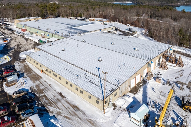


Property Detail
22 Tower Rd
RYMD-000006-000000-000025
CUMBERLAND
Industrialgeneral
Maine
I,RR2
25
B and X Area of moderate flood hazard, usually the area between the limits of the 100-year and 500-year floods.
77.64 AC
2024
NE Cumberland County
2024
Portland/South Portland
012002
Portland-South Portland, ME
121,478 SF
NEARBY LISTINGS FOR SALE OR LEASE
-
-
View all Raymond listings for sale on LoopNet.com
DEMOGRAPHICS near 22 Tower Rd
1 mile
3 mile
5 mile
2025 Total Population
521
4,457
10,391
2030 Population
544
4,663
10,977
Pop Growth 2025-2030
+ 4.41%
+ 4.62%
+ 5.64%
Average Age
45
46
46
2025 Total Households
214
1,853
4,369
HH Growth 2025-2030
+ 4.67%
+ 4.91%
+ 5.93%
Median Household Inc
$105,555
$92,358
$91,110
Avg Household Size
2.40
2.40
2.30
2025 Avg HH Vehicles
2.00
2.00
2.00
Median Home Value
$398,717
$467,539
$481,438
Median Year Built
1974
1983
1983
Nearby Places
Map Layers
Map Styles
 Street
 Aerial
Layers
 Traffic
 Biking
Places
Listings with unknown addresses are not visible on the map
- Restaurants
- Banks
- Shops
- Fitness
- Groceries
PUBLIC TRANSPORTATION
AIRPORT
Portland International Jetport
Drive
Walk
Distance
Portland International Jetport
45 min
24.3 mi
Freight Ports
Portland, ME
Drive
Walk
Distance
Portland, ME
43 min
24.4 mi
Nearby Properties
Address
Land Use
TOTAL SIZE
Lot Size
Zoning
Address
Land Use
TOTAL SIZE
Lot Size
Zoning
14,833 SF
13.59 AC
10
Address
Land Use
TOTAL SIZE
Lot Size
Zoning
64.48 AC
10
Address
Land Use
TOTAL SIZE
Lot Size
Zoning
3 AC
R
Address
Land Use
TOTAL SIZE
Lot Size
Zoning
58,143 SF
46.27 AC
RR
Address
Land Use
TOTAL SIZE
Lot Size
Zoning
Address
Land Use
TOTAL SIZE
Lot Size
Zoning
6.40 AC
RR
Address
Land Use
TOTAL SIZE
Lot Size
Zoning
82.10 AC
I
Address
Land Use
TOTAL SIZE
Lot Size
Zoning
0.20 AC
VR2
Address
Land Use
TOTAL SIZE
Lot Size
Zoning
3.10 AC
LRR2
Address
Land Use
TOTAL SIZE
Lot Size
Zoning
5.53 AC
10
Address
Land Use
TOTAL SIZE
Lot Size
Zoning
3,268 SF
0.96 AC
10
Address
Land Use
TOTAL SIZE
Lot Size
Zoning
1,152 SF
1.12 AC
10
Address
Land Use
TOTAL SIZE
Lot Size
Zoning
124 AC
LRR1
Address
Land Use
TOTAL SIZE
Lot Size
Zoning
7.50 AC
VR2
Address
Land Use
TOTAL SIZE
Lot Size
Zoning
1,372 SF
1.74 AC
10
Address
Land Use
TOTAL SIZE
Lot Size
Zoning
576 SF
3.95 AC
LRR2
Address
Land Use
TOTAL SIZE
Lot Size
Zoning
3.88 AC
LRR2
Address
Land Use
TOTAL SIZE
Lot Size
Zoning
5.40 AC
C
Address
Land Use
TOTAL SIZE
Lot Size
Zoning
4,482 SF
1.39 AC
10
Address
Land Use
TOTAL SIZE
Lot Size
Zoning
2 AC
LRR2
Address
Land Use
TOTAL SIZE
Lot Size
Zoning
3.50 AC
LRR2
Address
Land Use
TOTAL SIZE
Lot Size
Zoning
2,606 SF
2.41 AC
10
Address
Land Use
TOTAL SIZE
Lot Size
Zoning
3.63 AC
LRR2
Address
Land Use
TOTAL SIZE
Lot Size
Zoning
270.38 AC
BB
Address
Land Use
TOTAL SIZE
Lot Size
Zoning
2,450 SF
0.72 AC
10
Address
Land Use
TOTAL SIZE
Lot Size
Zoning
682 SF
4.36 AC
10
Address
Land Use
TOTAL SIZE
Lot Size
Zoning
52 AC
LRR1
Address
Land Use
TOTAL SIZE
Lot Size
Zoning
76 AC
LRR1
Address
Land Use
TOTAL SIZE
Lot Size
Zoning
90 AC
LRR1
The World's #1 Commercial Real Estate Marketplace
Connect with us
© 2026 CoStar Group
The information above has been obtained from sources believed reliable. While we do not doubt its accuracy we have not verified it and make no guarantee, warranty or representation about it. It is your responsibility to independently confirm its accuracy and completeness. Any projections, opinions, assumptions, or estimates used are for example only and do not represent the current or future performance of the property. The value of this transaction to you depends on tax and other factors which should be evaluated by your tax, financial, and legal advisors. You and your advisors should conduct a careful, independent investigation of the property to determine to your satisfaction the suitability of the property for your needs.