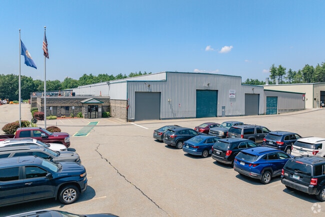
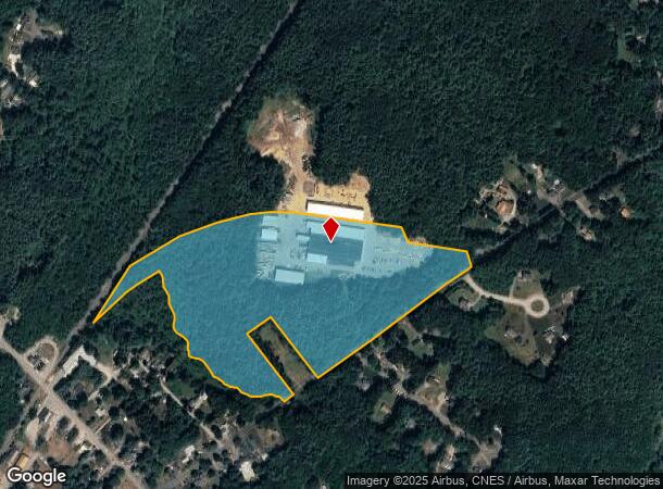
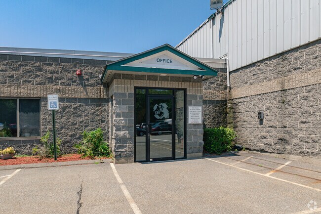
Property Record
22 Whittier St, Newton, NH 03858
NEARBY LISTINGS FOR SALE OR LEASE
Property Detail
22 Whittier St
NWTO-000006-000013-000002
Rockingham
Industrialgeneral
New Hampshire
X
2
25009C0081G
50.31 AC
2024
Rockingham
2024
Boston
102100
Boston-Cambridge-Newton, MA-NH
66,288 SF
DEMOGRAPHICS near 22 Whittier St
1 Mile
3 Mile
5 Mile
2024 Total Population
1,492
12,009
40,128
2029 Population
1,519
12,361
40,904
Pop Growth 2024-2029
+ 1.81%
+ 2.93%
+ 1.93%
Average Age
44
43
44
2024 Total Households
592
4,588
15,802
HH Growth 2024-2029
+ 1.52%
+ 2.88%
+ 1.80%
Median Household Inc
$130,120
$116,966
$107,417
Avg Household Size
2.50
2.60
2.50
2024 Avg HH Vehicles
2.00
2.00
2.00
Median Home Value
$367,777
$392,835
$416,811
Median Year Built
1976
1982
1982
Nearby Places
Map Layers
Map Styles
 Street
 Aerial
- Restaurants
- Banks
- Shops
- Fitness
- Groceries
PUBLIC TRANSPORTATION
COMMUTER RAIL
Haverhill (Haverhill Line - Massachusetts Bay Transportation Authority Commuter Rail (Purple Line))
DRIVE
WALK
Distance
Haverhill (Haverhill Line - Massachusetts Bay Transportation Authority Commuter Rail (Purple Line))
18 min
8.4 mi
Bradford (Haverhill Line - Massachusetts Bay Transportation Authority Commuter Rail (Purple Line))
DRIVE
WALK
Distance
Bradford (Haverhill Line - Massachusetts Bay Transportation Authority Commuter Rail (Purple Line))
20 min
8.8 mi
AIRPORT
Portsmouth International at Pease
DRIVE
WALK
Distance
Portsmouth International at Pease
48 min
28.9 mi
Manchester Boston Regional
DRIVE
WALK
Distance
Manchester Boston Regional
61 min
34.0 mi
Freight Ports
Port of Boston
DRIVE
WALK
Distance
Port of Boston
69 min
46.2 mi
Nearby Properties
Address
Land Use
TOTAL SIZE
Lot Size
Zoning
Address
Land Use
TOTAL SIZE
Lot Size
Zoning
279,958 SF
86 AC
SFRAQ
Address
Land Use
TOTAL SIZE
Lot Size
Zoning
8.79 AC
RRAQ R
Address
Land Use
TOTAL SIZE
Lot Size
Zoning
2,400 SF
4 AC
MDR
Address
Land Use
TOTAL SIZE
Lot Size
Zoning
39,670 SF
26.55 AC
RES-A
Address
Land Use
TOTAL SIZE
Lot Size
Zoning
32,074 SF
6.69 AC
C-1
Address
Land Use
TOTAL SIZE
Lot Size
Zoning
79,184 SF
9.96 AC
C-3
Address
Land Use
TOTAL SIZE
Lot Size
Zoning
130,422 SF
16.95 AC
LIGHT
Address
Land Use
TOTAL SIZE
Lot Size
Zoning
16,020 SF
6.68 AC
VC
Address
Land Use
TOTAL SIZE
Lot Size
Zoning
17,856 SF
19.80 AC
C-3
Address
Land Use
TOTAL SIZE
Lot Size
Zoning
27,362 SF
2.51 AC
C-3
Address
Land Use
TOTAL SIZE
Lot Size
Zoning
6,300 SF
6.70 AC
C3AQC3
Address
Land Use
TOTAL SIZE
Lot Size
Zoning
1,577 SF
122.25 AC
RRAQ R
Address
Land Use
TOTAL SIZE
Lot Size
Zoning
4,025 SF
45.06 AC
RES-A
Address
Land Use
TOTAL SIZE
Lot Size
Zoning
14,291 SF
19.51 AC
I
Address
Land Use
TOTAL SIZE
Lot Size
Zoning
33,600 SF
10.51 AC
I
Address
Land Use
TOTAL SIZE
Lot Size
Zoning
21,223 SF
12 AC
ICR
Address
Land Use
TOTAL SIZE
Lot Size
Zoning
15,155 SF
8.07 AC
C-3
Address
Land Use
TOTAL SIZE
Lot Size
Zoning
8,272 SF
10 AC
COMM
Address
Land Use
TOTAL SIZE
Lot Size
Zoning
21,645 SF
2.84 AC
I
Address
Land Use
TOTAL SIZE
Lot Size
Zoning
2.41 AC
MDR
Address
Land Use
TOTAL SIZE
Lot Size
Zoning
35,965 SF
C3AQC3
Address
Land Use
TOTAL SIZE
Lot Size
Zoning
5,836 SF
4.25 AC
MDR
Address
Land Use
TOTAL SIZE
Lot Size
Zoning
7,027 SF
182.50 AC
INDAQI
Address
Land Use
TOTAL SIZE
Lot Size
Zoning
3,810 SF
2.90 AC
C-3
Address
Land Use
TOTAL SIZE
Lot Size
Zoning
4,185 SF
1.49 AC
C-1
Address
Land Use
TOTAL SIZE
Lot Size
Zoning
3,750 SF
3.63 AC
C-3
Address
Land Use
TOTAL SIZE
Lot Size
Zoning
40,125 SF
6.09 AC
LIGHT
Address
Land Use
TOTAL SIZE
Lot Size
Zoning
6,689 SF
19.55 AC
C3C3
Address
Land Use
TOTAL SIZE
Lot Size
Zoning
10,000 SF
6.45 AC
C-1
The World's #1 Commercial Real Estate Marketplace
Connect with us
© 2025 CoStar Group
The information above has been obtained from sources believed reliable. While we do not doubt its accuracy we have not verified it and make no guarantee, warranty or representation about it. It is your responsibility to independently confirm its accuracy and completeness. Any projections, opinions, assumptions, or estimates used are for example only and do not represent the current or future performance of the property. The value of this transaction to you depends on tax and other factors which should be evaluated by your tax, financial, and legal advisors. You and your advisors should conduct a careful, independent investigation of the property to determine to your satisfaction the suitability of the property for your needs.