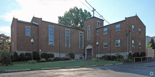
Property Record
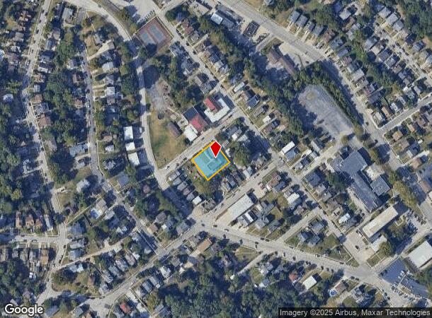
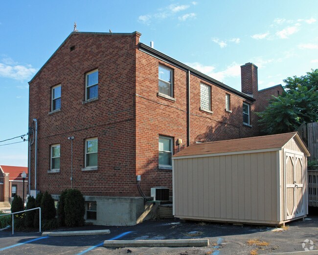
22 William F Blatt St, Newport, KY 41071
NEARBY LISTINGS FOR SALE OR LEASE
Property Detail
22 William F Blatt St
Cincinnati, OH-KY-IN
Original Plan Of Southgate
999-99-36-027.00
LOTS 149 THRU 152 SOUTHGATE 120 X 110
Commercialnec
Campbell
X
Kentucky
39061C0355G
149-152
0
0.30 AC
2025
Outlying N Kentucky
052500
Cincinnati/Dayton
DEMOGRAPHICS near 22 William F Blatt St
1 Mile
3 Mile
5 Mile
2024 Total Population
10,802
98,477
227,588
2029 Population
10,903
100,893
231,100
Pop Growth 2024-2029
+ 0.94%
+ 2.45%
+ 1.54%
Average Age
40
39
38
2024 Total Households
5,021
44,545
101,997
HH Growth 2024-2029
+ 0.90%
+ 2.62%
+ 1.63%
Median Household Inc
$64,275
$60,724
$59,649
Avg Household Size
2.10
2.10
2.10
2024 Avg HH Vehicles
2.00
1.00
1.00
Median Home Value
$190,446
$198,116
$237,306
Median Year Built
1969
1951
1953
Nearby Places
Map Layers
Map Styles
 Street
 Aerial
- Restaurants
- Banks
- Shops
- Fitness
- Groceries
PUBLIC TRANSPORTATION
COMMUTER RAIL
DRIVE
WALK
Distance
14 min
7.2 mi
AIRPORT
Cincinnati/Northern Kentucky International
DRIVE
WALK
Distance
Cincinnati/Northern Kentucky International
26 min
15.9 mi
Nearby Properties
Address
Land Use
TOTAL SIZE
Lot Size
Zoning
Address
Land Use
TOTAL SIZE
Lot Size
Zoning
560 SF
218.94 AC
Address
Land Use
TOTAL SIZE
Lot Size
Zoning
39.99 AC
MG
Address
Land Use
TOTAL SIZE
Lot Size
Zoning
17.10 AC
DD
Address
Land Use
TOTAL SIZE
Lot Size
Zoning
1.97 AC
DD
Address
Land Use
TOTAL SIZE
Lot Size
Zoning
243,000 SF
11.30 AC
Address
Land Use
TOTAL SIZE
Lot Size
Zoning
411,750 SF
21.25 AC
Address
Land Use
TOTAL SIZE
Lot Size
Zoning
60,750 SF
1.52 AC
Address
Land Use
TOTAL SIZE
Lot Size
Zoning
2.60 AC
Address
Land Use
TOTAL SIZE
Lot Size
Zoning
9.55 AC
Address
Land Use
TOTAL SIZE
Lot Size
Zoning
89,500 SF
0.58 AC
Address
Land Use
TOTAL SIZE
Lot Size
Zoning
290,233 SF
Address
Land Use
TOTAL SIZE
Lot Size
Zoning
9,962 SF
712 AC
Address
Land Use
TOTAL SIZE
Lot Size
Zoning
Address
Land Use
TOTAL SIZE
Lot Size
Zoning
153,312 SF
4 AC
Address
Land Use
TOTAL SIZE
Lot Size
Zoning
9.14 AC
Address
Land Use
TOTAL SIZE
Lot Size
Zoning
298,611 SF
Address
Land Use
TOTAL SIZE
Lot Size
Zoning
20.02 AC
Address
Land Use
TOTAL SIZE
Lot Size
Zoning
165,016 SF
15.23 AC
Address
Land Use
TOTAL SIZE
Lot Size
Zoning
20.49 AC
Address
Land Use
TOTAL SIZE
Lot Size
Zoning
256,000 SF
Address
Land Use
TOTAL SIZE
Lot Size
Zoning
1.95 AC
Address
Land Use
TOTAL SIZE
Lot Size
Zoning
12,150 SF
10.02 AC
Address
Land Use
TOTAL SIZE
Lot Size
Zoning
19,816 SF
26.42 AC
Address
Land Use
TOTAL SIZE
Lot Size
Zoning
Address
Land Use
TOTAL SIZE
Lot Size
Zoning
263,300 SF
1.74 AC
Address
Land Use
TOTAL SIZE
Lot Size
Zoning
2.46 AC
Address
Land Use
TOTAL SIZE
Lot Size
Zoning
844,128 SF
1.22 AC
DD
Address
Land Use
TOTAL SIZE
Lot Size
Zoning
15.05 AC
Address
Land Use
TOTAL SIZE
Lot Size
Zoning
Address
Land Use
TOTAL SIZE
Lot Size
Zoning
108,958 SF
2.12 AC
The World's #1 Commercial Real Estate Marketplace
Connect with us
© 2025 CoStar Group
The information above has been obtained from sources believed reliable. While we do not doubt its accuracy we have not verified it and make no guarantee, warranty or representation about it. It is your responsibility to independently confirm its accuracy and completeness. Any projections, opinions, assumptions, or estimates used are for example only and do not represent the current or future performance of the property. The value of this transaction to you depends on tax and other factors which should be evaluated by your tax, financial, and legal advisors. You and your advisors should conduct a careful, independent investigation of the property to determine to your satisfaction the suitability of the property for your needs.