Property Record
220 N Cedar Ave, Republic, MO 65738


Property Detail
220 N Cedar Ave
17-19-201-031
WEST BROOK CENTRE LOT 8
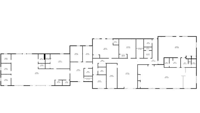
Officebuilding
Greene
INC
Missouri
AE The base floodplain where base flood elevations are provided. AE Zones are now used on new format FIRMs instead of A1-A30 Zones.
8
2025
0.79 AC
2025
Outlying Greene County
004803
Springfield
7,988 SF
Springfield, MO
NEARBY LISTINGS FOR SALE OR LEASE
DEMOGRAPHICS near 220 N Cedar Ave
1 mile
3 mile
5 mile
2025 Total Population
4,827
19,750
25,528
2030 Population
5,008
20,350
26,402
Pop Growth 2025-2030
+ 3.75%
+ 3.04%
+ 3.42%
Average Age
37
37
37
2025 Total Households
1,874
7,377
9,580
HH Growth 2025-2030
+ 3.95%
+ 3.17%
+ 3.56%
Median Household Inc
$72,043
$70,830
$72,091
Avg Household Size
2.50
2.60
2.60
2025 Avg HH Vehicles
2.00
2.00
2.00
Median Home Value
$223,115
$232,271
$245,629
Median Year Built
1983
1991
1994
Nearby Places
Map Layers
Map Styles
 Street
 Aerial
Layers
 Traffic
 Biking
Places
Listings with unknown addresses are not visible on the map
- Restaurants
- Banks
- Shops
- Fitness
- Groceries
PUBLIC TRANSPORTATION
AIRPORT
Springfield-Branson Ntl
Drive
Walk
Distance
Springfield-Branson Ntl
31 min
17.5 mi
SALE & LEASE HISTORY
LISTING DATE
SALE/LEASE

May 11, 2022
For Sale
Jun 23, 2022
For Sale
Apr 12, 2024
For Sale
Nearby Properties
Address
Land Use
TOTAL SIZE
Lot Size
Zoning
Address
Land Use
TOTAL SIZE
Lot Size
Zoning
157,134 SF
18.35 AC
INC
Address
Land Use
TOTAL SIZE
Lot Size
Zoning
129,624 SF
10.94 AC
INC
Address
Land Use
TOTAL SIZE
Lot Size
Zoning
136,508 SF
16.42 AC
INC
Address
Land Use
TOTAL SIZE
Lot Size
Zoning
12.09 AC
Address
Land Use
TOTAL SIZE
Lot Size
Zoning
1,315 SF
7.58 AC
Address
Land Use
TOTAL SIZE
Lot Size
Zoning
5.24 AC
Address
Land Use
TOTAL SIZE
Lot Size
Zoning
8.65 AC
INC
Address
Land Use
TOTAL SIZE
Lot Size
Zoning
3.56 AC
INC
Address
Land Use
TOTAL SIZE
Lot Size
Zoning
80,344 SF
5.31 AC
INC
Address
Land Use
TOTAL SIZE
Lot Size
Zoning
10,726 SF
1.92 AC
INC
Address
Land Use
TOTAL SIZE
Lot Size
Zoning
9,960 SF
5.09 AC
INC
Address
Land Use
TOTAL SIZE
Lot Size
Zoning
46,775 SF
4.60 AC
INC
Address
Land Use
TOTAL SIZE
Lot Size
Zoning
27,924 SF
2.04 AC
INC
Address
Land Use
TOTAL SIZE
Lot Size
Zoning
76,794 SF
6.46 AC
INC
Address
Land Use
TOTAL SIZE
Lot Size
Zoning
17,848 SF
1.15 AC
INC
Address
Land Use
TOTAL SIZE
Lot Size
Zoning
1.28 AC
INC
Address
Land Use
TOTAL SIZE
Lot Size
Zoning
23,336 SF
4 AC
INC
Address
Land Use
TOTAL SIZE
Lot Size
Zoning
14,493 SF
2.33 AC
INC
Address
Land Use
TOTAL SIZE
Lot Size
Zoning
Address
Land Use
TOTAL SIZE
Lot Size
Zoning
10,742 SF
2.21 AC
INC
Address
Land Use
TOTAL SIZE
Lot Size
Zoning
41,504 SF
2.70 AC
INC
Address
Land Use
TOTAL SIZE
Lot Size
Zoning
45,756 SF
11.25 AC
INC
Address
Land Use
TOTAL SIZE
Lot Size
Zoning
3.31 AC
INC
Address
Land Use
TOTAL SIZE
Lot Size
Zoning
2.21 AC
INC
Address
Land Use
TOTAL SIZE
Lot Size
Zoning
38,069 SF
3.10 AC
INC
Address
Land Use
TOTAL SIZE
Lot Size
Zoning
1.26 AC
Address
Land Use
TOTAL SIZE
Lot Size
Zoning
15.52 AC
C-2
Address
Land Use
TOTAL SIZE
Lot Size
Zoning
2.08 AC
INC
Address
Land Use
TOTAL SIZE
Lot Size
Zoning
1.15 AC
Address
Land Use
TOTAL SIZE
Lot Size
Zoning
35,832 SF
5.33 AC
INC
The World's #1 Commercial Real Estate Marketplace
Connect with us
© 2026 CoStar Group
The information above has been obtained from sources believed reliable. While we do not doubt its accuracy we have not verified it and make no guarantee, warranty or representation about it. It is your responsibility to independently confirm its accuracy and completeness. Any projections, opinions, assumptions, or estimates used are for example only and do not represent the current or future performance of the property. The value of this transaction to you depends on tax and other factors which should be evaluated by your tax, financial, and legal advisors. You and your advisors should conduct a careful, independent investigation of the property to determine to your satisfaction the suitability of the property for your needs.