Property Record
220 Baston Rd, Augusta, GA 30907


Property Detail
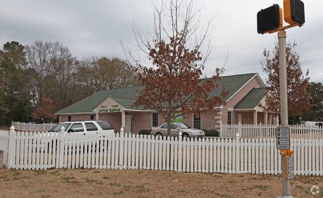
220 Baston Rd
082D011A
.506 ACS
Daycare
Columbia
C-2;GEN CO
Georgia
B and X Area of moderate flood hazard, usually the area between the limits of the 100-year and 500-year floods.
0.51 AC
2025
Evans/Martinez
2025
Augusta/Richmond County
030106
Augusta-Richmond County, GA-SC
4,000 SF
NEARBY LISTINGS FOR SALE OR LEASE
DEMOGRAPHICS near 220 Baston Rd
1 mile
3 mile
5 mile
2025 Total Population
6,827
58,434
127,988
2030 Population
6,983
59,500
130,743
Pop Growth 2025-2030
+ 2.29%
+ 1.82%
+ 2.15%
Average Age
41
41
41
2025 Total Households
2,765
24,779
54,392
HH Growth 2025-2030
+ 2.06%
+ 1.38%
+ 1.89%
Median Household Inc
$74,578
$80,027
$76,134
Avg Household Size
2.40
2.30
2.30
2025 Avg HH Vehicles
2.00
2.00
2.00
Median Home Value
$252,857
$286,191
$281,898
Median Year Built
1983
1988
1987
Nearby Places
Map Layers
Map Styles
 Street
 Aerial
Layers
 Traffic
 Biking
Places
Listings with unknown addresses are not visible on the map
- Restaurants
- Banks
- Shops
- Fitness
- Groceries
PUBLIC TRANSPORTATION
AIRPORT
Augusta Regional at Bush Field
Drive
Walk
Distance
Augusta Regional at Bush Field
25 min
15.4 mi
Freight Ports
Georgia Ports - Savannah
Drive
Walk
Distance
Georgia Ports - Savannah
159 min
124.6 mi
Nearby Properties
Address
Land Use
TOTAL SIZE
Lot Size
Zoning
Address
Land Use
TOTAL SIZE
Lot Size
Zoning
371,617 SF
13.26 AC
B-2
Address
Land Use
TOTAL SIZE
Lot Size
Zoning
7,216 SF
53.27 AC
B-1 SPEX
Address
Land Use
TOTAL SIZE
Lot Size
Zoning
5,541 SF
14.81 AC
B-2
Address
Land Use
TOTAL SIZE
Lot Size
Zoning
4,077 SF
20.88 AC
C-2;GEN CO
Address
Land Use
TOTAL SIZE
Lot Size
Zoning
13.19 AC
Address
Land Use
TOTAL SIZE
Lot Size
Zoning
7,749 SF
17.02 AC
R2
Address
Land Use
TOTAL SIZE
Lot Size
Zoning
57,341 SF
54.33 AC
Address
Land Use
TOTAL SIZE
Lot Size
Zoning
3,680 SF
13.42 AC
B-2
Address
Land Use
TOTAL SIZE
Lot Size
Zoning
3,498 SF
12.61 AC
B-2
Address
Land Use
TOTAL SIZE
Lot Size
Zoning
2,326 SF
21.90 AC
R-3B
Address
Land Use
TOTAL SIZE
Lot Size
Zoning
4,800 SF
19.81 AC
B-2
Address
Land Use
TOTAL SIZE
Lot Size
Zoning
16,323 SF
24.61 AC
Address
Land Use
TOTAL SIZE
Lot Size
Zoning
3,447 SF
16.67 AC
R-3B
Address
Land Use
TOTAL SIZE
Lot Size
Zoning
952 SF
29 AC
A
Address
Land Use
TOTAL SIZE
Lot Size
Zoning
2,508 SF
14.61 AC
A-R;APARTM
Address
Land Use
TOTAL SIZE
Lot Size
Zoning
150,807 SF
16.91 AC
R-1A SPEX
Address
Land Use
TOTAL SIZE
Lot Size
Zoning
997 SF
19.16 AC
Address
Land Use
TOTAL SIZE
Lot Size
Zoning
114,153 SF
12.91 AC
B-2
Address
Land Use
TOTAL SIZE
Lot Size
Zoning
66,300 SF
18.22 AC
B-1
Address
Land Use
TOTAL SIZE
Lot Size
Zoning
4,108 SF
14.12 AC
B-2
Address
Land Use
TOTAL SIZE
Lot Size
Zoning
8,640 SF
13.15 AC
R-3B
Address
Land Use
TOTAL SIZE
Lot Size
Zoning
150,263 SF
18.75 AC
PUD
Address
Land Use
TOTAL SIZE
Lot Size
Zoning
112,947 SF
14.91 AC
Address
Land Use
TOTAL SIZE
Lot Size
Zoning
72,381 SF
0.95 AC
Address
Land Use
TOTAL SIZE
Lot Size
Zoning
42,617 SF
40.26 AC
R-1_B-1
Address
Land Use
TOTAL SIZE
Lot Size
Zoning
2,757 SF
19.55 AC
B-2_R-1
Address
Land Use
TOTAL SIZE
Lot Size
Zoning
129,068 SF
8.74 AC
Address
Land Use
TOTAL SIZE
Lot Size
Zoning
62,440 SF
5.70 AC
B-2
Address
Land Use
TOTAL SIZE
Lot Size
Zoning
125,466 SF
15.98 AC
B-2
Address
Land Use
TOTAL SIZE
Lot Size
Zoning
2,355 SF
12.97 AC
B-2
The World's #1 Commercial Real Estate Marketplace
Connect with us
© 2026 CoStar Group
The information above has been obtained from sources believed reliable. While we do not doubt its accuracy we have not verified it and make no guarantee, warranty or representation about it. It is your responsibility to independently confirm its accuracy and completeness. Any projections, opinions, assumptions, or estimates used are for example only and do not represent the current or future performance of the property. The value of this transaction to you depends on tax and other factors which should be evaluated by your tax, financial, and legal advisors. You and your advisors should conduct a careful, independent investigation of the property to determine to your satisfaction the suitability of the property for your needs.