Property Record
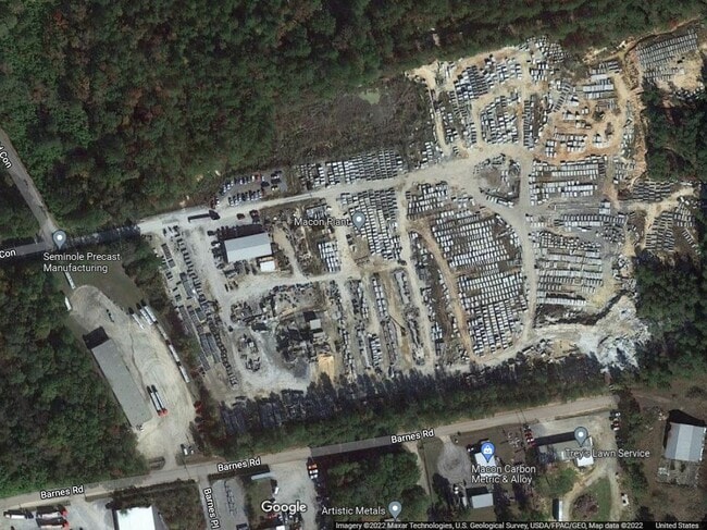
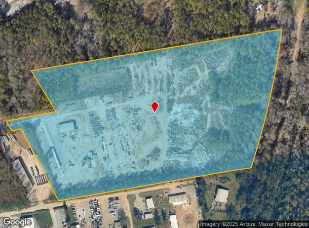
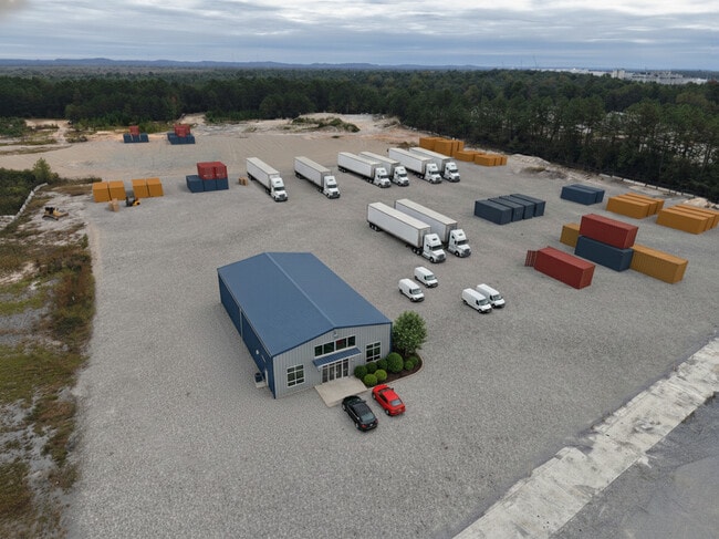
220 Cargill Road Connector Rd, Macon, GA 31216
Current Lease Availabilities
NEARBY LISTINGS FOR SALE OR LEASE
Property Detail
220 Cargill Road Connector Rd
P120-0026
4Th Land District
Commercialnec
Bibb
X
Georgia
13021C0144G
213
2025
29.33 AC
2025
Outlying Bibb County
013502
Atlanta
4,800 SF
Macon-Bibb County, GA
DEMOGRAPHICS near 220 Cargill Road Connector Rd
1 Mile
3 Mile
5 Mile
2024 Total Population
1,128
12,835
44,331
2029 Population
1,136
12,889
44,363
Pop Growth 2024-2029
+ 0.71%
+ 0.42%
+ 0.07%
Average Age
38
39
37
2024 Total Households
436
4,839
16,111
HH Growth 2024-2029
+ 0.69%
+ 0.41%
+ 0.24%
Median Household Inc
$70,555
$45,202
$36,972
Avg Household Size
2.50
2.50
2.50
2024 Avg HH Vehicles
2.00
2.00
2.00
Median Home Value
$168,951
$163,068
$122,887
Median Year Built
1994
1980
1970
Nearby Places
Map Layers
Map Styles
 Street
 Aerial
- Restaurants
- Banks
- Shops
- Fitness
- Groceries
Nearby Properties
Address
Land Use
TOTAL SIZE
Lot Size
Zoning
Address
Land Use
TOTAL SIZE
Lot Size
Zoning
616,986 SF
130.58 AC
M-2
Address
Land Use
TOTAL SIZE
Lot Size
Zoning
983,943 SF
136.41 AC
M-2
Address
Land Use
TOTAL SIZE
Lot Size
Zoning
12,817 SF
357.49 AC
M-2
Address
Land Use
TOTAL SIZE
Lot Size
Zoning
18,128 SF
95 AC
M-2
Address
Land Use
TOTAL SIZE
Lot Size
Zoning
5,096 SF
17.65 AC
A
Address
Land Use
TOTAL SIZE
Lot Size
Zoning
108,418 SF
24.45 AC
R-1A
Address
Land Use
TOTAL SIZE
Lot Size
Zoning
13,596 SF
9.04 AC
R-3
Address
Land Use
TOTAL SIZE
Lot Size
Zoning
1,590 SF
10.52 AC
R-3
Address
Land Use
TOTAL SIZE
Lot Size
Zoning
100,192 SF
30.29 AC
C-2
Address
Land Use
TOTAL SIZE
Lot Size
Zoning
6,776 SF
7.89 AC
C-2
Address
Land Use
TOTAL SIZE
Lot Size
Zoning
201,615 SF
20.36 AC
M-1
Address
Land Use
TOTAL SIZE
Lot Size
Zoning
214,303 SF
5.91 AC
M-2
Address
Land Use
TOTAL SIZE
Lot Size
Zoning
4,896 SF
19.77 AC
M-2
Address
Land Use
TOTAL SIZE
Lot Size
Zoning
66,158 SF
22.57 AC
M-1
Address
Land Use
TOTAL SIZE
Lot Size
Zoning
43,659 SF
21.29 AC
C-2
Address
Land Use
TOTAL SIZE
Lot Size
Zoning
100,170 SF
12.31 AC
C-2
Address
Land Use
TOTAL SIZE
Lot Size
Zoning
48,108 SF
6.58 AC
C-2
Address
Land Use
TOTAL SIZE
Lot Size
Zoning
15,800 SF
9.52 AC
M-1
Address
Land Use
TOTAL SIZE
Lot Size
Zoning
99.99 AC
M-2
Address
Land Use
TOTAL SIZE
Lot Size
Zoning
120,960 SF
6.31 AC
M-1
Address
Land Use
TOTAL SIZE
Lot Size
Zoning
7,140 SF
11.02 AC
M-1
Address
Land Use
TOTAL SIZE
Lot Size
Zoning
50,682 SF
11.78 AC
M-1
Address
Land Use
TOTAL SIZE
Lot Size
Zoning
Address
Land Use
TOTAL SIZE
Lot Size
Zoning
11,322 SF
8.82 AC
R-1AAA
Address
Land Use
TOTAL SIZE
Lot Size
Zoning
42,718 SF
4.82 AC
M-1
Address
Land Use
TOTAL SIZE
Lot Size
Zoning
224,044 SF
15.11 AC
M-1
Address
Land Use
TOTAL SIZE
Lot Size
Zoning
44,763 SF
6.07 AC
R-1AAA
Address
Land Use
TOTAL SIZE
Lot Size
Zoning
16,241 SF
4.72 AC
R-1
Address
Land Use
TOTAL SIZE
Lot Size
Zoning
45,740 SF
4.65 AC
M-1
Address
Land Use
TOTAL SIZE
Lot Size
Zoning
2,400 SF
5.90 AC
C-4
The World's #1 Commercial Real Estate Marketplace
Connect with us
© 2025 CoStar Group
The information above has been obtained from sources believed reliable. While we do not doubt its accuracy we have not verified it and make no guarantee, warranty or representation about it. It is your responsibility to independently confirm its accuracy and completeness. Any projections, opinions, assumptions, or estimates used are for example only and do not represent the current or future performance of the property. The value of this transaction to you depends on tax and other factors which should be evaluated by your tax, financial, and legal advisors. You and your advisors should conduct a careful, independent investigation of the property to determine to your satisfaction the suitability of the property for your needs.