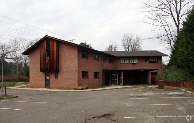
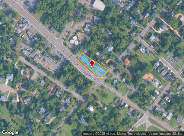
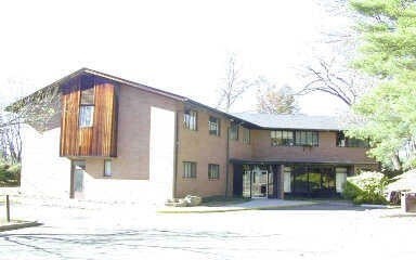
Property Record
220 Culpeper St, Warrenton, VA 20186
Current Lease Availabilities
NEARBY LISTINGS FOR SALE OR LEASE
Property Detail
220 Culpeper St
6984-22-6047
T 6
Multipleuses
Fauquier
X
Virginia
51061C0308D
6
2025
0.65 AC
2025
Fauquier County/Vint Hill
930305
Washington, DC
5,262 SF
Washington-Arlington-Alexandria, DC-VA-MD-WV
DEMOGRAPHICS near 220 Culpeper St
1 Mile
3 Mile
5 Mile
2024 Total Population
6,498
17,900
26,353
2029 Population
6,875
18,899
27,776
Pop Growth 2024-2029
+ 5.80%
+ 5.58%
+ 5.40%
Average Age
41
41
42
2024 Total Households
2,596
6,733
9,754
HH Growth 2024-2029
+ 5.86%
+ 5.63%
+ 5.47%
Median Household Inc
$87,681
$106,429
$115,841
Avg Household Size
2.40
2.60
2.60
2024 Avg HH Vehicles
2.00
2.00
2.00
Median Home Value
$419,195
$449,034
$467,778
Median Year Built
1985
1987
1986
Nearby Places
- Restaurants
- Banks
- Shops
- Fitness
- Groceries
PUBLIC TRANSPORTATION
AIRPORT
Washington Dulles International
DRIVE
WALK
Distance
Washington Dulles International
54 min
34.7 mi
Nearby Properties
Address
Land Use
TOTAL SIZE
Lot Size
Zoning
Address
Land Use
TOTAL SIZE
Lot Size
Zoning
252,713 SF
19.49 AC
PUBLIC/SEM
Address
Land Use
TOTAL SIZE
Lot Size
Zoning
1,496 SF
44.80 AC
PUBLIC/SEM
Address
Land Use
TOTAL SIZE
Lot Size
Zoning
159,120 SF
39.18 AC
PUBLIC/SEM
Address
Land Use
TOTAL SIZE
Lot Size
Zoning
167,332 SF
22.59 AC
COMMERCIAL
Address
Land Use
TOTAL SIZE
Lot Size
Zoning
41.71 AC
INDUSTRIAL
Address
Land Use
TOTAL SIZE
Lot Size
Zoning
80,429 SF
28.90 AC
RESIDENTIA
Address
Land Use
TOTAL SIZE
Lot Size
Zoning
5,560 SF
18.43 AC
COMMERCIAL
Address
Land Use
TOTAL SIZE
Lot Size
Zoning
1,494 SF
5.30 AC
PUBLIC/SEM
Address
Land Use
TOTAL SIZE
Lot Size
Zoning
26,754 SF
6.60 AC
PUD PLANNE
Address
Land Use
TOTAL SIZE
Lot Size
Zoning
57,782 SF
64.53 AC
AGRICULTUR
Address
Land Use
TOTAL SIZE
Lot Size
Zoning
112,530 SF
12.42 AC
COMMERCIAL
Address
Land Use
TOTAL SIZE
Lot Size
Zoning
52,796 SF
11.68 AC
PUD PLANNE
Address
Land Use
TOTAL SIZE
Lot Size
Zoning
59,889 SF
12.16 AC
PUBLIC/SEM
Address
Land Use
TOTAL SIZE
Lot Size
Zoning
93,692 SF
14.82 AC
PUBLIC/SEM
Address
Land Use
TOTAL SIZE
Lot Size
Zoning
14,402 SF
1.16 AC
PUBLIC/SEM
Address
Land Use
TOTAL SIZE
Lot Size
Zoning
128,153 SF
15.48 AC
RES, 1 DWE
Address
Land Use
TOTAL SIZE
Lot Size
Zoning
75,534 SF
5 AC
R10-RESIDE
Address
Land Use
TOTAL SIZE
Lot Size
Zoning
97,367 SF
8.89 AC
COMMERCIAL
Address
Land Use
TOTAL SIZE
Lot Size
Zoning
68,083 SF
21.35 AC
PUBLIC/SEM
Address
Land Use
TOTAL SIZE
Lot Size
Zoning
70,512 SF
26.28 AC
RES, 1 DWE
Address
Land Use
TOTAL SIZE
Lot Size
Zoning
92,036 SF
9.32 AC
COMMERCIAL
Address
Land Use
TOTAL SIZE
Lot Size
Zoning
31,020 SF
3.76 AC
PUBLIC/SEM
Address
Land Use
TOTAL SIZE
Lot Size
Zoning
11,390 SF
338.71 AC
CONSERVATI
Address
Land Use
TOTAL SIZE
Lot Size
Zoning
924 SF
2.75 AC
RESIDENTIA
Address
Land Use
TOTAL SIZE
Lot Size
Zoning
51,048 SF
3.99 AC
PUD PLANNE
Address
Land Use
TOTAL SIZE
Lot Size
Zoning
43,784 SF
4.80 AC
PUBLIC/SEM
Address
Land Use
TOTAL SIZE
Lot Size
Zoning
47,840 SF
5.70 AC
COMMERCIAL
Address
Land Use
TOTAL SIZE
Lot Size
Zoning
57,880 SF
4.46 AC
COMMERCIAL
Address
Land Use
TOTAL SIZE
Lot Size
Zoning
76,092 SF
2.26 AC
COMMERCIAL
Address
Land Use
TOTAL SIZE
Lot Size
Zoning
62,078 SF
3.92 AC
RESIDENTIA
The World's #1 Commercial Real Estate Marketplace
Connect with us
© 2025 CoStar Group
The information above has been obtained from sources believed reliable. While we do not doubt its accuracy we have not verified it and make no guarantee, warranty or representation about it. It is your responsibility to independently confirm its accuracy and completeness. Any projections, opinions, assumptions, or estimates used are for example only and do not represent the current or future performance of the property. The value of this transaction to you depends on tax and other factors which should be evaluated by your tax, financial, and legal advisors. You and your advisors should conduct a careful, independent investigation of the property to determine to your satisfaction the suitability of the property for your needs.