Property Record
220 E 5Th St, Delavan, IL 61734


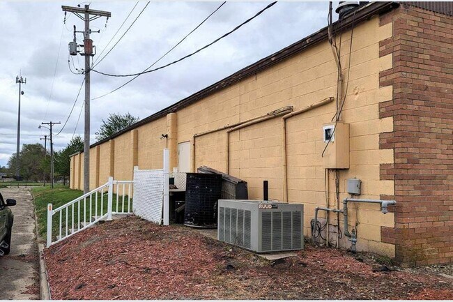
Property Detail
220 E 5Th St
Peoria, IL
SEC 10 T22N R4W ORIGINAL TOWN E 100 OF LOT 2 SW 1/4
21-21-10-301-002
Tazewell
Storebuilding
Illinois
B and X Area of moderate flood hazard, usually the area between the limits of the 100-year and 500-year floods.
2
2023
0.34 AC
2024
Outlying Tazewell County
021900
Peoria
8,976 SF
NEARBY LISTINGS FOR SALE OR LEASE
-
-
View all Delavan listings for sale on LoopNet.com
DEMOGRAPHICS near 220 E 5Th St
1 mile
3 mile
5 mile
2025 Total Population
1,752
1,939
2,622
2030 Population
1,749
1,937
2,611
Pop Growth 2025-2030
(0.17%)
(0.10%)
(0.42%)
Average Age
42
42
43
2025 Total Households
714
787
1,052
HH Growth 2025-2030
(0.14%)
(0.13%)
(0.38%)
Median Household Inc
$70,262
$71,013
$73,813
Avg Household Size
2.40
2.40
2.50
2025 Avg HH Vehicles
2.00
2.00
2.00
Median Home Value
$133,877
$137,681
$151,595
Median Year Built
1953
1954
1956
Nearby Places
Map Layers
Map Styles
 Street
 Aerial
Transit
 Traffic
 Biking
Places
Listings with unknown addresses are not visible on the map
- Restaurants
- Banks
- Shops
- Fitness
- Groceries
PUBLIC TRANSPORTATION
AIRPORT
General Downing - Peoria International
Drive
Walk
Distance
General Downing - Peoria International
48 min
35.4 mi
Central Il Regional/Bloomington-Normal
Drive
Walk
Distance
Central Il Regional/Bloomington-Normal
68 min
45.9 mi
SALE & LEASE HISTORY
LISTING DATE
SALE/LEASE

Aug 29, 2023
For Sale
Nearby Properties
Address
Land Use
TOTAL SIZE
Lot Size
Zoning
Address
Land Use
TOTAL SIZE
Lot Size
Zoning
5.49 AC
Address
Land Use
TOTAL SIZE
Lot Size
Zoning
8.20 AC
Address
Land Use
TOTAL SIZE
Lot Size
Zoning
Address
Land Use
TOTAL SIZE
Lot Size
Zoning
1,063,061 SF
80 AC
Address
Land Use
TOTAL SIZE
Lot Size
Zoning
1.24 AC
Address
Land Use
TOTAL SIZE
Lot Size
Zoning
2,800 SF
0.54 AC
Address
Land Use
TOTAL SIZE
Lot Size
Zoning
0.52 AC
Address
Land Use
TOTAL SIZE
Lot Size
Zoning
240 AC
Address
Land Use
TOTAL SIZE
Lot Size
Zoning
235.40 AC
Address
Land Use
TOTAL SIZE
Lot Size
Zoning
220 AC
Address
Land Use
TOTAL SIZE
Lot Size
Zoning
206.06 AC
Address
Land Use
TOTAL SIZE
Lot Size
Zoning
12,672 SF
1.03 AC
Address
Land Use
TOTAL SIZE
Lot Size
Zoning
8,516 SF
0.36 AC
Address
Land Use
TOTAL SIZE
Lot Size
Zoning
186.50 AC
Address
Land Use
TOTAL SIZE
Lot Size
Zoning
153.74 AC
Address
Land Use
TOTAL SIZE
Lot Size
Zoning
155.79 AC
Address
Land Use
TOTAL SIZE
Lot Size
Zoning
Address
Land Use
TOTAL SIZE
Lot Size
Zoning
160 AC
Address
Land Use
TOTAL SIZE
Lot Size
Zoning
7,874 SF
1.03 AC
Address
Land Use
TOTAL SIZE
Lot Size
Zoning
162.02 AC
Address
Land Use
TOTAL SIZE
Lot Size
Zoning
157.40 AC
Address
Land Use
TOTAL SIZE
Lot Size
Zoning
149.71 AC
Address
Land Use
TOTAL SIZE
Lot Size
Zoning
9,660 SF
1.90 AC
Address
Land Use
TOTAL SIZE
Lot Size
Zoning
151.21 AC
Address
Land Use
TOTAL SIZE
Lot Size
Zoning
Address
Land Use
TOTAL SIZE
Lot Size
Zoning
129.97 AC
Address
Land Use
TOTAL SIZE
Lot Size
Zoning
160 AC
Address
Land Use
TOTAL SIZE
Lot Size
Zoning
134.88 AC
Address
Land Use
TOTAL SIZE
Lot Size
Zoning
7,574 SF
0.52 AC
Address
Land Use
TOTAL SIZE
Lot Size
Zoning
The World's #1 Commercial Real Estate Marketplace
Connect with us
© 2026 CoStar Group
The information above has been obtained from sources believed reliable. While we do not doubt its accuracy we have not verified it and make no guarantee, warranty or representation about it. It is your responsibility to independently confirm its accuracy and completeness. Any projections, opinions, assumptions, or estimates used are for example only and do not represent the current or future performance of the property. The value of this transaction to you depends on tax and other factors which should be evaluated by your tax, financial, and legal advisors. You and your advisors should conduct a careful, independent investigation of the property to determine to your satisfaction the suitability of the property for your needs.