Property Record
220 Lowes Blvd, Lexington, NC 27292


NEARBY LISTINGS FOR SALE OR LEASE
Property Detail
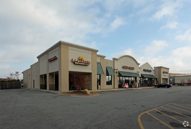
220 Lowes Blvd
11-342-0-000-0024-J-0-0
PB43-53&57&53-92 L24J L1 BK1901-782
Stripcommercialcenter
Davidson
X
North Carolina
3710672400J
3.34 AC
2025
South Davidson County
2025
Greensboro/Winston-Salem
061501
Winston-Salem, NC
14,148 SF
DEMOGRAPHICS near 220 Lowes Blvd
1 Mile
3 Mile
5 Mile
2024 Total Population
4,605
22,918
40,478
2029 Population
4,931
24,381
42,943
Pop Growth 2024-2029
+ 7.08%
+ 6.38%
+ 6.09%
Average Age
39
40
41
2024 Total Households
1,850
9,176
16,260
HH Growth 2024-2029
+ 7.08%
+ 6.34%
+ 6.01%
Median Household Inc
$33,659
$36,621
$39,423
Avg Household Size
2.40
2.40
2.40
2024 Avg HH Vehicles
2.00
2.00
2.00
Median Home Value
$80,555
$136,358
$152,337
Median Year Built
1981
1974
1978
Nearby Places
Map Layers
Map Styles
 Street
 Aerial
- Restaurants
- Banks
- Shops
- Fitness
- Groceries
PUBLIC TRANSPORTATION
AIRPORT
Piedmont Triad International
DRIVE
WALK
Distance
Piedmont Triad International
54 min
41.2 mi
SALE & LEASE HISTORY
LISTING DATE
SALE/LEASE

Sep 26, 2017
For Lease
Aug 09, 2018
For Lease
Nearby Properties
Address
Land Use
TOTAL SIZE
Lot Size
Zoning
Address
Land Use
TOTAL SIZE
Lot Size
Zoning
187,540 SF
26.94 AC
PD
Address
Land Use
TOTAL SIZE
Lot Size
Zoning
4,622 SF
246.40 AC
I
Address
Land Use
TOTAL SIZE
Lot Size
Zoning
1,444 SF
19.95 AC
RA1
Address
Land Use
TOTAL SIZE
Lot Size
Zoning
943,340 SF
202.76 AC
RA1
Address
Land Use
TOTAL SIZE
Lot Size
Zoning
22,560 SF
204.19 AC
I
Address
Land Use
TOTAL SIZE
Lot Size
Zoning
2,736 SF
4.77 AC
U
Address
Land Use
TOTAL SIZE
Lot Size
Zoning
3,156 SF
332.28 AC
HI
Address
Land Use
TOTAL SIZE
Lot Size
Zoning
207,185 SF
29.84 AC
B
Address
Land Use
TOTAL SIZE
Lot Size
Zoning
2,821 SF
32.06 AC
TN
Address
Land Use
TOTAL SIZE
Lot Size
Zoning
20,651 SF
12.03 AC
B
Address
Land Use
TOTAL SIZE
Lot Size
Zoning
33,282 SF
4.41 AC
B
Address
Land Use
TOTAL SIZE
Lot Size
Zoning
43,008 SF
25.21 AC
B
Address
Land Use
TOTAL SIZE
Lot Size
Zoning
142,700 SF
18.21 AC
B
Address
Land Use
TOTAL SIZE
Lot Size
Zoning
15,192 SF
117.89 AC
SN
Address
Land Use
TOTAL SIZE
Lot Size
Zoning
8,008 SF
9.26 AC
TN
Address
Land Use
TOTAL SIZE
Lot Size
Zoning
46,562 SF
1.73 AC
B
Address
Land Use
TOTAL SIZE
Lot Size
Zoning
5,490 SF
212.79 AC
RA1
Address
Land Use
TOTAL SIZE
Lot Size
Zoning
1,160 SF
28.40 AC
TN
Address
Land Use
TOTAL SIZE
Lot Size
Zoning
131,100 SF
17.78 AC
I
Address
Land Use
TOTAL SIZE
Lot Size
Zoning
85,425 SF
1.16 AC
U
Address
Land Use
TOTAL SIZE
Lot Size
Zoning
115,748 SF
8.14 AC
B
Address
Land Use
TOTAL SIZE
Lot Size
Zoning
49,578 SF
7.74 AC
I
Address
Land Use
TOTAL SIZE
Lot Size
Zoning
128 SF
107.80 AC
PD
Address
Land Use
TOTAL SIZE
Lot Size
Zoning
23,572 SF
36.39 AC
I
Address
Land Use
TOTAL SIZE
Lot Size
Zoning
115,600 SF
13.15 AC
I
Address
Land Use
TOTAL SIZE
Lot Size
Zoning
59,281 SF
4.34 AC
B
Address
Land Use
TOTAL SIZE
Lot Size
Zoning
313,535 SF
107.06 AC
I
Address
Land Use
TOTAL SIZE
Lot Size
Zoning
95,953 SF
1.42 AC
U
Address
Land Use
TOTAL SIZE
Lot Size
Zoning
8,248 SF
10.29 AC
TN
The World's #1 Commercial Real Estate Marketplace
Connect with us
© 2026 CoStar Group
The information above has been obtained from sources believed reliable. While we do not doubt its accuracy we have not verified it and make no guarantee, warranty or representation about it. It is your responsibility to independently confirm its accuracy and completeness. Any projections, opinions, assumptions, or estimates used are for example only and do not represent the current or future performance of the property. The value of this transaction to you depends on tax and other factors which should be evaluated by your tax, financial, and legal advisors. You and your advisors should conduct a careful, independent investigation of the property to determine to your satisfaction the suitability of the property for your needs.