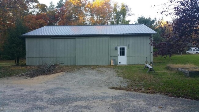
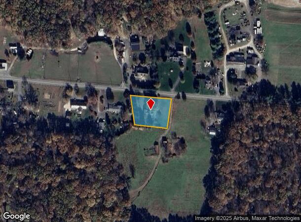
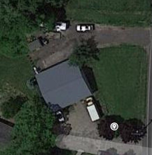
Property Record
220 Merrick Rd, Farmingdale, NJ 07727
NEARBY LISTINGS FOR SALE OR LEASE
Property Detail
220 Merrick Rd
21-00178-06-00006
Monmouth
Farms
New Jersey
X
6
34025C0304F
1 AC
2024
Western Monmouth
2025
Northern New Jersey
811102
New York-Jersey City-White Plains, NY-NJ
2,016 SF
DEMOGRAPHICS near 220 Merrick Rd
1 Mile
3 Mile
5 Mile
2024 Total Population
1,013
15,736
66,951
2029 Population
998
15,683
66,268
Pop Growth 2024-2029
(1.48%)
(0.34%)
(1.02%)
Average Age
40
45
41
2024 Total Households
315
6,105
23,746
HH Growth 2024-2029
(1.59%)
(0.41%)
(1.21%)
Median Household Inc
$155,555
$96,942
$112,066
Avg Household Size
3.00
2.50
2.70
2024 Avg HH Vehicles
3.00
2.00
2.00
Median Home Value
$707,880
$513,136
$453,322
Median Year Built
1984
1986
1982
Nearby Places
Map Layers
Map Styles
 Street
 Aerial
- Restaurants
- Banks
- Shops
- Fitness
- Groceries
SALE & LEASE HISTORY
LISTING DATE
SALE/LEASE

Jul 14, 2020
For Lease
Nearby Properties
Address
Land Use
TOTAL SIZE
Lot Size
Zoning
Address
Land Use
TOTAL SIZE
Lot Size
Zoning
3,255.78 AC
ARE6
Address
Land Use
TOTAL SIZE
Lot Size
Zoning
36.48 AC
HD-2
Address
Land Use
TOTAL SIZE
Lot Size
Zoning
267,666 SF
29.06 AC
M-1
Address
Land Use
TOTAL SIZE
Lot Size
Zoning
114,738 SF
19.02 AC
M-1
Address
Land Use
TOTAL SIZE
Lot Size
Zoning
13 AC
R-40
Address
Land Use
TOTAL SIZE
Lot Size
Zoning
81,657 SF
12.62 AC
B-10
Address
Land Use
TOTAL SIZE
Lot Size
Zoning
126,300 SF
10.12 AC
M-1
Address
Land Use
TOTAL SIZE
Lot Size
Zoning
120,000 SF
77 AC
ARE2
Address
Land Use
TOTAL SIZE
Lot Size
Zoning
8,694 SF
73.93 AC
R-40
Address
Land Use
TOTAL SIZE
Lot Size
Zoning
56,000 SF
21.53 AC
M-1
Address
Land Use
TOTAL SIZE
Lot Size
Zoning
43.22 AC
ARE2
Address
Land Use
TOTAL SIZE
Lot Size
Zoning
106,345 SF
10.53 AC
LI-3
Address
Land Use
TOTAL SIZE
Lot Size
Zoning
240,362 SF
61.13 AC
ARE6
Address
Land Use
TOTAL SIZE
Lot Size
Zoning
117,975 SF
21.20 AC
HD-1
Address
Land Use
TOTAL SIZE
Lot Size
Zoning
161,000 SF
21.60 AC
ARE2
Address
Land Use
TOTAL SIZE
Lot Size
Zoning
61,840 SF
12.32 AC
LI-3
Address
Land Use
TOTAL SIZE
Lot Size
Zoning
55,984 SF
16.11 AC
LI
Address
Land Use
TOTAL SIZE
Lot Size
Zoning
42,354 SF
0.92 AC
LI-3
Address
Land Use
TOTAL SIZE
Lot Size
Zoning
86,936 SF
3.42 AC
LI
Address
Land Use
TOTAL SIZE
Lot Size
Zoning
69,465 SF
7.70 AC
HD-1
Address
Land Use
TOTAL SIZE
Lot Size
Zoning
32,800 SF
6.32 AC
LI-3
Address
Land Use
TOTAL SIZE
Lot Size
Zoning
33.17 AC
LI-3
Address
Land Use
TOTAL SIZE
Lot Size
Zoning
42.76 AC
SED
Address
Land Use
TOTAL SIZE
Lot Size
Zoning
33,128 SF
12.68 AC
ARE6
Address
Land Use
TOTAL SIZE
Lot Size
Zoning
113,086 SF
9.35 AC
M-1
Address
Land Use
TOTAL SIZE
Lot Size
Zoning
75,288 SF
5.50 AC
HD-1
Address
Land Use
TOTAL SIZE
Lot Size
Zoning
14.69 AC
LI-3
Address
Land Use
TOTAL SIZE
Lot Size
Zoning
12,800 SF
8.96 AC
LI-3
Address
Land Use
TOTAL SIZE
Lot Size
Zoning
64,383 SF
5.85 AC
LI-3
Address
Land Use
TOTAL SIZE
Lot Size
Zoning
66,440 SF
5.85 AC
LI-3
The World's #1 Commercial Real Estate Marketplace
Connect with us
© 2025 CoStar Group
The information above has been obtained from sources believed reliable. While we do not doubt its accuracy we have not verified it and make no guarantee, warranty or representation about it. It is your responsibility to independently confirm its accuracy and completeness. Any projections, opinions, assumptions, or estimates used are for example only and do not represent the current or future performance of the property. The value of this transaction to you depends on tax and other factors which should be evaluated by your tax, financial, and legal advisors. You and your advisors should conduct a careful, independent investigation of the property to determine to your satisfaction the suitability of the property for your needs.