Property Record
220 N Adair St, Cornelius, OR 97113
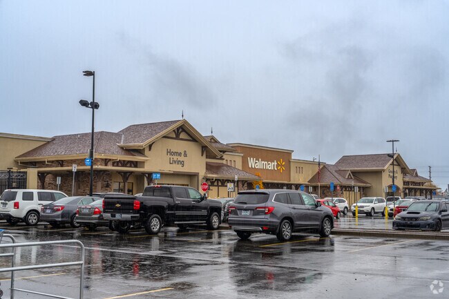

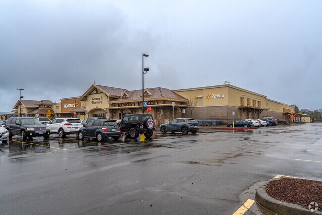
Property Detail
220 N Adair St
R2162828
2008-052 PARTITION PLAT, LOT 1, ACRES 15.63
Commercialbuilding
Washington
C2
Oregon
B and X Area of moderate flood hazard, usually the area between the limits of the 100-year and 500-year floods.
1
2024
15.63 AC
2026
Westside Outlying
032901
Portland
154,371 SF
Portland-Vancouver-Hillsboro, OR-WA
NEARBY LISTINGS FOR SALE OR LEASE
DEMOGRAPHICS near 220 N Adair St
1 mile
3 mile
5 mile
2024 Total Population
12,466
41,265
73,945
2029 Population
12,772
42,508
75,464
Pop Growth 2024-2029
+ 2.45%
+ 3.01%
+ 2.05%
Average Age
39
38
39
2024 Total Households
4,087
13,379
24,413
HH Growth 2024-2029
+ 2.57%
+ 3.05%
+ 2.07%
Median Household Inc
$71,397
$86,972
$96,631
Avg Household Size
3.00
2.90
2.90
2024 Avg HH Vehicles
2.00
2.00
2.00
Median Home Value
$384,696
$465,655
$496,438
Median Year Built
1981
1986
1985
Nearby Places
Map Layers
Map Styles
 Street
 Aerial
Transit
 Traffic
 Biking
Places
Listings with unknown addresses are not visible on the map
- Restaurants
- Banks
- Shops
- Fitness
- Groceries
PUBLIC TRANSPORTATION
AIRPORT
Portland International
Drive
Walk
Distance
Portland International
57 min
37.6 mi
Freight Ports
Port of Portland
Drive
Walk
Distance
Port of Portland
40 min
26.7 mi
Nearby Properties
Address
Land Use
TOTAL SIZE
Lot Size
Zoning
Address
Land Use
TOTAL SIZE
Lot Size
Zoning
608,403 SF
30.03 AC
RMH
Address
Land Use
TOTAL SIZE
Lot Size
Zoning
79,574 SF
16.54 AC
GI
Address
Land Use
TOTAL SIZE
Lot Size
Zoning
220,000 SF
35.85 AC
INST
Address
Land Use
TOTAL SIZE
Lot Size
Zoning
13.80 AC
GI
Address
Land Use
TOTAL SIZE
Lot Size
Zoning
108.84 AC
GI
Address
Land Use
TOTAL SIZE
Lot Size
Zoning
46,175 SF
28.39 AC
INST
Address
Land Use
TOTAL SIZE
Lot Size
Zoning
2.83 AC
GMU
Address
Land Use
TOTAL SIZE
Lot Size
Zoning
169,980 SF
14 AC
GMU
Address
Land Use
TOTAL SIZE
Lot Size
Zoning
37,000 SF
29.09 AC
INST
Address
Land Use
TOTAL SIZE
Lot Size
Zoning
65,500 SF
9.67 AC
R7
Address
Land Use
TOTAL SIZE
Lot Size
Zoning
0.05 AC
LI
Address
Land Use
TOTAL SIZE
Lot Size
Zoning
20.48 AC
LI
Address
Land Use
TOTAL SIZE
Lot Size
Zoning
222,852 SF
11.17 AC
RMH
Address
Land Use
TOTAL SIZE
Lot Size
Zoning
72,365 SF
11.25 AC
R7
Address
Land Use
TOTAL SIZE
Lot Size
Zoning
61,520 SF
2.02 AC
RMH
Address
Land Use
TOTAL SIZE
Lot Size
Zoning
46,000 SF
7.68 AC
INST
Address
Land Use
TOTAL SIZE
Lot Size
Zoning
59,902 SF
1.40 AC
RMH
Address
Land Use
TOTAL SIZE
Lot Size
Zoning
137,200 SF
9.52 AC
INST
Address
Land Use
TOTAL SIZE
Lot Size
Zoning
25,372 SF
5.99 AC
R-10
Address
Land Use
TOTAL SIZE
Lot Size
Zoning
176,108 SF
0.44 AC
CC
Address
Land Use
TOTAL SIZE
Lot Size
Zoning
19.02 AC
INST
Address
Land Use
TOTAL SIZE
Lot Size
Zoning
32,187 SF
9.19 AC
AF-5
Address
Land Use
TOTAL SIZE
Lot Size
Zoning
7.35 AC
Address
Land Use
TOTAL SIZE
Lot Size
Zoning
69,792 SF
7.75 AC
INST
Address
Land Use
TOTAL SIZE
Lot Size
Zoning
Address
Land Use
TOTAL SIZE
Lot Size
Zoning
1,210 SF
4.50 AC
CC
Address
Land Use
TOTAL SIZE
Lot Size
Zoning
47,110 SF
2.57 AC
RMH
Address
Land Use
TOTAL SIZE
Lot Size
Zoning
90,000 SF
5.39 AC
INST
Address
Land Use
TOTAL SIZE
Lot Size
Zoning
3.34 AC
GI
The World's #1 Commercial Real Estate Marketplace
Connect with us
© 2026 CoStar Group
The information above has been obtained from sources believed reliable. While we do not doubt its accuracy we have not verified it and make no guarantee, warranty or representation about it. It is your responsibility to independently confirm its accuracy and completeness. Any projections, opinions, assumptions, or estimates used are for example only and do not represent the current or future performance of the property. The value of this transaction to you depends on tax and other factors which should be evaluated by your tax, financial, and legal advisors. You and your advisors should conduct a careful, independent investigation of the property to determine to your satisfaction the suitability of the property for your needs.