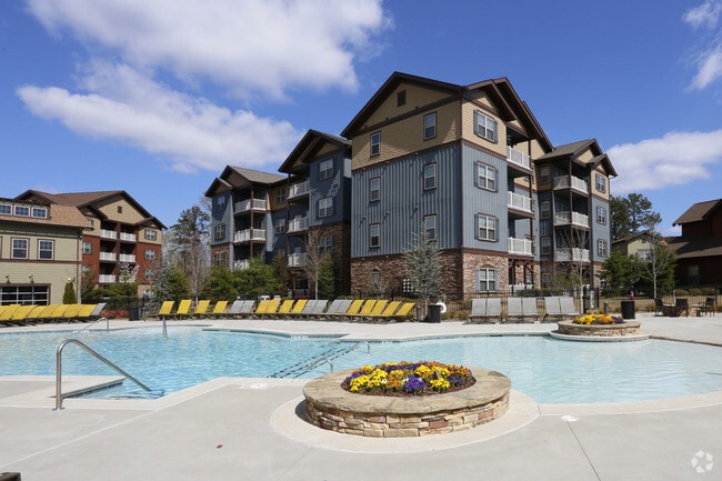
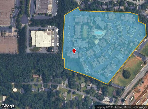
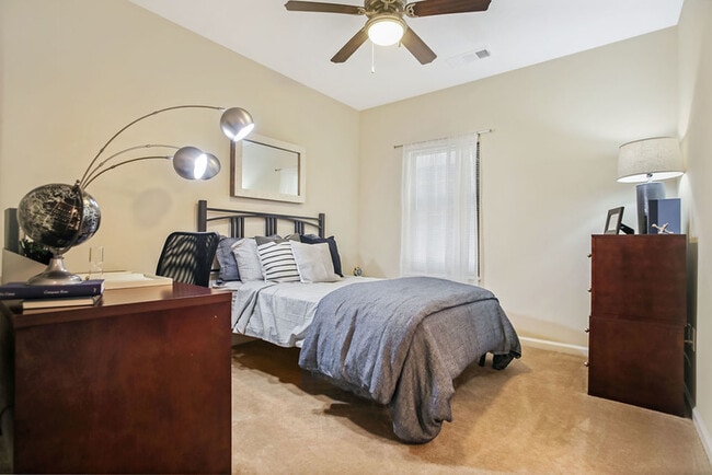
Property Record
2200 Bensman Ln Nw, Kennesaw, GA 30144

NEARBY LISTINGS FOR SALE OR LEASE
Property Detail
2200 Bensman Ln Nw
Apartment
Cobb
X
Georgia
13057C0350E
19.15 AC
2025
Kennesaw
2025
Atlanta
030246
Atlanta-Sandy Springs-Roswell, GA
342,443 SF
20-0092-0-388-0
DEMOGRAPHICS near 2200 Bensman Ln Nw
1 Mile
3 Mile
5 Mile
2024 Total Population
8,204
79,260
183,480
2029 Population
8,239
80,520
190,424
Pop Growth 2024-2029
+ 0.43%
+ 1.59%
+ 3.78%
Average Age
36
37
38
2024 Total Households
3,194
28,347
68,132
HH Growth 2024-2029
+ 0.47%
+ 1.56%
+ 3.79%
Median Household Inc
$64,550
$83,870
$86,282
Avg Household Size
2.50
2.60
2.60
2024 Avg HH Vehicles
2.00
2.00
2.00
Median Home Value
$265,203
$272,554
$289,616
Median Year Built
1989
1994
1994
Nearby Places
Map Layers
Map Styles
 Street
 Aerial
- Restaurants
- Banks
- Shops
- Fitness
- Groceries
PUBLIC TRANSPORTATION
AIRPORT
Hartsfield - Jackson Atlanta International
DRIVE
WALK
Distance
Hartsfield - Jackson Atlanta International
50 min
36.4 mi
Freight Ports
Georgia Ports - Savannah
DRIVE
WALK
Distance
Georgia Ports - Savannah
313 min
275.7 mi
Nearby Properties
Address
Land Use
TOTAL SIZE
Lot Size
Zoning
Address
Land Use
TOTAL SIZE
Lot Size
Zoning
497,466 SF
40.63 AC
RM-12
Address
Land Use
TOTAL SIZE
Lot Size
Zoning
489,796 SF
44.09 AC
RM-12
Address
Land Use
TOTAL SIZE
Lot Size
Zoning
4,812 SF
4.20 AC
PVC
Address
Land Use
TOTAL SIZE
Lot Size
Zoning
416,821 SF
12.96 AC
Address
Land Use
TOTAL SIZE
Lot Size
Zoning
35,085 SF
3.77 AC
RRC
Address
Land Use
TOTAL SIZE
Lot Size
Zoning
95,228 SF
12.97 AC
CBD
Address
Land Use
TOTAL SIZE
Lot Size
Zoning
7.79 AC
RRC
Address
Land Use
TOTAL SIZE
Lot Size
Zoning
382,704 SF
18.72 AC
RM-16
Address
Land Use
TOTAL SIZE
Lot Size
Zoning
1,120 SF
42.20 AC
HI
Address
Land Use
TOTAL SIZE
Lot Size
Zoning
352,938 SF
19.86 AC
RM-16
Address
Land Use
TOTAL SIZE
Lot Size
Zoning
269,464 SF
2.61 AC
CBD
Address
Land Use
TOTAL SIZE
Lot Size
Zoning
69,476 SF
8.11 AC
PVC
Address
Land Use
TOTAL SIZE
Lot Size
Zoning
617,562 SF
35.22 AC
PSC
Address
Land Use
TOTAL SIZE
Lot Size
Zoning
300,369 SF
10.64 AC
Address
Land Use
TOTAL SIZE
Lot Size
Zoning
13.43 AC
OI
Address
Land Use
TOTAL SIZE
Lot Size
Zoning
437,231 SF
5.79 AC
PVC
Address
Land Use
TOTAL SIZE
Lot Size
Zoning
7.53 AC
OI
Address
Land Use
TOTAL SIZE
Lot Size
Zoning
3.16 AC
PVC
Address
Land Use
TOTAL SIZE
Lot Size
Zoning
13.46 AC
PVC
Address
Land Use
TOTAL SIZE
Lot Size
Zoning
367,587 SF
26.87 AC
RM-12
Address
Land Use
TOTAL SIZE
Lot Size
Zoning
270,275 SF
21.52 AC
RM-12
Address
Land Use
TOTAL SIZE
Lot Size
Zoning
360,937 SF
32.56 AC
RM-12
Address
Land Use
TOTAL SIZE
Lot Size
Zoning
280,546 SF
26.91 AC
RM-12
Address
Land Use
TOTAL SIZE
Lot Size
Zoning
27.25 AC
OS
Address
Land Use
TOTAL SIZE
Lot Size
Zoning
288,926 SF
75 AC
LI
Address
Land Use
TOTAL SIZE
Lot Size
Zoning
195,033 SF
22.85 AC
RM-8
Address
Land Use
TOTAL SIZE
Lot Size
Zoning
212,038 SF
24.96 AC
RM-8
Address
Land Use
TOTAL SIZE
Lot Size
Zoning
198,423 SF
15.31 AC
OI
Address
Land Use
TOTAL SIZE
Lot Size
Zoning
347,298 SF
30.41 AC
GC/HI/WS
The World's #1 Commercial Real Estate Marketplace
Connect with us
© 2025 CoStar Group
The information above has been obtained from sources believed reliable. While we do not doubt its accuracy we have not verified it and make no guarantee, warranty or representation about it. It is your responsibility to independently confirm its accuracy and completeness. Any projections, opinions, assumptions, or estimates used are for example only and do not represent the current or future performance of the property. The value of this transaction to you depends on tax and other factors which should be evaluated by your tax, financial, and legal advisors. You and your advisors should conduct a careful, independent investigation of the property to determine to your satisfaction the suitability of the property for your needs.