Property Record
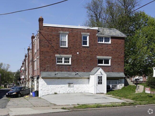
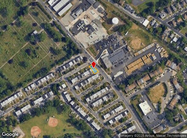
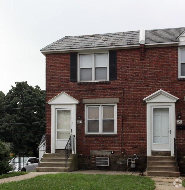
2200 Bond Ave, Drexel Hill, PA 19026
NEARBY LISTINGS FOR SALE OR LEASE
Property Detail
2200 Bond Ave
16-08-00334-00
Drexel Park Gardens Plan 05
Commercialnec
2 STY HSE & GAR 32 X 84 X IRR
X
Delaware
42045C0108F
Pennsylvania
2024
0.08 AC
2025
Delaware County
401101
Philadelphia
2,703 SF
Philadelphia-Camden-Wilmington, PA-NJ-DE-MD
DEMOGRAPHICS near 2200 Bond Ave
1 Mile
3 Mile
5 Mile
2024 Total Population
24,859
242,829
594,269
2029 Population
24,520
238,680
585,111
Pop Growth 2024-2029
(1.36%)
(1.71%)
(1.54%)
Average Age
39
39
39
2024 Total Households
8,966
91,630
228,629
HH Growth 2024-2029
(1.43%)
(1.86%)
(1.71%)
Median Household Inc
$78,804
$66,816
$60,036
Avg Household Size
2.70
2.50
2.50
2024 Avg HH Vehicles
2.00
1.00
1.00
Median Home Value
$199,063
$230,774
$234,658
Median Year Built
1948
1948
1949
Nearby Places
Map Layers
Map Styles
 Street
 Aerial
- Restaurants
- Banks
- Shops
- Fitness
- Groceries
PUBLIC TRANSPORTATION
TRANSIT/SUBWAY
Lansdowne Av (Route 101 - SEPTA, Route 102 - SEPTA)
DRIVE
WALK
Distance
Lansdowne Av (Route 101 - SEPTA, Route 102 - SEPTA)
2 min
17 min
0.9 mi
Lansdowne Avenue (Route 101 - Southeastern Pennsylvania Transportation Authority Rapid Transit (SEPTA Subway & Trolley), Route 102 - Southeastern Pennsylvania Transportation Authority Rapid Transit (SEPTA Subway & Trolley))
DRIVE
WALK
Distance
Lansdowne Avenue (Route 101 - Southeastern Pennsylvania Transportation Authority Rapid Transit (SEPTA Subway & Trolley), Route 102 - Southeastern Pennsylvania Transportation Authority Rapid Transit (SEPTA Subway & Trolley))
2 min
17 min
0.9 mi
COMMUTER RAIL
Lansdowne (R3 - Southeastern Pennsylvania Transportation Authority Regional Rail (SEPTA Regional Rail))
DRIVE
WALK
Distance
Lansdowne (R3 - Southeastern Pennsylvania Transportation Authority Regional Rail (SEPTA Regional Rail))
5 min
2.1 mi
Gladstone (R3 - Southeastern Pennsylvania Transportation Authority Regional Rail (SEPTA Regional Rail))
DRIVE
WALK
Distance
Gladstone (R3 - Southeastern Pennsylvania Transportation Authority Regional Rail (SEPTA Regional Rail))
8 min
2.9 mi
AIRPORT
Philadelphia International
DRIVE
WALK
Distance
Philadelphia International
22 min
8.9 mi
Freight Ports
South Jersey Port
DRIVE
WALK
Distance
South Jersey Port
26 min
12.1 mi
SALE & LEASE HISTORY
LISTING DATE
SALE/LEASE

May 12, 2017
For Lease
Nearby Properties
Address
Land Use
TOTAL SIZE
Lot Size
Zoning
Address
Land Use
TOTAL SIZE
Lot Size
Zoning
2,178,860 SF
48.65 AC
R3
Address
Land Use
TOTAL SIZE
Lot Size
Zoning
158,496 SF
Address
Land Use
TOTAL SIZE
Lot Size
Zoning
1,600 SF
177.07 AC
SPPOA
Address
Land Use
TOTAL SIZE
Lot Size
Zoning
511,806 SF
1.70 AC
RM4
Address
Land Use
TOTAL SIZE
Lot Size
Zoning
15,660 SF
56.60 AC
Address
Land Use
TOTAL SIZE
Lot Size
Zoning
448,864 SF
32.89 AC
Address
Land Use
TOTAL SIZE
Lot Size
Zoning
112,268 SF
28.27 AC
Address
Land Use
TOTAL SIZE
Lot Size
Zoning
82,153 SF
13.97 AC
Address
Land Use
TOTAL SIZE
Lot Size
Zoning
1.65 AC
CMX3
Address
Land Use
TOTAL SIZE
Lot Size
Zoning
7.96 AC
Address
Land Use
TOTAL SIZE
Lot Size
Zoning
20,880 SF
27.20 AC
Address
Land Use
TOTAL SIZE
Lot Size
Zoning
321,744 SF
14 AC
C1
Address
Land Use
TOTAL SIZE
Lot Size
Zoning
136,972 SF
27 AC
Address
Land Use
TOTAL SIZE
Lot Size
Zoning
454,536 SF
26.63 AC
Address
Land Use
TOTAL SIZE
Lot Size
Zoning
93,353 SF
1.03 AC
CMX2.5
Address
Land Use
TOTAL SIZE
Lot Size
Zoning
131,980 SF
9.17 AC
Address
Land Use
TOTAL SIZE
Lot Size
Zoning
131,200 SF
2.19 AC
RM4
Address
Land Use
TOTAL SIZE
Lot Size
Zoning
114,058 SF
3.20 AC
Address
Land Use
TOTAL SIZE
Lot Size
Zoning
746,701 SF
71.71 AC
R3
Address
Land Use
TOTAL SIZE
Lot Size
Zoning
68,096 SF
7.78 AC
Address
Land Use
TOTAL SIZE
Lot Size
Zoning
69,420 SF
17.12 AC
Address
Land Use
TOTAL SIZE
Lot Size
Zoning
140,820 SF
3.57 AC
RM2
Address
Land Use
TOTAL SIZE
Lot Size
Zoning
86,052 SF
7.63 AC
Address
Land Use
TOTAL SIZE
Lot Size
Zoning
283,058 SF
10.24 AC
R4
Address
Land Use
TOTAL SIZE
Lot Size
Zoning
Address
Land Use
TOTAL SIZE
Lot Size
Zoning
72,564 SF
24.44 AC
Address
Land Use
TOTAL SIZE
Lot Size
Zoning
144,140 SF
20.40 AC
R3
Address
Land Use
TOTAL SIZE
Lot Size
Zoning
150,333 SF
17.16 AC
R3
Address
Land Use
TOTAL SIZE
Lot Size
Zoning
203.40 AC
SPPOA
Address
Land Use
TOTAL SIZE
Lot Size
Zoning
60,588 SF
9.43 AC
The World's #1 Commercial Real Estate Marketplace
Connect with us
© 2025 CoStar Group
The information above has been obtained from sources believed reliable. While we do not doubt its accuracy we have not verified it and make no guarantee, warranty or representation about it. It is your responsibility to independently confirm its accuracy and completeness. Any projections, opinions, assumptions, or estimates used are for example only and do not represent the current or future performance of the property. The value of this transaction to you depends on tax and other factors which should be evaluated by your tax, financial, and legal advisors. You and your advisors should conduct a careful, independent investigation of the property to determine to your satisfaction the suitability of the property for your needs.