Property Record
2200 E Shawnee Byp, Muskogee, OK 74403

NEARBY LISTINGS FOR SALE OR LEASE
Property Detail
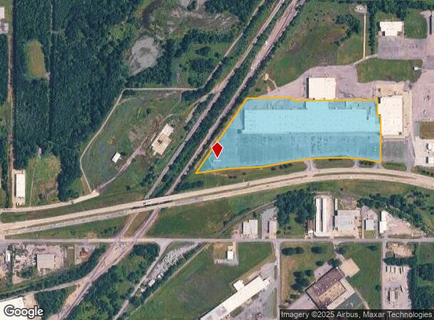
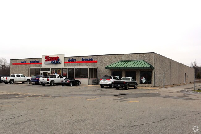
2200 E Shawnee Byp
Muskogee, OK
Curts Shopping Center
49635
CURTS SHOPPING CENTER TRACT 2 AKA PART OF LOT 1 COMM@ SE/C SEC 13 T15N R18E N01?3422W 656.59 S88?2538W 25 S38?0510W 72.70 TO
Regionalshoppingcenterormallwithanchorstore
Muskogee
X
Oklahoma
40145C0500H
1
2024
19.21 AC
2025
Muskogee County
001301
Tulsa
245,822 SF
DEMOGRAPHICS near 2200 E Shawnee Byp
1 Mile
3 Mile
5 Mile
2024 Total Population
1,633
22,635
39,238
2029 Population
1,635
22,928
39,735
Pop Growth 2024-2029
+ 0.12%
+ 1.29%
+ 1.27%
Average Age
40
38
39
2024 Total Households
668
9,178
15,956
HH Growth 2024-2029
0.00%
+ 1.26%
+ 1.23%
Median Household Inc
$66,000
$40,427
$40,998
Avg Household Size
2.30
2.30
2.30
2024 Avg HH Vehicles
2.00
2.00
2.00
Median Home Value
$224,154
$91,766
$98,879
Median Year Built
1978
1968
1971
Nearby Places
Map Layers
Map Styles
 Street
 Aerial
- Restaurants
- Banks
- Shops
- Fitness
- Groceries
Nearby Properties
Address
Land Use
TOTAL SIZE
Lot Size
Zoning
Address
Land Use
TOTAL SIZE
Lot Size
Zoning
1,760 SF
21.64 AC
Address
Land Use
TOTAL SIZE
Lot Size
Zoning
35,682 SF
1.75 AC
F
Address
Land Use
TOTAL SIZE
Lot Size
Zoning
59,306 SF
0.74 AC
MI
Address
Land Use
TOTAL SIZE
Lot Size
Zoning
69,776 SF
20.13 AC
Address
Land Use
TOTAL SIZE
Lot Size
Zoning
52,964 SF
4.86 AC
MI
Address
Land Use
TOTAL SIZE
Lot Size
Zoning
217,566 SF
42.13 AC
Address
Land Use
TOTAL SIZE
Lot Size
Zoning
43,002 SF
1.09 AC
MI
Address
Land Use
TOTAL SIZE
Lot Size
Zoning
19,548 SF
3.77 AC
B
Address
Land Use
TOTAL SIZE
Lot Size
Zoning
20,962 SF
1.51 AC
MI
Address
Land Use
TOTAL SIZE
Lot Size
Zoning
8,796 SF
17.35 AC
Address
Land Use
TOTAL SIZE
Lot Size
Zoning
9,000 SF
11.77 AC
Address
Land Use
TOTAL SIZE
Lot Size
Zoning
6,000 SF
1.39 AC
Address
Land Use
TOTAL SIZE
Lot Size
Zoning
34,000 SF
1.20 AC
Address
Land Use
TOTAL SIZE
Lot Size
Zoning
30,594 SF
0.85 AC
E1
Address
Land Use
TOTAL SIZE
Lot Size
Zoning
12,552 SF
0.88 AC
B
Address
Land Use
TOTAL SIZE
Lot Size
Zoning
2,080 SF
0.46 AC
MI
Address
Land Use
TOTAL SIZE
Lot Size
Zoning
20.13 AC
A
Address
Land Use
TOTAL SIZE
Lot Size
Zoning
5,250 SF
5.40 AC
Address
Land Use
TOTAL SIZE
Lot Size
Zoning
34,070 SF
2.33 AC
PP
Address
Land Use
TOTAL SIZE
Lot Size
Zoning
7,649 SF
2.22 AC
Address
Land Use
TOTAL SIZE
Lot Size
Zoning
90,709 SF
11.61 AC
Address
Land Use
TOTAL SIZE
Lot Size
Zoning
212,283 SF
26.18 AC
Address
Land Use
TOTAL SIZE
Lot Size
Zoning
48,656 SF
4 AC
Address
Land Use
TOTAL SIZE
Lot Size
Zoning
18,510 SF
1.04 AC
MI
Address
Land Use
TOTAL SIZE
Lot Size
Zoning
1,500 SF
7.35 AC
Address
Land Use
TOTAL SIZE
Lot Size
Zoning
25,820 SF
14.63 AC
A
Address
Land Use
TOTAL SIZE
Lot Size
Zoning
7,269 SF
2.07 AC
PP
Address
Land Use
TOTAL SIZE
Lot Size
Zoning
28,306 SF
2.42 AC
D
Address
Land Use
TOTAL SIZE
Lot Size
Zoning
16,896 SF
2.42 AC
B
Address
Land Use
TOTAL SIZE
Lot Size
Zoning
41,046 SF
1.48 AC
PP
The World's #1 Commercial Real Estate Marketplace
Connect with us
© 2025 CoStar Group
The information above has been obtained from sources believed reliable. While we do not doubt its accuracy we have not verified it and make no guarantee, warranty or representation about it. It is your responsibility to independently confirm its accuracy and completeness. Any projections, opinions, assumptions, or estimates used are for example only and do not represent the current or future performance of the property. The value of this transaction to you depends on tax and other factors which should be evaluated by your tax, financial, and legal advisors. You and your advisors should conduct a careful, independent investigation of the property to determine to your satisfaction the suitability of the property for your needs.